Suffern in Rockland County, New York — The American Northeast (Mid-Atlantic)
Rochambeau’s Encampment
1781 – 1782
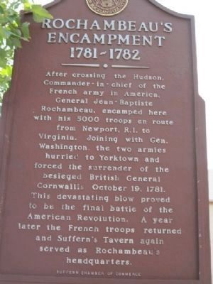
Photographed by Paul Gross, August 8, 2010
1. Rochambeau’s Encampment Marker
Erected by Historical Society of Rockland County, Suffern Chamber of Commerce.
Topics and series. This historical marker is listed in this topic list: War, US Revolutionary. In addition, it is included in the Former U.S. Presidents: #01 George Washington, the New York, Historical Society of Rockland County, and the The Washington-Rochambeau Route series lists. A significant historical year for this entry is 1781.
Location. 41° 6.885′ N, 74° 8.976′ W. Marker is in Suffern, New York, in Rockland County. It is at the intersection of Washington Avenue and Lafayette Avenue, on the left when traveling north on
this page online

Regionally, this marker is in the Hudson Valley and in the New York City Metropolitan Area. It is also in the American Northeast, in the Mid-Atlantic, and on the Eastern Seaboard. Globally, it is in the North Atlantic Region, North America, the Western Hemisphere, the Western World, and the Anglosphere. Historically, it finds itself in what was once New Netherland and also one of the original Thirteen Colonies.
Other nearby markers. At least 8 other markers are within walking distance of this marker: This Cannon “Independence” (a few steps from this marker); Soldier’s Monument (a few steps from this marker); Horse Watering Trough (within shouting distance of this marker); Suffern’s Tavern (within shouting distance of this marker); Lt. John Fitzgerald Ginley / Richard Edward Bosco (approx. 0.2 miles away); Suffern Grammar School (approx. ¼ mile away); Ben Walker / Vincenzo "Vinny" Tamburro
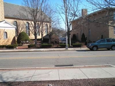
Photographed by Bill Coughlin, November 29, 2009
2. Previous site of the Rochambeau’s Encampment Marker
Note the remains of the marker's post at the bottom of the photo.
More about this marker. Marker was damaged and removed. The Historical Society of Rockland County Historical Marker Program is aware and is in the process of replacing the marker.
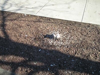
Photographed by Bill Coughlin, November 29, 2009
3. Previous site of Rochambeau’s Encampment Marker
The remains of the base of the marker can be seen in this photo.
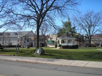
Photographed by Bill Coughlin, November 29, 2009
4. Site of Suffern's Tavern
Rochambeau used Suffern's Tavern, located at this site, as his headquarters during the 1781 and 1872 encampments. It is located just north of the marker.
Photographed by Bill Coughlin, November 29, 2009
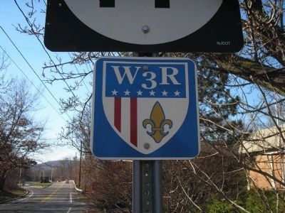
5. Washington & Rochambeau Route
The route taken by Washington and Rochambeau during their march to Yorktown in 1781 is marked by signs such as this one, located about a mile away in Mahwah, NJ.
Credits. This page was last revised on January 15, 2022. It was originally submitted on December 23, 2009, by Bill Coughlin of Woodland Park, New Jersey. This page has been viewed 3,265 times since then and 119 times this year. Last updated on January 6, 2022, by Joseph Adler of Gambier, Ohio. Photos: 1. submitted on August 8, 2010, by Paul Gross of Staten Island, New York. 2, 3, 4, 5. submitted on December 23, 2009, by Bill Coughlin of Woodland Park, New Jersey. • Michael Herrick was the editor who published this page.
