Near Sheridan in Sheridan County, Wyoming — The American West (Mountains)
Working in the Mines

Photographed By Barry Swackhamer, July 20, 2021
1. Working in the Mines Marker
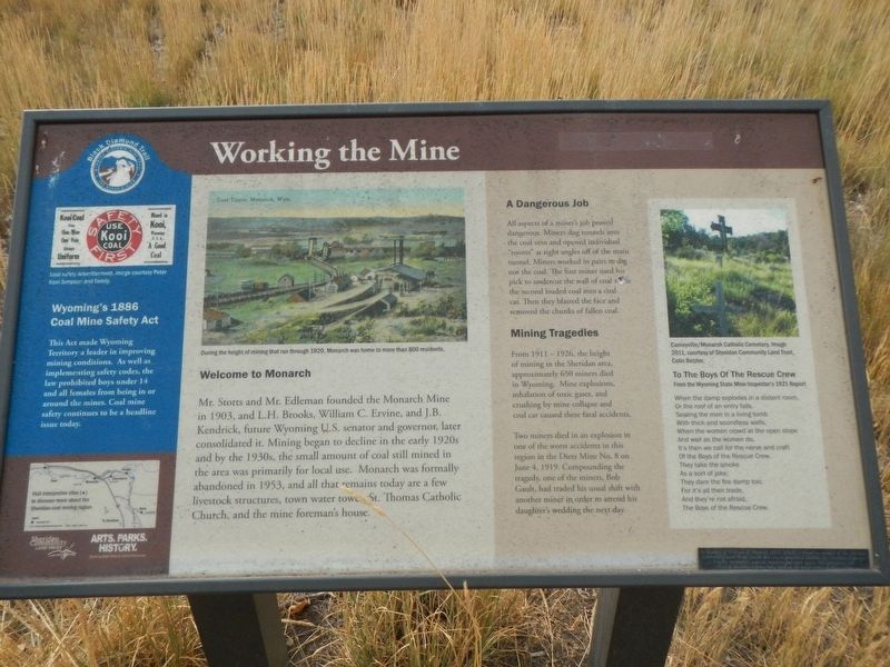
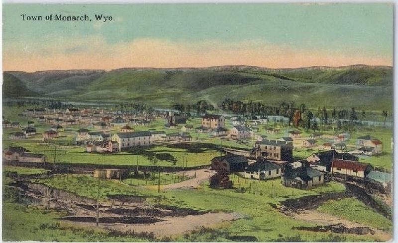
Photo Captions: (upper center) During the height of mining that ran through 1920, Monarch was home to more than 800 residents.; (upper right) Cameyville/Monarch Catholic Cemetery. (side-bar on left) Kooi safety advertisement.
Welcome to Monarch
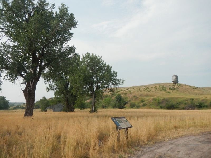
Mr. Stotts and Mr. Edleman founded the Monarch Mine in 1903, and L.H. Brooks, William C. Ervine, and J.B. Kendrick, future Wyoming U.S. senator and governor, later consolidated it. Mining began to decline in the early 1920s and by the 1930s, a small amount of coal still aimed in the area was primarily for local use. Monarch was formally abandoned in 1953, and all that remains today are a few livestock structures, town water tower, St. Thomas Catholic Church, and the mine foreman's house.
A Dangerous Job
All aspects of a miner's jog proved dangerous. Miners dug tunnels into the coal vein and opened individual "rooms" at right angles off the main tunnel. Miners worked in pairs to dig out the coal. The first miner used his pick to undercut the wall of coal while the second loaded coal into a coal car. Then they blasted the face and removed the chunks of fallen coal.
Mining Tragedies
From 1911 - 1926, the height of mining in the Sheridan area, Approximately 659 miners died in Wyoming. Mine explosions, inhalation of toxic gases, and crushing by mine collapse and coal car caused these fatal accidents.
Two miners died in an explosion in one of the worst accidents in the region in the Dietz Mine No. 8 on June, 4 1919. Compounding the tragedy, one of the miners, Bob Gault, had traded his usual shift with another miner in order to attend his daughter's wedding the next day.
To the Boys of the Rescue Crew
From the Wyoming State Mine Inspector's 1921 Report
When the damp explodes in a distant room,
Or the roof of an entry falls,
Sealing the men in a living tomb
With thick and soundless walls,
When the women crowd at the open slope
And wail as the women do. br It's then we call for the nerve and craft
Of the Boys of the Rescue Crew.
They take the smoke
As a sort of joke;
They dare the fire damp too;
For it's all their trade,
And they're not afraid,
The Boys of the Rescue Crew.
(side-bar on left:)
Wyoming's 1886 Coal Mine Safety Act
This Act make Wyoming Territory a leader in improving mining conditions. As well as implementing safety codes, the law prohibited boys under 14 and all females for being in or around the mines. Coal mine safety continues to be a headline issue today.
Erected by Sheridan Community Land Trust and Wyoming State Parks & Cultural Resources.
Topics. This historical marker is listed in these topic lists: Industry & Commerce • Settlements & Settlers. A significant historical date for this entry is June 4, 1919.
Location.
44° 54.405′ N, 107° 2.068′ W. Marker is near Sheridan, Wyoming, in Sheridan County. Marker is on State Highway 345 near County Road 123, on the left when traveling west. Touch for map. Marker is in this post office area: Sheridan WY 82801, United States of America. Touch for directions.
Other nearby markers. At least 8 other markers are within 7 miles of this marker, measured as the crow flies. The Aftermath of Mining (approx. 1.2 miles away); Mining Modernizes (approx. 1.2 miles away); The Black Diamond Trail (approx. 1.2 miles away); The Black Diamonds of Wyoming (approx. 1.2 miles away); Mine Communities Supply Miner's Needs (approx. 1.7 miles away); Mines Shape a Community (approx. 3.8 miles away); Rock Creek to Montana Stage Line (approx. 5.9 miles away); Connor Battlefield State Park (approx. 6.3 miles away). Touch for a list and map of all markers in Sheridan.
More about this marker. This maker is a part of the Black Diamond Trail of Sheridan County.
Also see . . . Coal Camp Photos, Sheridan Area -- Wyoming Tales and Trails. At its peak Monarch had a population of approximately 800 and was connected to Sheridan by a street railway. Sheridan-Wyoming controlled some 14,000 acres of coal lands and had an additional 2,700 acres under lease. It had a reserve of an estimated 650,000,000 tons of coal and mined some 5,000,000 tons a year. In its company towns it owed some 876 "cottages" as well as hotels and store buildings. (Submitted on January 7, 2022, by Barry Swackhamer of Brentwood, California.)
Credits. This page was last revised on January 7, 2022. It was originally submitted on January 7, 2022, by Barry Swackhamer of Brentwood, California. This page has been viewed 183 times since then and 29 times this year. Photos: 1, 2, 3. submitted on January 7, 2022, by Barry Swackhamer of Brentwood, California.

