Parkersburg in Wood County, West Virginia — The American South (Appalachia)
Welcome
General History
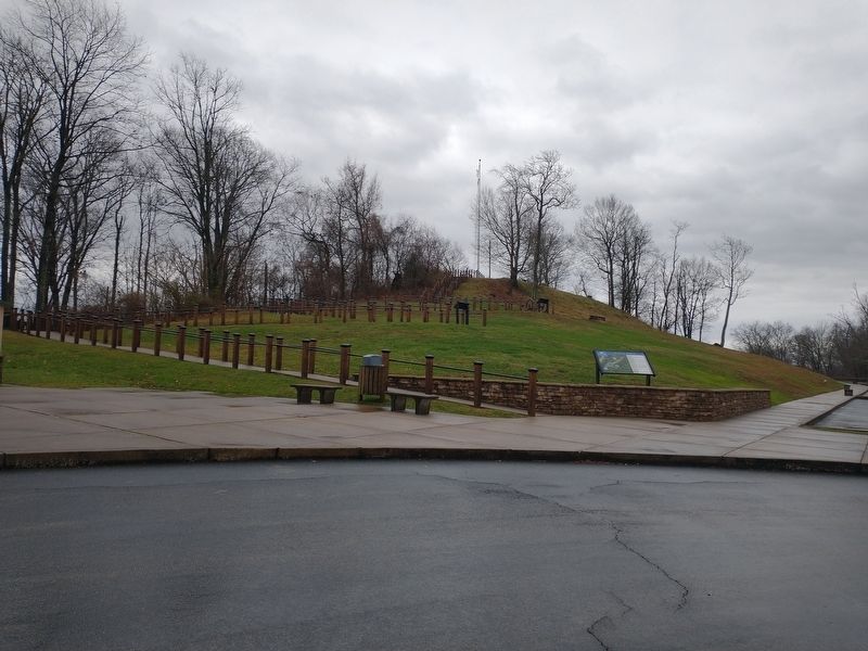
Fort Boreman is the site of a Civil War fort, located on what had been called Mount Logan, overlooking the valley formed by the confluence of the Little Kanawha and Ohio Rivers at Parkersburg. Built by Union troops in 1863 to protect the Baltimore and Ohio Railroad terminal and the key commercial river facilities in the valley, Fort Boreman was named for West Virginia's first governor, Parkersburg citizen Arthur I. Boreman.
In May 1861, Union troops began occupation of Parkersburg. Because of the controlling vantage point offered from Mount Logan, troops from the Eighteenth Ohio Infantry soon occupied the hilltop. In 1863, two forts were planned for the protection of the railroad facilities at Parkersburg: one atop Mount Logan and the other was to be situated on Prospect Hill, today's Quincy Hill. Though the Prospect Hill project was never completed, the fortification that would be known as Fort Boreman was commenced in the summer of 1863. Although Fort Boreman was never under eminent threat during the Civil War, one soldier was killed and another seriously injured during a ceremonial firing when a cannon exploded in August of 1863. While the early years of the hill's history are shrouded in mystery, it is known that it played a role in early Wood County as timber was cut from its slopes, floated across the Little Kanawha River and used to construct the county's first "official" courthouse.
The Fort Boreman site was added to the National Register of Historic Places in 2003. Work on Fort Boreman Park began in 1997 when the Wood County Historical and Preservation Society held a meeting to discuss its creation. The Society was awarded $2,000 by the Wood County Commission to begin cutting thick brush from the hill, which took two years. Fort Boreman Historical Park opened to the public in 2007 as a lasting memorial to the Wood County Bicentennial Celebration of 1999. Today, the park features a reconstructed Union Civil War fortification, trenches, interpretive signage, picnic shelters, nature trail and spectacular views of Parkersburg and the Ohio River.
Erected by Wood County, WV County Commission; West Virginia Division of Highways; Citizens Conservation Corps of West Virginia; Wood County Historical & Preservation Society.
Topics. This historical marker is listed in these topic lists: Forts and Castles • Government & Politics • War, US Civil. A significant historical month for this entry is May 1861.
Location. 39° 15.732′ N, 81° 34.156′ W. Marker is in Parkersburg, West Virginia, in Wood County. Marker is on Fort Boreman Drive, on the right when traveling north. Touch for map. Marker is at or near this postal address: 1710 Fort Boreman Road, Parkersburg WV 26101, United States of America. Touch for directions.
Other nearby markers. At least 8 other markers are within walking distance of this marker. Parkersburg in 1861 (a few steps from this marker); Fort Boreman (a few steps from this marker); Fort Boreman During The Civil War (within shouting distance of this marker); William L. “Mudwall” Jackson (within shouting distance of this marker); a different marker also named Fort Boreman (within shouting distance of this marker); Fort Boreman Hill (within shouting distance of this marker); Parkersburg and the Civil War (within shouting distance of this marker); Historic Parkersburg (West) Virginia (within shouting distance of this marker). Touch for a list and map of all markers in Parkersburg.
Credits. This page was last revised on January 18, 2022. It was originally submitted on January 8, 2022, by Craig Doda of Napoleon, Ohio. This page has been viewed 115 times since then and 20 times this year. Photos: 1, 2. submitted on January 8, 2022, by Craig Doda of Napoleon, Ohio. • Devry Becker Jones was the editor who published this page.

