Colbert in Bryan County, Oklahoma — The American South (West South Central)
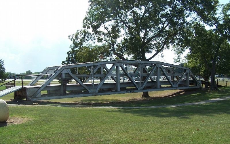
Red River Bridge

Photographed by Jason Armstrong, October 12, 2013
1. Red River Bridge Marker
North span first free bridge across Red River erected 1931, replaced 1996. Oklahoma Gov. "Alfalfa" Bill Murray defied Federal Court injunction plowed up road to "toll" bridge forcing opening of "free" bridge linking Texas & Oklahoma hwy's. Gov. Murray came personally to oversee the bridge opening. OK National Guard vs TX Rangers
Erected 1997 by Colbert Historical Society, Colbert Park Board and Oklahoma Historical Society. (Marker Number 227-1997.)
Topics. This historical marker is listed in this topic list: Bridges & Viaducts. A significant historical year for this entry is 1931.
Location. 33° 51.421′ N, 96° 30.651′ W. Marker is in Colbert, Oklahoma, in Bryan County. It is on Timothy Drive north of Moore Avenue, on the right when traveling north. The marker is located at the Colbert City Park. Entrance to the park is on Timothy Drive. The walking trail leads to the marker and bridge. Touch for map. Marker is in this post office area: Colbert OK 74733, United States of America. Touch for directions.

Regionally, this marker is in the Choctaw Nation and in Southeast Oklahoma—Choctaw Country. It is also in the American
this page online
Other nearby markers. At least 8 other markers are within 7 miles of this marker, measured as the crow flies: Colbert's Ferry (approx. half a mile away); The Message Tree (approx. 0.9 miles away); Site of Colbert'S Ferry (approx. 2.7 miles away); 1931 Free Bridge Controversy (approx. 3 miles away in Texas); a different marker also named Colbert's Ferry (approx. 3 miles away in Texas); Lake Texoma (approx. 4½ miles away in Texas); Site of Terrell High School (approx. 6.6 miles away in Texas); Joseph G. McCoy (approx. 6.6 miles away in Texas). Touch for a list and map of all markers in Colbert.
Photographed by Jason Armstrong, October 12, 2013
2. Red River Bridge
Part of the bridge was moved to the city park.
Credits. This page was last revised on January 9, 2022. It was originally submitted on January 8, 2022, by Jason Armstrong of Talihina, Oklahoma. This page has been viewed 840 times since then and 86 times this year. Photos: 1, 2. submitted on January 8, 2022, by Jason Armstrong of Talihina, Oklahoma. • J. Makali Bruton was the editor who published this page.
Editor’s want-list for this marker. A complete close-up photo of the marker. • A wide view photo of the marker and the surrounding area together in context. • Can you help?
