Near Waskish in Beltrami County, Minnesota — The American Midwest (Upper Plains)
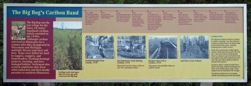
The Big Bog's Caribou Band
Late 1920s
The Big Bog Caribou band is considered the last resident herd in the U.S. In 1928, it dwindles to 13, raising fear of extinction.
1931
Fire consumes 1,600 square miles of the Big Bog.
1932
Minnesota established the 480,000-acre Red Lake Wildlife Refuge to preserve caribou and other big game.
1935
Beltrami Island Resettlement Project begins, aiding caribou by relocating settlers, reducing poaching, and blocking drainage ditches.
1938
Ten caribou from Saskatchewan travel to a corral on Ludlow Island. The largest bull travels (by Caterpillar tractor) to a fenced area south of Hillman Lake. He joins the last three cows of the original band.
1939
The remaining captive caribou move to the Hillman Lake enclosure.
1940
Four cows give birth. The last original cow dies, probably from old age. The Bell Museum of Natural History acquires her remains.
1942
Food shortage prompts the release of all 15–20 caribou from the Hillman Lake enclosure.
1946–50
Aerial searches reveal no sign of caribou in their Big Bog range or the Hillman Lake area.
1950–present
Unverified reports mention tracks and fleeting glimpses of caribou in Minnesota, mostly near the Canadian border.
Captions:
Caribou trails trod more than 80 years ago still crisscross the Big Bog.
Caribou Brought From Canada, 1938
Jack Manweiler Tends Big Bog Caribou, 1939
Manweiler led the intense effort to save the vanishing caribou.
Reindeer Moss Fed to Caribou, 1939
This photo was probably taken on Ludlow Island.
And That's a Lot of Moss!
Caribou Facts
The Micmac Indian word for caribou is xalibu, meaning "one that shovels." Caribou use their hooves to shovel food from beneath the snow, creating feeding places called craters.
Both male and female caribou grow antlers. Bulls shed them after the fall rut. Cows keep theirs until spring. They're a boon to survival for the cow, her unborn calf, and her previous year's calf—she uses them against
males to defend food craters.
In places where a person sinks knee-deep in the bog, caribou footprints are only a few inches deep. Large, bowl-shaped hooves distribute the weight.
Woodland caribou live in Canada, Alaska, and other parts of the far north.
Erected by Minnesota Department of Natural Resources.
Topics. This historical marker is listed in this topic list: Animals. A significant historical year for this entry is 1942.
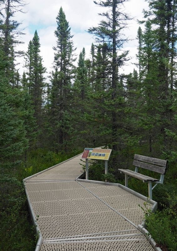
Location. 48° 17.495′ N, 94° 34.021′ W. Marker is near Waskish, Minnesota, in Beltrami County. Marker can be reached from State Highway 72, on the left when traveling north. The marker is in the northern unit of Big Bog State Recreation Area (fee area), on the Bog Boardwalk trail. Touch for map. Marker is in this post office area: Waskish MN 56685, United States of America. Touch for directions.
Other nearby markers. At least 7 other markers are within 9 miles of this marker, measured as the crow flies. The Bog That Couldn't Be Tamed (approx. 0.2 miles away); Ludlow Island History (approx. 0.3 miles away); The Patterned Peatland: Rare and Valuable (approx. half a mile away); The Old Waskish Town Site (approx. 8.4 miles away); Harry Davidson (approx. 8˝ miles away); The Marina (approx. 8.6 miles away); Where There is Smoke / Forests of the Agassiz Lowlands (approx. 8.8 miles away).
Credits. This page was last revised on January 15, 2022. It was originally submitted on January 9, 2022, by McGhiever of Minneapolis, Minnesota. This page has been viewed 354 times since then and 36 times this year. Photos: 1, 2, 3. submitted on January 9, 2022, by McGhiever of Minneapolis, Minnesota. • J. Makali Bruton was the editor who published this page.


