Near Crewe in Nottoway County, Virginia — The American South (Mid-Atlantic)
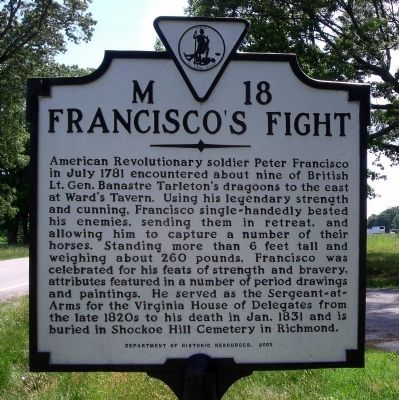
Francisco's Fight
Erected 2003 by Department of Historic Resources. (Marker Number M-18.)
Topics and series. This historical marker is listed in this topic list: War, US Revolutionary. In addition, it is included in the Virginia Department of Historic Resources (DHR) series list. A significant historical month for this entry is July 1781.
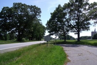
Location. 37° 15.974′ N, 78° 7.923′ W. Marker is near Crewe, Virginia, in Nottoway County. Marker is on Patrick Henry Highway (U.S. 360) 0.9 miles west of Holly Farms Road, on the right when traveling west. Touch for map. Marker is in this post office area: Crewe VA 23930, United States of America. Touch for directions.
Other nearby markers. At least 8 other markers are within 5 miles of this marker, measured as the crow flies. Nottoway County / Amelia County (approx. 0.6 miles away); a different marker also named Nottoway County / Amelia County (approx. 0.6 miles away); Lee's Retreat (approx. 2.7 miles away); a different marker also named Lee's Retreat (approx. 2.7 miles away); a different marker also named Lee's Retreat (approx. 2.7 miles away); Jetersville (approx. 2.8 miles away); a different marker also named Lee's Retreat (approx. 4.6 miles away); a different marker also named Lee's Retreat (approx. 4.7 miles away).
Also see . . . Peter Francisco: A One Man Army. George Washington said of Francisco, "Without him we would have lost two crucial battles, perhaps the War, and with it our freedom. He was truly a One-Man Army." (Submitted on June 11, 2010, by Craig Swain of Leesburg, Virginia.)
Credits. This page was last revised on June 16, 2016. It was originally submitted on May 16, 2009, by Bernard Fisher of Richmond, Virginia. This page has been viewed 1,146 times since then and 36 times this year. Photos: 1, 2. submitted on May 16, 2009, by Bernard Fisher of Richmond, Virginia.

