Crewe in Nottoway County, Virginia — The American South (Mid-Atlantic)
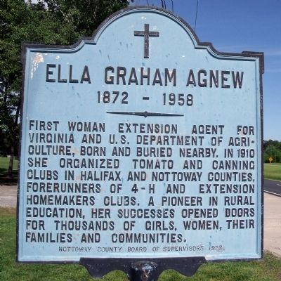
Ella Graham Agnew
1872 - 1958
Erected 1978 by Nottoway County Board of Supervisors.
Topics. This historical marker is listed in these topic lists: Agriculture • Education. A significant historical year for this entry is 1910.
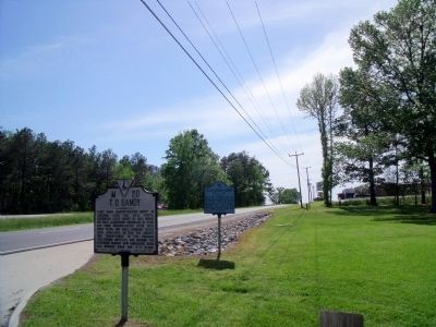
Location. 37° 11.432′ N, 78° 9.436′ W. Marker is in Crewe, Virginia, in Nottoway County. Marker is on Colonial Trail (U.S. 460) 0.3 miles west of Rocky Ford Road, on the right when traveling west. Touch for map. Marker is in this post office area: Crewe VA 23930, United States of America. Touch for directions.
Other nearby markers. At least 8 other markers are within 2 miles of this marker, measured as the crow flies. T. O. Sandy (a few steps from this marker); Veterans Memorial (approx. 1.8 miles away); Tarleton's Southside Virginia Raid (approx. 1.8 miles away); Peter Francisco's Fight: Fact or Fiction? (approx. 1.8 miles away); Peter Francisco: Hercules of the Revolution (approx. 1.8 miles away); Peter Francisco: Washington's One Man Army (approx. 1.8 miles away); Crewe (approx. 1.9 miles away); Roger Atkinson Pryor (approx. 1.9 miles away). Touch for a list and map of all markers in Crewe.
Credits. This page was last revised on June 16, 2016. It was originally submitted on May 16, 2009, by Bernard Fisher of Richmond, Virginia. This page has been viewed 1,400 times since then and 92 times this year. Photos: 1, 2. submitted on May 16, 2009, by Bernard Fisher of Richmond, Virginia.

