Nassau near Lewes in Sussex County, Delaware — The American Northeast (Mid-Atlantic)
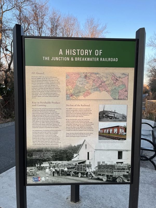
A History of the Junction & Breakwater Railroad

Photographed By Devry Becker Jones (CC0), January 14, 2022
1. A History of the Junction & Breakwater Railroad Marker
All Aboard!
Chartered in 1857, the Junction & Breakwater Railroad (J&BRR) ran the 38 miles from a junction with the Delaware Railroad in Harrington to the Delaware Breakwater in Lewes. The portion of the line from Georgetown to Lewes opened for service in 1870 with stations at each end. Between the established endpoints, new stations constructed at Messick, Gravely Hill (later Bennum), Harbeson (later Broadkill), Cool Spring, and Nassau served as anchors for the growth of small communities around each location. All of the stations were used to load freight, while only four stations (Georgetown, Broadkill, Nassau, and Lewes) offered passenger service.
Rise in Perishable Produce and Canning
The arrival of the railroad spurred local manufacturing and agricultural activities and transformed communities, like Georgetown, into important regional transportation and trade centers. The J&BRR enabled local farmers to ship their products to urban markets more efficiently. A rise in demand for perishable products, like fruits and vegetables, spurred the establishments of canning and preserving facilities along the railroad line during the late nineteenth and early twentieth centuries at Georgetown, Cool Spring, and Nassau.
Decline of the Railroad
The J&BRR continued to serve as an important regional transportation route for commercial and passenger traffic into the mid-twentieth century, first as a subsidiary of the Delaware Maryland & Virginia Railroad, and later as a lessee of the Philadelphia, Baltimore & Wilmington Railroad.
By the mid-twentieth century, the J&BRR faced increasing competition from Delaware's emerging trucking industry and the rising national trend in automobile use. Unable to compete, passenger service on the line terminated in 1949. During the 1980s, the State of Delaware acquired the rights to the section of the railroad line from Georgetown to Lewes, and up until 2016, it operated as a freight line under the Delaware Coast Line Railroad.
Today, the only railroad buildings that remain along this section of the line are the former Passenger Station and Engine House in Georgetown.
[Caption:]
The efficiency of the railroad encouraged local farmers to grow perishable crops, like fruit and vegetables, and spurred the creation of a regional canning industry. Trucks delivered raw produce to packinghouses (like the one seen here), where it was received and processed before being loaded onto railroad cars and shipped to urban markets (image courtesy of the Delaware Public Archives, Dover, Delaware).
Erected by Delaware Department of Transportation
Topics. This historical marker is listed in these topic lists: Agriculture • Industry & Commerce • Railroads & Streetcars. A significant historical year for this entry is 1857.
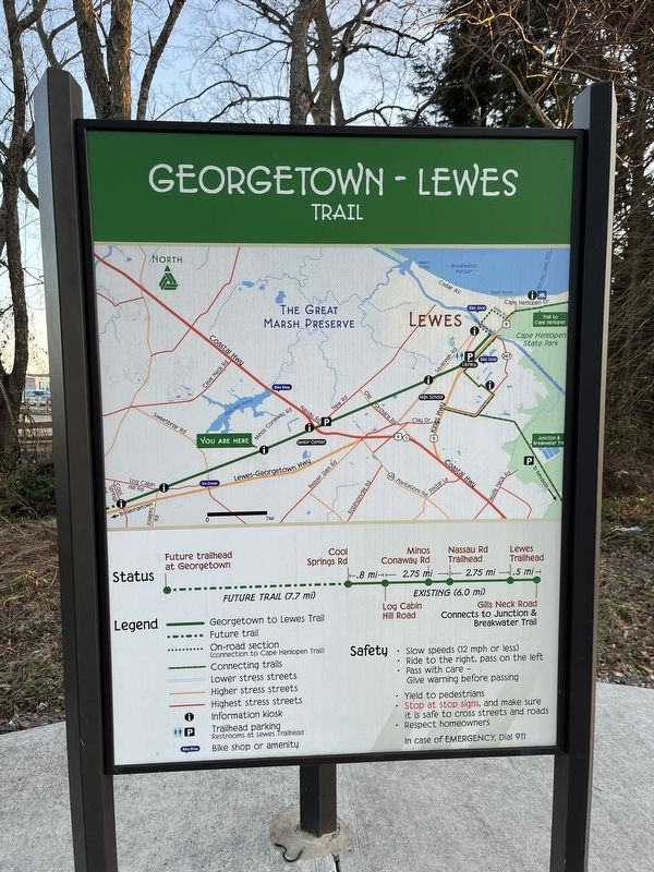
Location. 38° 44.736′ N, 75° 12.388′ W. Marker is near Lewes, Delaware, in Sussex County. It is in Nassau. Marker is on Lewes Georgetown Trail just east of Minos Conaway Road (Delaware Route 265), on the right when traveling east. Touch for map. Marker is at or near this postal address: 17495 Minos Conaway Rd, Lewes DE 19958, United States of America. Touch for directions.
Other nearby markers. At least 8 other markers are within 3 miles of this marker, measured as the crow flies. Cool Spring Station (here, next to this marker); Kiosk Dedicated in Memory of Thomas H. Draper (approx. 0.9 miles away); Broadkiln Hundred (approx. one mile away); a different marker also named A History of the Junction & Breakwater Railroad (approx. 1.1 miles away); Nassau Station (approx. 1.1 miles away); Cool Spring Presbyterian Church (approx. 1.9 miles away); Israel United Methodist Church (approx. 2 miles away); The Coursey-Daisey Nanticoke Indian Burial Ground (approx. 2.1 miles away). Touch for a list and map of all markers in Lewes.
Credits. This page was last revised on September 18, 2023. It was originally submitted on January 16, 2022, by Devry Becker Jones of Washington, District of Columbia. This page has been viewed 197 times since then and 36 times this year. Photos: 1, 2. submitted on January 16, 2022, by Devry Becker Jones of Washington, District of Columbia.
Editor’s want-list for this marker. A wide shot of the marker in context. • Can you help?
