Wesser in Swain County, North Carolina — The American South (South Atlantic)
Nantahala Town
"the trail where they cried"
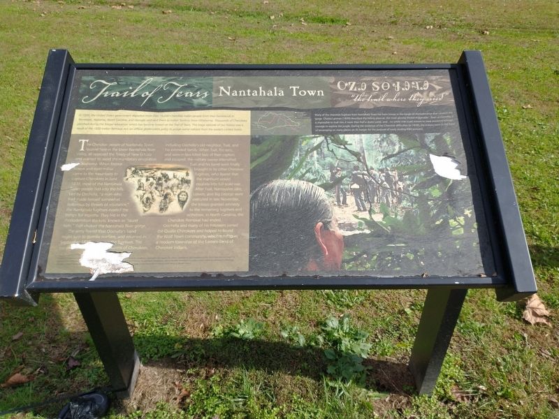
— Trail of Tears —
In 1838, the United States government deported more than 16,000 Cherokee Indian people from the homelands in Tennessee, Alabama, North Carolina, and Georgia, and sent them to Indian Territory (now Oklahoma). Thousands of Cherokees perished during the forced relocation, which has become known as the Trail of Tears. This tragic episode in our history was a result of the 1830 Indian Removal Act, an official government policy to purge native nations from the eastern United States.
The Cherokee people of Nantahala Town, located here in the lower Nantahala River Valley, all opposed the Treaty of New Echota and wanted to avoid the mandatory emigration to Oklahoma. When federal troops and state militia came to the mountains to capture Cherokees in June 1838, most of the Nantahala Town people fled into the hills. Led by Oochella, “a man who had made himself somewhat notorious by threats of resistance”, the Nantahala fugitives evaded the troops for months. They hid in the rhododendron thickets, known as “laurel hells”, that choked the Nantahala River gorge.
The army feared that Oochella’s band might turn to guerilla warfare, and returned in September …illegible….the fugitives. The troops…illegible….dozens of Cherokees, including Oochella’s old neighbor, Tsali, and his extended family. When Tsali, his sons, and sons-in-law killed two of their captors and escaped, the military sweep intensified. Tsali and his band were finally brought in by other Cherokee fugitives, who feared that the manhunt would escalate into full-scale war. After Tsali, Nantayalee Jake, Lowen, and Big George were executed in late November, the troops granted amnesty to the remaining fugitives and withdrew. In North Carolina, the Cherokee Removal had ended.
Oochella and many of his followers joined the Qualla Cherokees and helped to found the Wolf Town community, which survives as a modern township of the Eastern Band of Cherokee Indians.
(sidebar)
Many of the Cherokee fugitives from Nantahala Town hid from troops in the tangle of rhododendron that covered the gorge. Charles Lanman (1849) described the hiding place as: the most gloomy thicket imaginable…Even at noonday, it is impossible to look into it more than half a dozen yards, and…no white man is yet known to have mustered enough courage to explore the jungle. During the existence of the Cherokee difficulties [in 1838], the Indians were in the habit of encamping on many places on its margin for the purpose of easily eluding their pursuers.
Topics and series. This historical marker is listed in this topic list: Native Americans. In addition, it is included in the Trail of Tears series list. A significant historical month for this entry is June 1838.
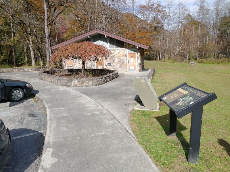
Location. 35° 18.184′ N, 83° 39.191′ W. Marker is in Wesser, North Carolina, in Swain County. Marker is on Andrew Jackson Highway (U.S. 19/74) 0.1 miles north of Hewitts Road, on the right when traveling south. Marker is located at the Ferebee Memorial Picnic Area. Touch for map. Marker is at or near this postal address: 18100 W Hwy 19, Bryson City NC 28713, United States of America. Touch for directions.
Other nearby markers. At least 8 other markers are within 9 miles of this marker, measured as the crow flies. William Bartram (approx. 2.3 miles away); Civil War in Graham County (approx. 8.8 miles away); Junaluska (approx. 8.8 miles away); Junaluska and The Battle of Horseshoe Bend (approx. 8.8 miles away); 1819 Treaty with the United States (approx. 8.8 miles away); Junaluska and the Trail of Tears (approx. 8.8 miles away); a different marker also named Junaluska (approx. 8.8 miles away); Junaluska's Meeting With Tecumseh at Soco Gap (approx. 8.9 miles away).
Credits. This page was last revised on January 17, 2022. It was originally submitted on January 17, 2022, by Tom Bosse of Jefferson City, Tennessee. This page has been viewed 245 times since then and 31 times this year. Photos: 1, 2. submitted on January 17, 2022, by Tom Bosse of Jefferson City, Tennessee. • Bernard Fisher was the editor who published this page.

