Laurel in Yellowstone County, Montana — The American West (Mountains)
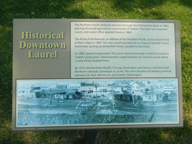
Historical Downtown Laurel
The Rocky Fork Railroad, an affiliate of the Northern Pacific, built a branch line to Red Lodge in 1889. The new Laurel was laid out as a typical railroad town; businesses sprang up along Main Street parallel to the tracks.
In 1906, Laurel incorporated. The Laurel Sentinel proudly invited the world to "watch Laurel grow" while boosters urged investors to come to Laure where "a sure thing" awaited them.
By 1914, the Northern Pacific; Chicago, Burlington and Quincy; and the Great Northern railroad converged at Laurel. The town became the leading terminal between St. Paul, Minnesota and Seattle, Washington.
Erected by Laurel Chamber of Commerce.
Topics. This historical marker is listed in this topic list: Settlements & Settlers.
Location. 45° 40.155′ N, 108° 46.237′ W. Marker is in Laurel, Montana, in Yellowstone County. Marker is on East Main Street (Old U.S. 10) near 1st Avenue, on the left when traveling west. Touch for map. Marker is at or near this postal address: 108 East Main Street, Laurel MT 59044, United States of America. Touch for directions.
Other nearby markers. At least 8 other markers are within 8 miles of this marker, measured as the crow flies. The Yellowstone Trail (here, next to this marker); Lewis & Clark expedition July 24, 1806 (here, next to this marker); The Battle at Canyon Creek (here, next to this marker); Chamber Log Cabin (here, next to this marker); North School's Bell (a few steps from this marker); Abraham and Carrie Erb Residence (approx. ¼ mile away); Battle of Canyon Creek (approx. 7½ miles away); Nez Perce National Historical Park (approx. 7½ miles away). Touch for a list and map of all markers in Laurel.
Credits. This page was last revised on January 21, 2022. It was originally submitted on January 21, 2022, by Barry Swackhamer of Brentwood, California. This page has been viewed 126 times since then and 13 times this year. Photos: 1, 2. submitted on January 21, 2022, by Barry Swackhamer of Brentwood, California.

