Kill Devil Hills in Dare County, North Carolina — The American South (South Atlantic)
Among Friends
Wright Brothers National Memorial
Photographed by Tom Bosse, September 18, 2021
1. Among Friends Marker
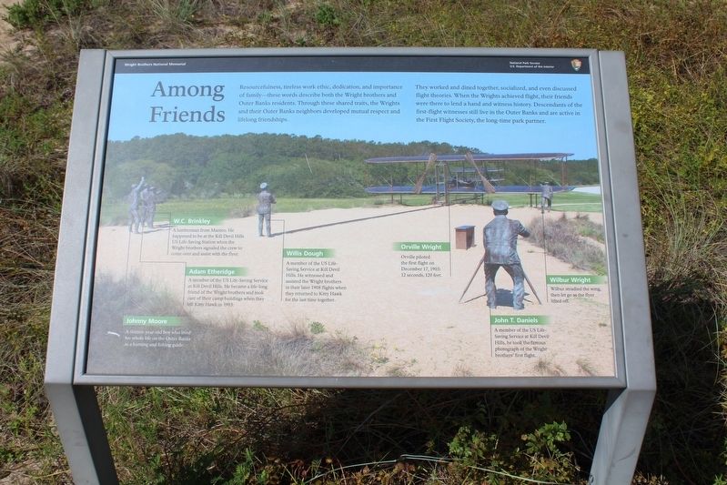
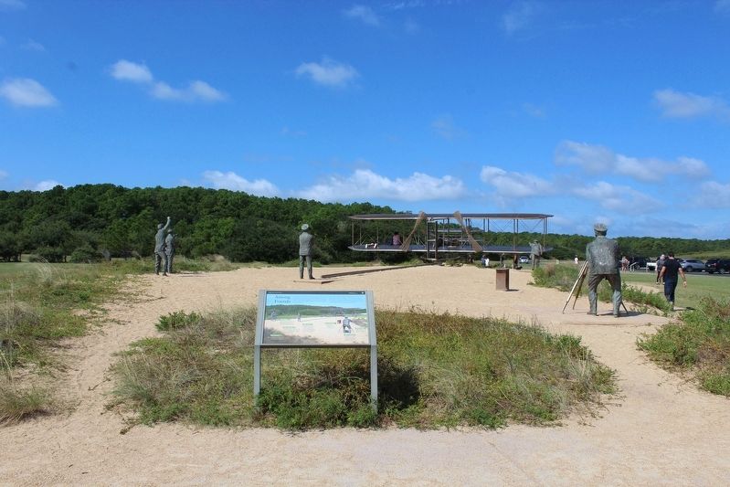
They worked and dined together, socialized, and even discussed flight theories. When the Wrights achieved flight, their friends were there to lend a hand and witness history. Descendants of the first-flight witnesses still live in the Outer Banks and are active in the First Flight Society, the long-time park partner.
(caption)
Johnny Moore - A sixteen-year-old boy who lived his whole live on the Outer Banks as a hunting and fishing guide.
Adam Etheridge - A member of the US Life-Saving Service at Kill Devil Hills. He became a life-long friend of the Wright brothers and took care of their camp buildings when they left Kitty Hawk in 1903.
W.C. Brinkley - A lumberman from Manteo. He happened to be at the Kill Devil Hills US Life-Saving Station when the Wright brothers signaled the crew to come over and assist with the flyer.
Willis Dough -
this page online
Orville Wright - Orville piloted the first flight on December 17, 1903: 12 seconds, 120 feet.
John T. Daniels - A member of the US Life-Saving Service at Kill Devil Hills, he took the famous photograph of the Wright brothers' first flight.
Wilbur Wright - Wilbur steadied the wing, then let go as the flyer lifted off.
Erected by National Park Service, U.S. Department of the Interior.
Topics. This historical marker is listed in this topic list: Air & Space. A significant historical date for this entry is December 17, 1903.
Location. 36° 0.712′ N, 75° 40.015′ W. Marker is in Kill Devil Hills, North Carolina, in Dare County. It can be reached from the intersection of Colington Road and Veterans Drive, on the left when traveling east. Touch for map. Marker is at or near this postal address: 1000 N Croatan Hwy, Kill Devil Hills NC 27948, United States of America. Touch for directions.

Regionally, this marker is in North Carolina’s Coastal Plain
Photographed by Tom Bosse, September 18, 2021
2. Among Friends Marker
Other nearby markers. At least 8 other markers are within walking distance of this marker: The Conquest of the Air (within shouting distance of this marker); A hospitable people... (within shouting distance of this marker); 12 Seconds that Changed the World (within shouting distance of this marker); Big Kill Devil Hill (within shouting distance of this marker); Dare County's Tribute to Veterans (about 800 feet away, measured in a direct line); Wright Brothers National Memorial (approx. 0.2 miles away); Monument to the Impossible (approx. ¼ mile away); Pitch, Roll and Yaw (approx. ¼ mile away). Touch for a list and map of all markers in Kill Devil Hills.
Also see . . . Wright Brothers National Memorial.
Photographed by Tom Bosse, September 18, 2021
3. Among Friends Sculpture
Photographed by Tom Bosse, September 18, 2021
4. Among Friends Sculpture
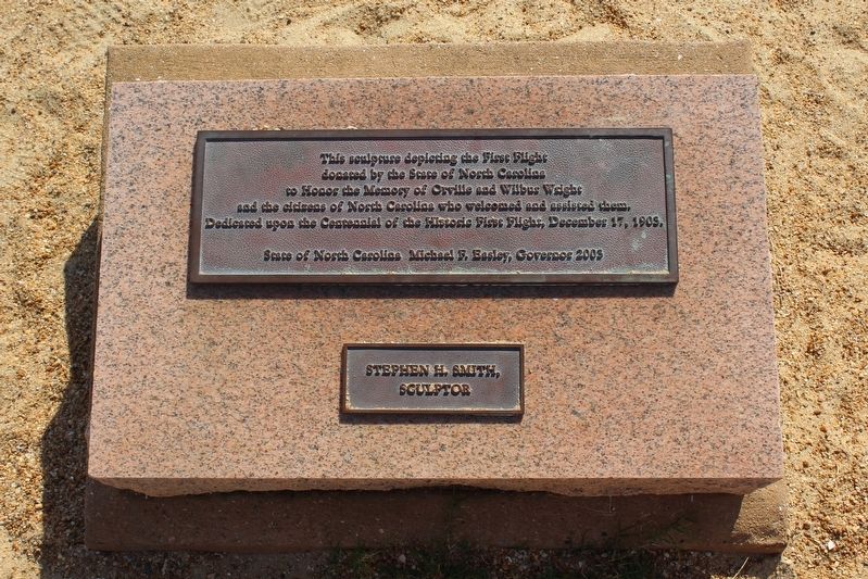
Photographed by Tom Bosse, September 18, 2021
5. Among Friends Sculpture
Credits. This page was last revised on January 22, 2022. It was originally submitted on January 22, 2022, by Tom Bosse of Jefferson City, Tennessee. This page has been viewed 537 times since then and 28 times this year. Photos: 1, 2, 3, 4, 5. submitted on January 22, 2022, by Tom Bosse of Jefferson City, Tennessee. • Bernard Fisher was the editor who published this page.
