Kill Devil Hills in Dare County, North Carolina — The American South (South Atlantic)
Wright Brothers
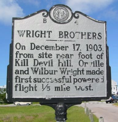
Photographed by Kevin W., July 19, 2008
1. Wright Brothers Marker
Erected 1989 by Division of Archives and History. (Marker Number B-4.)
Topics and series. This historical marker is listed in this topic list: Air & Space. In addition, it is included in the North Carolina Division of Archives and History series list. A significant historical month for this entry is December 1819.
Location. This marker has been replaced by another marker nearby. It was located near 36° 1.272′ N, 75° 39.741′ W. Marker was in Kill Devil Hills, North Carolina, in Dare County. It was on Prospect Avenue near Virginia Dare Trail (North Carolina Highway 12), on the right when traveling west. Touch for map. Marker was in this post office area: Kill Devil Hills NC 27948, United States of America. Touch for directions.

Regionally, this marker was in the Coastal Plain and on the Outer Banks. It was also in the American South, specifically in the Upper South, in the Tidewater, and on the Eastern Seaboard. Globally, it was in the North Atlantic Region, North America, the
this page online
Other nearby markers. At least 8 other markers are within walking distance of this location: From Ohio to the Outer Banks (approx. 0.2 miles away); Remembering First Flight (approx. 0.2 miles away); a different marker also named Wright Brothers (approx. 0.2 miles away); Wright Brothers National Memorial Visitor Center (approx. 0.3 miles away); They Taught Us to Fly (approx. 0.3 miles away); Wind, Sand, & Isolation (approx. 0.3 miles away); The First Flight (approx. 0.3 miles away); Field for Flight (approx. 0.3 miles away). Touch for a list and map of all markers in Kill Devil Hills.
More about this marker. This marker replaces a previous marker, also numbered B-4, located on Virginia Dare Trail (NC Highway 12). the original marker, titled Kill Devil Hill read, "There Orville and Wilbur Wright made first flight of power driven airplane, Dec. 17, 1903. National Monument
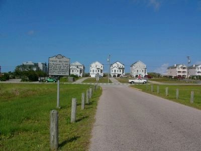
Photographed by Kevin W., July 19, 2008
2. Wright Brothers Marker
View is looking east, toward Virginia Dare Trail (NC Highway 12) and the Atlantic Ocean.
Related marker. Click here for another marker that is related to this marker. Updated Marker Relocated Nearby also titled "Wright Brothers".
Also see . . . The Wright Brothers. Smithsonian Air and Space Museum online exhibit for the Wright Brothers. (Submitted on July 30, 2008, by Craig Swain of Leesburg, Virginia.)
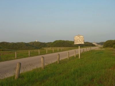
Photographed by Kevin W., July 22, 2008
3. Wright Brothers Marker
View is looking west, toward the Wright Brothers National Monument. The monument itself can barely be seen to the left of the marker, about halfway to the edge of the picture.
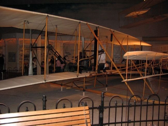
Photographed by Craig Swain, May 23, 2008
4. The 1903 Wright Flyer
The original Wright Flyer is today on exhibit at the National Air and Space Museum, Washington, D.C.
Credits. This page was last revised on January 24, 2022. It was originally submitted on July 30, 2008, by Kevin W. of Stafford, Virginia. This page has been viewed 2,218 times since then and 90 times this year. Last updated on January 22, 2022, by Tom Bosse of Jefferson City, Tennessee. Photos: 1, 2, 3. submitted on July 30, 2008, by Kevin W. of Stafford, Virginia. 4. submitted on July 30, 2008, by Craig Swain of Leesburg, Virginia. • J. Makali Bruton was the editor who published this page.
