Hamilton Township in Atlantic County, New Jersey — The American Northeast (Mid-Atlantic)
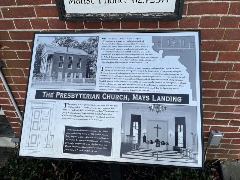
The Presbyterian Church, Mays Landing
1841

Photographed By Devry Becker Jones (CC0), January 22, 2022
1. The Presbyterian Church, Mays Landing Marker
The Presbyterian Church in Mays Landing was constructed between 1841 and 1844 in the Greek Revival Style. Samuel Richards, owner of the Weymouth Furnace, and his wife Anna donated a lot of ground, valued at $100 and centrally located in May's Landing on Main Street. The cornerstone was laid in April 1841. Red bricks used for the exterior walls were reportedly carried by ship from New York, while the Richards donated cast iron columns to provide central interior support for the sanctuary floor. The sanctuary was finished and dedicated on 4 December 1844. The total cost for construction was $3,279.
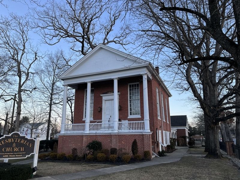
The church is architecturally significant as an atypical, early rural example of a high-style Greek Revival red brick building. It incorporates many of the characteristics of this style, including the full temple-front portico, the symmetrical facade with an accented center entrance, the symmetry on the secondary elevations, the proportions of the building, and the tall graceful windows. This church is the only known example in New Jersey of a raised base, full portico Greek Revival facade with flanking staircases. Greek Revival, once called America's "National Style," became popular in the 1820s and represented a break with the earlier architectural styles, which were associated with England at a time when the United States was establishing its own independent culture. The temple front, modeled on the Parthenon, with its porticoed gable-end facade, became the Greek Revival standard as seen here.
The property is also significant for its association with Rev. Allen H. Brown, D.D. (1820-1907) who served as its pastor from 1846-1854 and 1862-1872 and was considered the "Historian of New Jersey Presbyterianism." It is noteworthy that the Presbyterian Church is the oldest in Mays Landing, and one of the few unaltered historic sanctuaries in continuous use in New Jersey.
The Presbyterian Church was recorded by the Historic American Buildings Survey in 1938, listed on the New Jersey Register of Historic Places in 1981, and listed on the National Register of Historic Places in 1982. Funding for this sign was provided, in part, by the Garden State Historic Preservation Trust, administered by the New Jersey Historic Trust/State of New Jersey.
Topics. This historical marker is listed in these topic lists: Architecture • Churches & Religion. A significant historical month for this entry is April 1841.
Location. 39° 27.145′ N, 74° 43.657′ W. Marker is near Hamilton, New Jersey, in Atlantic County. It is in Hamilton Township. Marker is on Cape May Avenue (New Jersey Route 50) just north of Main Street, on the left when traveling north. Touch for map
Other nearby markers. At least 8 other markers are within walking distance of this marker. Colonel Richard Wescoat (within shouting distance of this marker); Veterans Memorial (within shouting distance of this marker); Fallen Soldiers Memorial (within shouting distance of this marker); World War I Memorial (within shouting distance of this marker); 9-11-2001 (within shouting distance of this marker); Atlantic County Court House (about 500 feet away, measured in a direct line); American Hotel (about 800 feet away); POW★MIA (approx. ¼ mile away). Touch for a list and map of all markers in Hamilton.
Credits. This page was last revised on February 7, 2023. It was originally submitted on January 23, 2022, by Devry Becker Jones of Washington, District of Columbia. This page has been viewed 131 times since then and 18 times this year. Photos: 1, 2. submitted on January 23, 2022, by Devry Becker Jones of Washington, District of Columbia.
