Manteo in Dare County, North Carolina — The American South (South Atlantic)
Windmills on Roanoke Island
Charles Johnson, Hawkins Zouaves, 1862
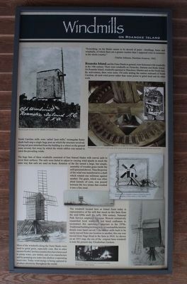
Roanoke Island, and the Outer Banks in general, were festooned with windmills in the 19th century. There were windmills on Ocracoke, Hatteras and Bodie Island. On Roanoke Island, windmills operated in Wanchese, Manteo and on the North End. By mid-century, there were some 150 mills dotting the eastern seaboard of North Carolina’ all used wind power rather than water power to grind meal and do other work.
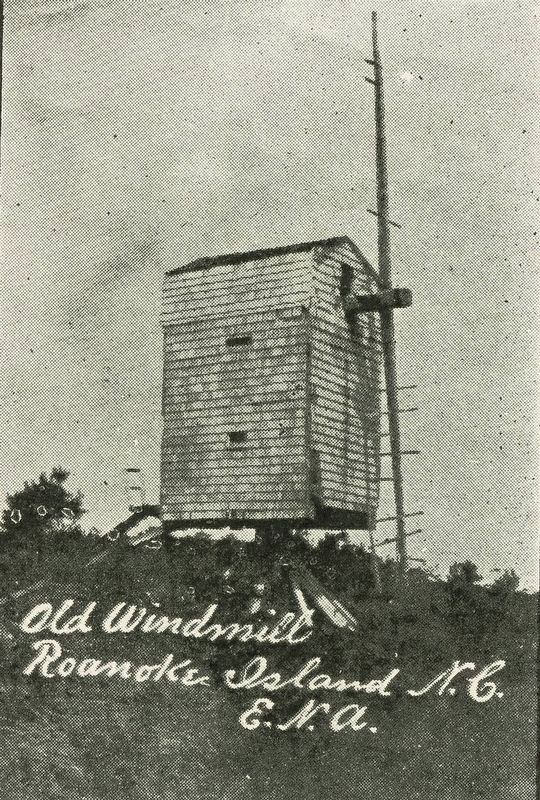
North Carolina mills were called “post mills”, rectangular frame sheds built atop a single huge post on which the structure revolved. A long tail post stretched from the building to a wheel on the ground some seventy feet away by which the whole edifice was turned to catch the prevailing winds.
The huge fans of these windmills consisted of four frame blades with canvas sails to cover their surfaces. The sails were furled to adjust to varying wind speeds in much the same way that sails are used on boats. Rotation of the fan turned a large, but simple, assembly of wooden gears inside the mill (pictured above). Thus, the power of the wind was transferred to a shaft which rotated one millstone against another. The grain, which was often dried kernels of corn, was poured between the two stones that crushed it into a fine meal.
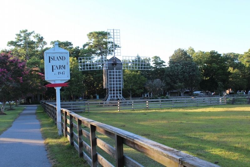
The windmill located here at Island Farm today is representative of the mill that stood on this farm from the mid-1800s until the early 20th century. National Park Service employee Lynanne Wescott extensively researched local windmills and hired craftsmen to reconstruct this operational structure in the 1970s. Traditional building techniques were used and the interior details were hand carved. Like earlier mills build to be easily moved from one location to another, this one was moved from Nags Head to the farm in 2010. As shown on an 1851 map, the site of the original farm windmill is near the present-day Elizabethan Gardens.
Most of the windmills along the Outer Banks were used to grind grain, especially corn. But in other eastern North Carolina counties they have been used to pump water, saw timber, and even manufacture salt by pumping sea water into shallow evaporating reservoirs. Today wind energy is being captured to produce electricity throughout the world.
(captions)
This photograph was taken by E.N. Anketell, who lived in Manteo.
Wooden gears were used to transfer energy of the wind to rotate the grinding millstone. Inset shows interior of a post mill.
This drawing of a windmill on Hatteras Island was done by Edwin Champney, a Union soldier, in 1862 (OBHC)
Windmills ground corn kernels into cornmeal for cooking. Photograph by Emma Coleman.
Erected by The Island Farm.
Topics. This historical marker is listed in these topic lists: Agriculture • Industry & Commerce.
Location. 35° 55.729′ N, 75° 41.244′ W. Marker is in Manteo, North Carolina, in Dare County. Marker can be reached from the intersection of U.S. 64 and Buzzy Lane, on the left when traveling north. Touch for map. Marker is at or near this postal address: 1140 US-64, Manteo NC 27954, United States of America. Touch for directions.
Other nearby markers. At least 8 other markers are within 2 miles of this marker, measured as the crow flies. Freedmen's Colony (approx. 0.4 miles away); Joachim Gans (approx. 1.1 miles away); Civil Air Patrol (approx. 1.2 miles away); First Light of Freedom (approx. 1.3 miles away); The New Fort in Virginia / Virginia Dare (approx. 1.3 miles away); A Civil War Refuge (approx. 1.3 miles away); A Legacy of Freedom (approx. 1.3 miles away); Exploring the Unknown (approx. 1.4 miles away). Touch for a list and map of all markers in Manteo.
Also see . . . Island Farm. Outer Banks Conservationists (Submitted on January 24, 2022, by Tom Bosse of Jefferson City, Tennessee.)

courtesy of Wilson Library, University of North Carolina at Chapel Hill
4. Old Windmill, Roanoke Island, N.C. (source image for upper left marker photo)
"This windmill, still standing just south of the town of Manteo, N.C., was erected many years ago. It used to grind all the grain used in this section."
Credits. This page was last revised on January 24, 2022. It was originally submitted on January 24, 2022, by Tom Bosse of Jefferson City, Tennessee. This page has been viewed 823 times since then and 155 times this year. Photos: 1, 2, 3. submitted on January 24, 2022, by Tom Bosse of Jefferson City, Tennessee. 4. submitted on January 24, 2022. • Bernard Fisher was the editor who published this page.


