Mount Pleasant in Charleston County, South Carolina — The American South (South Atlantic)
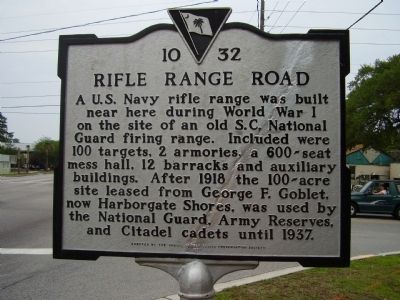
Rifle Range Road
Erected 1999 by Christ Church Parish Preservation Society. (Marker Number 10-32.)
Topics. This historical marker is listed in these topic lists: Military • Roads & Vehicles • War, World I. A significant historical year for this entry is 1918.
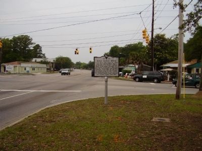
Location. 32° 47.617′ N, 79° 51.374′ W. Marker is in Mount Pleasant, South Carolina, in Charleston County. Marker is at the intersection of Ben Sawyer Boulevard (State Highway 703) and Rifle Range Road on Ben Sawyer Boulevard. Touch for map. Marker is in this post office area: Mount Pleasant SC 29464, United States of America. Touch for directions.
Other nearby markers. At least 10 other markers are within 2 miles of this marker, measured as the crow flies. Vaughn Edward Kee (approx. ¼ mile away); Edmund Jenkins / Ocean Grove Cemetery (approx. 0.9 miles away); Jasper Green/ Sergeant William Jasper (approx. one mile away); General William Moultrie / Moultrie Schools (approx. one mile away); Mount Pleasant Academy (approx. one mile away); The King's Highway / Coleman Boulevard (approx. one mile away); "The Kings Highway" (approx. 1.1 miles away); The Old Village (approx. 1.1 miles away); "Storm of the Century" (approx. 1.1 miles away); Friendship A.M.E. Church (approx. 1.1 miles away). Touch for a list and map of all markers in Mount Pleasant.
Additional commentary.
1.
I recently acquired a scrap book, with almost 100 pages, that appears to have been kept by one of the original range masters at Mt. Pleasant Naval Gun Range in 1918. It is full of history and names and wondered if it would be of any interest to anyone there. Please send me any questions and I will look them up. Thank you, Mike- [email protected]
— Submitted October 11, 2014, by Mike Hall of Redlands, California.
Credits. This page was last revised on June 16, 2016. It was originally submitted on May 17, 2009, by Stanley and Terrie Howard of Greer, South Carolina. This page has been viewed 1,478 times since then and 67 times this year. Photos: 1, 2. submitted on May 17, 2009, by Stanley and Terrie Howard of Greer, South Carolina. • Kevin W. was the editor who published this page.

