Roanoke, Virginia — The American South (Mid-Atlantic)
The Norwich Neighborhood
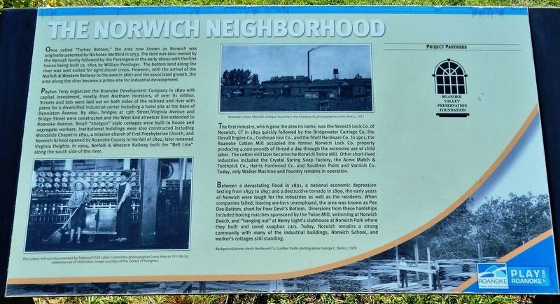
Once called "Turkey Bottom," the area now known as Norwich was originally patented by Nicholas Hartford in 1753. The land was later owned by the Hannah family followed by the Persingers in the early 1800s with the first house being built ca. 1825 by William Persinger. The bottom land along the river was well suited for agricultural crops. However, with the arrival of the Norfolk & Western Railway to the area in 1882 and the associated growth, the area along the river became a prime site for industrial development.
Peyton Terry organized the Roanoke Development Company in 1890 with capital investment, mostly from Northern investors, of over $1 million. Streets and lots were laid out on both sides of the railroad and river with plans for a diversified industrial center including a hotel site at the base of Denniston Avenue. By 1891, bridges at 13th Street/Virginia Avenue and Bridge Street were constructed and the West End streetcar line extended to Roanoke Avenue. Small "shotgun" style cottages were built to house and segregate workers. Institutional buildings were also constructed including Woodside Chapel in 1891, a mission church of First Presbyterian Church, and Norwich School opened by Roanoke County in the fall of 1892, later renamed Virginia Heights. In 1904, Norfolk & Western Railway built the "Belt Line" along the south side of the river.
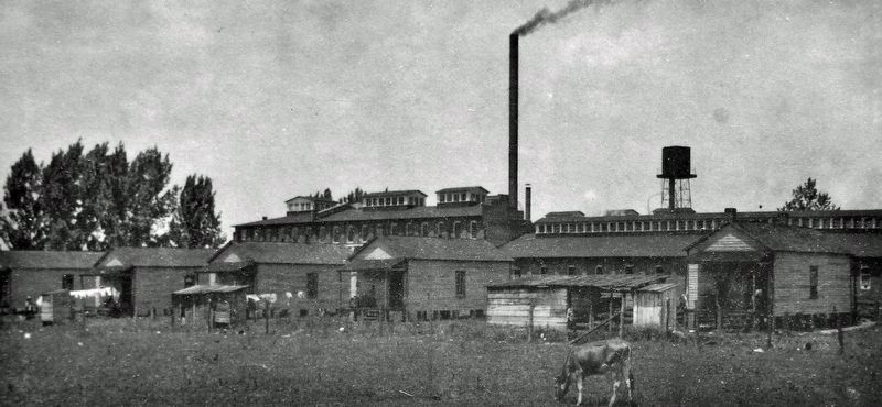
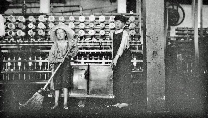
The first industry, which gave the area its name, was the Norwich Lock Co. of Norwich, CT in 1891 quickly followed by the Bridgewater Carriage Co., the Duvall Engine Co., Cushman Iron Co., and the Shelf Hardware Co. In 1901, the Roanoke Cotton Mill occupied the former Norwich Lock Co. property producing 4,000 pounds of thread a day through the extensive use of child labor. The cotton mill later became the Norwich Twine Mill. Other short-lived industries included the Crystal Spring Soap Factory, the Acme Match & Toothpick Co., Harris Hardwood Co. and Southern Paint and Varnish Co. Today, only Walker Machine and Foundry remains in operation.
Between a devastating flood in 1891, a national economic depression lasting from 1893 to 1897 and a destructive tornado in 1899, the early years of Norwich were tough for the industries as well as the residents. When companies failed, leaving workers unemployed, the area was known as Pee Dee Bottom, short for Poor Devil's Bottom. Diversions from these hardships included boxing matches sponsored by the Twine Mill, swimming at Norwich Beach, and "hanging out" at Henry Light's clubhouse at Norwich Park where they built and raced soapbox cars. Today, Norwich remains a strong community with many of the industrial buildings, Norwich School, and worker's cottages still standing.
Background photo: Harris
Hardwood Co. Lumber Yards;
photographer George C. Davis; c. 1920
Erected by Roanoke Parks and Recreation; and Roanoke Valley Preservation Foundation.
Topics. This historical marker is listed in these topic lists: Industry & Commerce • Railroads & Streetcars • Settlements & Settlers. A significant historical year for this entry is 1753.
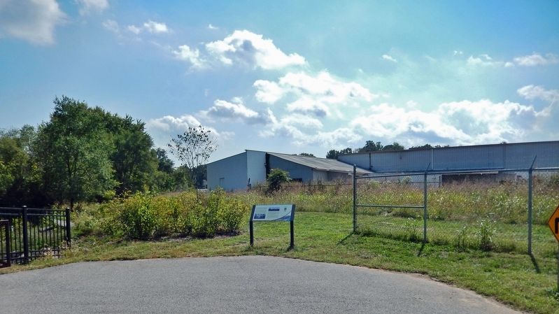
Location. 37° 16.356′ N, 79° 58.529′ W. Marker is in Roanoke, Virginia. Marker is on Roanoke River Greenway, 0.3 miles east of Bridge Street Southwest. Marker is 3/10 mile east of the Roanoke River Greenway Bridge Street Trailhead. Access to the marker is via foot or bicycle. Touch for map. Marker is in this post office area: Roanoke VA 24015, United States of America. Touch for directions.
Other nearby markers. At least 8 other markers are within 2 miles of this marker, measured as the crow flies. Fire Station No. 7 (approx. half a mile away); Roanoke Memorial Bridge (approx. 0.6 miles away); Birthplace of Henrietta Lacks (approx. 0.8 miles away); Torteras Village Indian Trail (approx. 0.8 miles away); Agatha Strother Lewis/Col. Elijah McClanahan (approx. 0.9 miles away); James Alexander Tract Boundary (approx. 0.9 miles away); 511 Day Ave SW (approx. 1.4 miles away); Villa Heights (approx. 1.4 miles away). Touch for a list and map of all markers in Roanoke.
Also see . . .
1. Norwich Neighborhood.
Norwich is a small, historic community that once thrived with factories, mills, grocery stores, churches, and a school — all supported by a community well from an underground spring. Located approximately two miles west of downtown, the neighborhood dates back to the late 1800s when it was settled on the south bank of the Roanoke River with foundries and factories. The village flourished through the mid-twentieth century until a majority of its sustainable manufacturing plants, such as the Norwich Twine Mill and the Harris Hardwood Company lumber yard, succumbed to floods and fire. The residents pride themselves in their long and continuous ties to the neighborhood; one such family has resided there for five generations.(Submitted on January 29, 2022, by Cosmos Mariner of Cape Canaveral, Florida.)
2. Norwich, Roanoke, Virginia.
Annexed to Roanoke in 1919, the area since the 1960s has remained primarily residential in character, with some areas of industrial infill on the periphery. Most homes in the Norwich community were built in 1900.(Submitted on January 29, 2022, by Cosmos Mariner of Cape Canaveral, Florida.)
Credits. This page was last revised on February 1, 2023. It was originally submitted on January 28, 2022, by Cosmos Mariner of Cape Canaveral, Florida. This page has been viewed 632 times since then and 35 times this year. Photos: 1, 2, 3, 4. submitted on January 29, 2022, by Cosmos Mariner of Cape Canaveral, Florida.


