Glenwood Springs in Garfield County, Colorado — The American Mountains (Southwest)
Potter's Field
What is a Potter's Field?
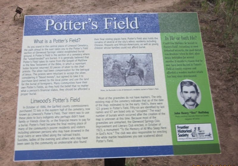
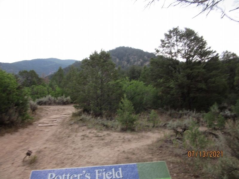
As you stand in the central plaza of Linwood Cemetery, the path ahead to the east takes you to the Potter's Field section of Glenwood Springs' oldest established burial ground. A Potter's Field is the section of a cemetery where the "unbefriended" are buried. It is generally believed that Potter's Field takes its name from the Gospel of Matthew in the New Testament of the Bible, in which a repentant Judas Iscariot returned 30 pieces of silver to the chief priest. The sliver had been compensation for the betrayal of Jesus. The priests were reluctant to accept the silver, considering it "blood money", but agreed to take it to purchase land owned by the local potter and use the land for burial of foreigners. Many communities have their own Potter's Fields, as they hold the belief that no matter a person's financial status, they should be afforded a proper burial.
Linwood's Potter's Field
In October of 1886, the Garfield commissioners purchased 72 lots in the eastern half of the cemetery, now known as Linwood's Potter's Field. Their intent was to use these plots to bury indigents who perhaps didn't have family or friends close by, or the financial means to pay for a burial. Potter's Field became the final resting place of many of the community's poorer residents and visitors including unknown persons who may have drowned in the local rivers or were killed along the railroad tracks. Suicides, ladies of the evening and others who may have been seen by the community as undesirables also found their final resting places here. Potter's Field also holds the remains of several or the city's ethnic residents including Chinese, Hispanic and African-Americans, as well young children whose families could not afford burial.
Most of the gravesites do not have markers. The only existing map of the cemetery indicates that as of the date of the map, estimated to be the early 1940's, there were 123 graves in Potter's Field. Fifty-six are identified by last names and 67 are listed only as "occupied." The exact number of burials which occurred after the creation of the map is unknown at this time. Because most of the gravesites are unmarked, the Glenwood Springs Civic Improvement and Literary Club erected, in October of 1923, monument "To the Memory of All Who Sleep Here in God's Acre." The club was also responsible for erecting the white marble headstones you see scattered about Potter's Field.
Is He or Isn't He?
Could Doc Holiday be buried in Potter's Field? According to most historical accounts, the good doctor was destitute when he died, after being bedridden for several months. It stands to reason that he may have been buried in Potter's Field at county expense and afforded a wooden marker which has long since deteriorated.
Erected by Frontier Historical Society.
Topics. This historical marker is listed in these topic lists: Cemeteries & Burial Sites • Settlements & Settlers. A significant historical year for this entry is 1886.
Location. 39° 32.373′ N, 107° 19.227′ W. Marker is in Glenwood Springs, Colorado, in Garfield County. Marker can be reached from Bennett Avenue south of 12th Street. To get to the Marker you must take the Doc Holliday's Grave Trailhead 1/2 mile up to Linwood Cemetery. Located on the grounds of the Cemetery. Touch for map. Marker is at or near this postal address: 1398 Bennett Ave, Glenwood Springs CO 81601, United States of America. Touch for directions.
Other nearby markers. At least 8 other markers are within walking distance of this marker. Linwood Cemetery (about 700 feet away, measured in a direct line); McCoy-Armory Building (approx. half a mile away); Hughes-Anderson Building (approx. half a mile away); I.O.O.F. Building (approx. half a mile away); When the Railroads Arrived in Glenwood Springs (approx. half a mile away); Water for Glenwood Springs (approx. half a mile away); And Devereux Said Unto Glenwood, "Let There Be Light" (approx. half a mile away); When Snow Slides Closed the Canyon (approx. half a mile away). Touch for a list and map of all markers in Glenwood Springs.
Credits. This page was last revised on February 4, 2022. It was originally submitted on January 28, 2022, by Jason Armstrong of Talihina, Oklahoma. This page has been viewed 536 times since then and 94 times this year. Photos: 1, 2. submitted on January 28, 2022, by Jason Armstrong of Talihina, Oklahoma. • Andrew Ruppenstein was the editor who published this page.

