Riverfront in Wilmington in New Castle County, Delaware — The American Northeast (Mid-Atlantic)
World War II
Riverfront Wilmington
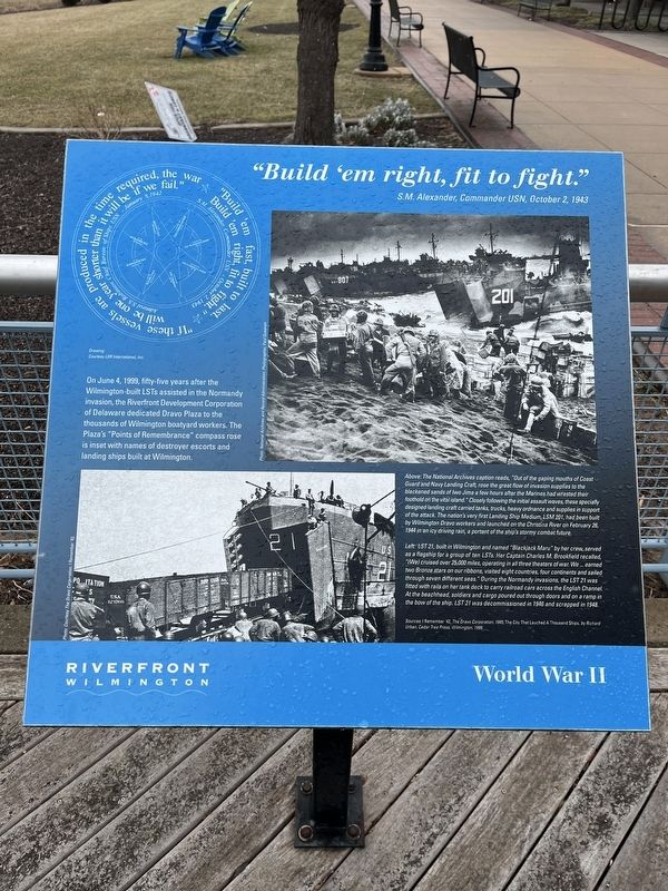
"Build 'em right, fit to fight."
S.M. Alexander, Commander USN, October 2, 1943
On June 4, 1999, fifty-five years after the Wilmington-built LSTs assisted in the Normandy invasion, the Riverfront Development Corporation of Delaware dedicated Dravo Plaza to the thousands of Wilmington boatyard workers. The Plaza's "Points of Remembrance" compass rose is inset with names of destroyer escorts and landing ships built at Wilmington.
[Captions:]
Above: The National Archives caption reads, "Out of the gaping mouths of Coast Guard and Navy Landing Craft, rose the great flow of invasion supplies to the blackened sands of Iwo Jima a few hours after the Marines had wrested their foothold on the vital island." Closely following the initial assault waves, these specially designed landing craft carried tanks, trucks, heavy ordnance and supplies in support of the attack. The nation's very first Landing Ship Medium, LSM 201, had been built by Wilmington Dravo workers and launched on the Christina River on February 26, 1944 in an icy driving rain, a portent of the ship's stormy combat future.
Left: LST 21, built in Wilmington and named "Blackjack Maru" by her crew, served as a flagship for a group of ten LSTs. Her Captain Charles M. Brookfield recalled, "(We) cruised over 25,000 miles, operating in all three theaters of war. We … earned two Bronze stars on our ribbons, visited eight countries, four continents and sailed through seven different seas. During the Normandy invasions, the LST 21 was fitted with rails on her tank deck to carry railroad cars across the English Channel. At the beachhead, soldiers and cargo poured out through doors and on a ramp in the bow of the ship. LST 21 was decommissioned in 1946 and scrapped in 1948.
Sources: I Remember '42, The Dravo Corporation, 1945; The City That Launched A Thousand Ships, by Richard Urban, Cedar Tree Press, Wilmington 1999.
"If these vessels are produced in the time required, the war will be one year shorter than it will be if we fail."
Admiral S.S. Robinson, Chief, Bureau of Ships, USN - January 8, 1942
"Build 'em fast, built to last. Build 'em right, fit to fight."
S.M. Alexander, Commander, USN - October 2, 1943
Topics. This historical marker is listed in these topic lists: Industry & Commerce • War, World II • Waterways & Vessels. A significant historical date for this entry is January 8, 1942.
Location. 39° 43.793′ N, 75° 33.685′ W. Marker is in Wilmington, Delaware, in New
Other nearby markers. At least 8 other markers are within walking distance of this marker. A different marker also named World War II (within shouting distance of this marker); Michael S. Purzycki Riverwalk (about 300 feet away, measured in a direct line); Russell W. Peterson Urban Wildlife Refuge (about 600 feet away); The New World (approx. 0.2 miles away); William Julius "Judy" Johnson (approx. 0.2 miles away); Daniel S. Frawley Stadium (approx. 0.2 miles away); Delaware Stadium Corporation (approx. 0.2 miles away); Vic Willis (approx. 0.2 miles away). Touch for a list and map of all markers in Wilmington.
Credits. This page was last revised on February 10, 2023. It was originally submitted on January 29, 2022, by Devry Becker Jones of Washington, District of Columbia. This page has been viewed 201 times since then and 35 times this year. Photos: 1, 2. submitted on January 29, 2022, by Devry Becker Jones of Washington, District of Columbia.

