Near Hanover in Hanover County, Virginia — The American South (Mid-Atlantic)
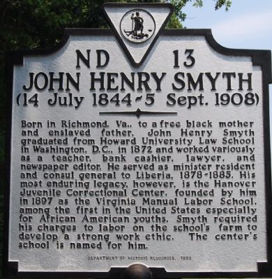
John Henry Smyth
(14 July 1844–5 Sept. 1908)
Erected 1999 by Department of Historic Resources. (Marker Number ND-13.)
Topics and series. This historical marker is listed in these topic lists: African Americans • Education • Industry & Commerce • Law Enforcement. In addition, it is included in the Historically Black Colleges and Universities, and the Virginia Department of Historic Resources (DHR) series lists. A significant historical month for this entry is July 1844.
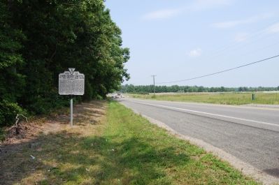
Location. 37° 44.884′ N, 77° 21.578′ W. Marker is near Hanover, Virginia, in Hanover County. Marker is on Hanover Courthouse Road (U.S. 301) 0.2 miles south of Courtland Farm Road, on the right when traveling south. Touch for map. Marker is in this post office area: Hanover VA 23069, United States of America. Touch for directions.
Other nearby markers. At least 8 other markers are within 2 miles of this marker, measured as the crow flies. Cornwallis’s Route (about 400 feet away, measured in a direct line); The Colonial River Road (approx. 0.3 miles away); Hanover Tavern (approx. 1.1 miles away); a different marker also named Hanover Tavern (approx. 1.1 miles away); a different marker also named Hanover Tavern (approx. 1.1 miles away); Patrick Henry (approx. 1.1 miles away); Hanover Courthouse (approx. 1.1 miles away); Hanover Confederate Soldiers Monument (approx. 1.1 miles away). Touch for a list and map of all markers in Hanover.
Credits. This page was last revised on December 25, 2019. It was originally submitted on July 29, 2007, by Dawn Bowen of Fredericksburg, Virginia. This page has been viewed 1,785 times since then and 37 times this year. Last updated on July 29, 2007, by Dawn Bowen of Fredericksburg, Virginia. Photos: 1, 2. submitted on July 29, 2007, by Dawn Bowen of Fredericksburg, Virginia. • J. J. Prats was the editor who published this page.

