North Platte in Lincoln County, Nebraska — The American Midwest (Upper Plains)
Pony Express Station
Photographed by Cosmos Mariner, August 4, 2021
1. Pony Express Station Marker
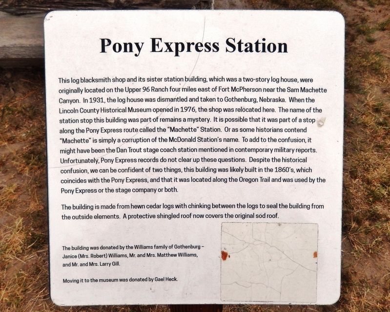
The building is made from hewn cedar logs with chinking
this page online
The building was donated by the Williams family of Gothenburg — Janice (Mrs. Robert) Williams, Mr. and Mrs. Matthew Williams, and Mr. and Mrs. Larry Gill.
Moving it to the museum was donated by Gael Heck.
Topics and series. This historical marker is listed in these topic lists: Architecture • Communications • Roads & Vehicles. In addition, it is included in the Oregon Trail, and the Pony Express National Historic Trail series lists.
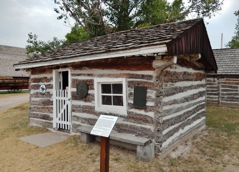
Location. 41° 9.604′ N, 100° 47.389′ W. Marker is in North Platte, Nebraska, in Lincoln County. It can be reached from North Buffalo Bill Avenue 0.8 miles north of Lincoln Highway (U.S. 30), on the right when traveling north. Marker and blacksmith shop are located on the Lincoln County Historical Museum grounds. Touch for map. Marker is at or near this postal address: 2403 North Buffalo Bill Avenue, North Platte NE 69101, United States of America. Touch for directions.

Regionally, this marker is in Central Nebraska and
Photographed by Cosmos Mariner, August 4, 2021
2. Pony Express Station Marker
Other nearby markers. At least 8 other markers are within walking distance of this marker: Maxwell Jail (a few steps from this marker); Fort McPherson (a few steps from this marker); Fort McPherson Cabin (a few steps from this marker); Fort McPherson Flagpole (a few steps from this marker); Windmill & Cistern (within shouting distance of this marker); D.A.R. Cabin (within shouting distance of this marker); This Cabin Built in 1867 (within shouting distance of this marker); Dick Neve Barber Shop (within shouting distance of this marker). Touch for a list and map of all markers in North Platte.
Related markers. Click here for a list of markers that are related to this marker. Lincoln County Historical Museum
Also see . . .
1. History of the Sam Machette Station.
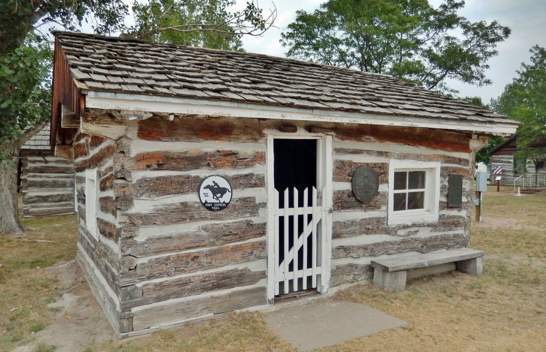
The Sam Machette Station(Submitted on February 8, 2022, by Cosmos Mariner of Cape Canaveral, Florida.)was erected in 1854 on the Oregon Trail and was used as a Fur Trading Post & Ranch House. From 1860-1861 the station was used as a Pony Express Station. After the Pony Express ended, the station was used as an Overland Trail Stage Station, bunk house, storage house, and dwelling until 1931. In 1931 Mrs. C.A. Williams donated the station to the city of Gothenburg. The city had it moved from its original site to Ehmen Park inside Gothenburg city limits.Photographed by Cosmos Mariner, August 4, 20213. Blacksmith Shop / Pony Express Station
2. Machette's Station.
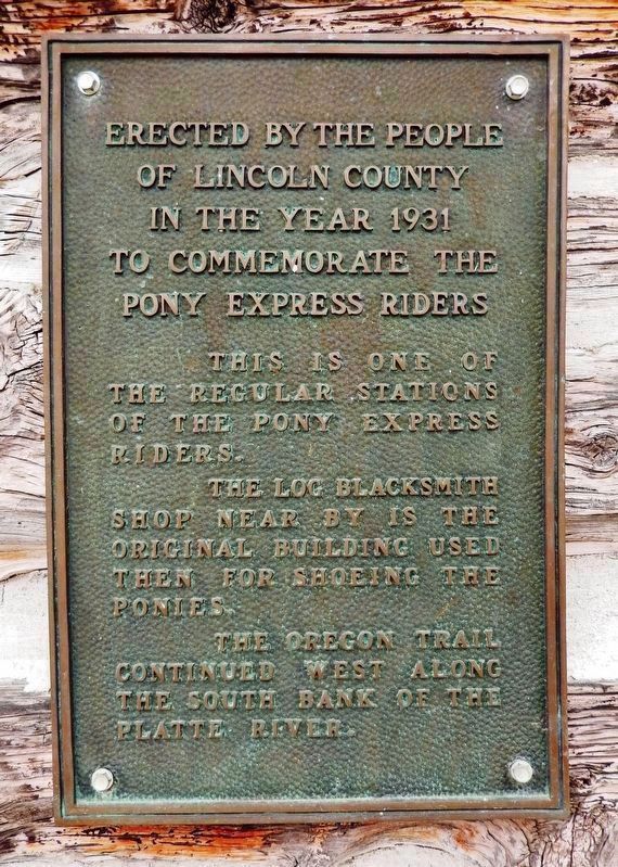
The identity and location of Machette's Station remains controversial. Local tradition places the site on the Williams' Upper 96 Ranch, four miles east of Fort McPherson in Lincoln County, Nebraska. Up until 1931, there was a two-story log cabin and a blacksmith shop linked to this site. However, in 1931 the American Legion Post No. 64 dismantled the main two-story log structure from the original site and moved the log building to Gothenburg City Park. Apparently at the same time they removed the log structure, a monument was placed commemorating this site. It read, "Erected(Submitted on February 8, 2022, by Cosmos Mariner of Cape Canaveral, Florida.)by the people of Lincoln County, 1931, to commemorate the Pony Express riders..." At that time, the blacksmith shop for the station remained at its original site.Photographed by Cosmos Mariner, August 4, 20214. Pony Express Station
Lincoln County Marker, 1931(on blacksmith shop wall, behind marker) Erected by the people of Lincoln County in the year 1931 to commemorate the Pony Express riders.This is one of the regular stations of the Pony Express riders.
The log blacksmith shop nearby is the original building used then for shoeing the ponies.
The Oregon Trail continued West along the South Bank of the Platte River.
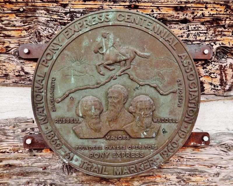
Photographed by Cosmos Mariner, August 4, 2021
5. Pony Express Centennial Medallion
On blacksmith shop wall, behind the marker.
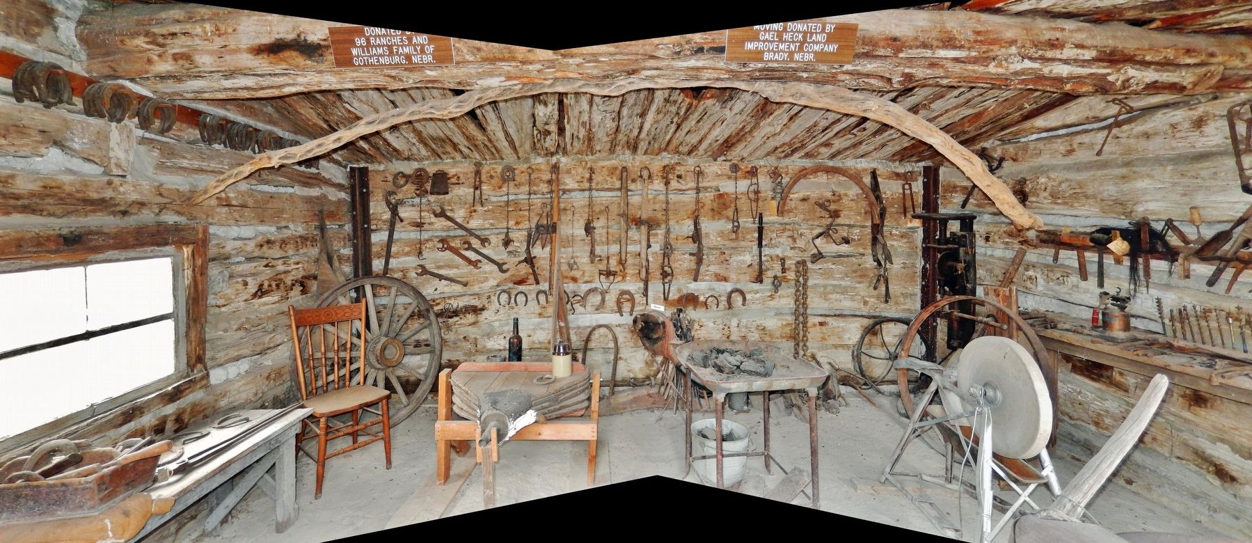
Photographed by Cosmos Mariner, August 4, 2021
6. Blacksmith Shop / Pony Express Station (interior)
Credits. This page was last revised on March 3, 2024. It was originally submitted on February 7, 2022, by Cosmos Mariner of Cape Canaveral, Florida. This page has been viewed 1,300 times since then and 100 times this year. Photos: 1, 2, 3, 4, 5, 6. submitted on February 8, 2022, by Cosmos Mariner of Cape Canaveral, Florida.
