Logan Square in Philadelphia in Philadelphia County, Pennsylvania — The American Northeast (Mid-Atlantic)
15th & Market
On this block in 1859
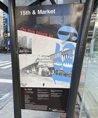
The Western Farmers' Market was located on Market Street, west of 15th Street. This 1859 photograph shows the market sheds where fresh produce was delivered from farms that, at the time, were just north and west of Philadelphia's urban center.
The open-air market operated until 1881, when the Pennsylvania Railroad built a massive masonry viaduct to support elevated tracks connecting the site of today's 30th Street Station to the Broad Street Station, immediately across from the new City Hall, which was built between 1871 and 1901. The elevated tracks cut across the west side of downtown, creating a major impediment to development and was thus known as the "Chinese Wall." It was demolished in 1953, making way for the development of the Penn Center office buildings, all of which were connected to new underground tracks.
In 1859
President: James Buchanan (D)
Mayor: Alexander Henry (People's, R)
Philadelphia population: 565,529
Money matters
Bacon: 11¢ / pound
Flour: $7.25 / barrel
Cotton: 13¢ / pound
Ladies walking shoes: $1.75 / pair
Shovel: 25¢
Rocking chair: $4
Mahogany sofa: $15
Monkey wrench: 25¢
Pair
this page online
Train ticket from New York to Baltimore: $6
Events
February 14—Oregon was admitted as 33rd U.S. state.
February 28—Arkansas Legislature required free blacks to choose between exile or slavery.
March 21—The Commonwealth of Pennsylvania issued a charter establishing the Zoological Society of Philadelphia, the first organization of its kind in the United States and the founder of the nation's first zoo.
April 20—Charles Dickens published A Tale of Two Cities.
September 5—Harriet E. Wilson became the first African American to publish a novel in the United States.
November 24—Charles Darwin published On the Origin of Species.
One of the first reports relating tobacco to cancer was published in France.
Erected 2017 by Center City District, Philadelphia.
Topics and series. This historical marker is listed in this topic list: Industry & Commerce. In addition, it is included in the Pennsylvania Railroad (PRR), and the Pennsylvania, Ride! Philadelphia series lists. A significant historical year for this entry is 1859.
Location. 39° 57.173′ N, 75° 9.918′ W. Marker is in Philadelphia, Pennsylvania, in Philadelphia
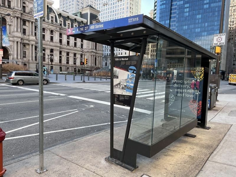

Regionally, this marker is in Southeast Pennsylvania. It is also in the American Northeast and in the Mid-Atlantic. Globally, it is in North America, the Western Hemisphere, the Western World, and the Anglosphere. Historically, it finds itself in what was once the Haudenosaunee (Iroquois) Confederacy, New Netherland, and one of the original Thirteen Colonies.
Other nearby markers. At least 8 other markers are within walking distance of this marker: Broad Street Station (here, next to this marker); The Plan for Philadelphia (within shouting distance of this marker); Centre Square Water Works (within shouting distance of this marker); The Building of City Hall (within shouting distance of this marker); 20th Century Transformation (within shouting distance of this marker); Center City Renewal (within shouting distance of this marker); Industry & the Railroad (within shouting distance of this marker); Where the Parkway Begins (within shouting distance of this marker). Touch for a list and map of all markers in Philadelphia.
Credits. This page was last revised on November 12, 2024. It was originally submitted on February 10, 2022, by Devry Becker Jones of Washington, District of Columbia. This page has been viewed 1,366 times since then and 66 times this year. Photos: 1, 2. submitted on February 11, 2022, by Devry Becker Jones of Washington, District of Columbia.
