Alameda in Alameda County, California — The American West (Pacific Coastal)
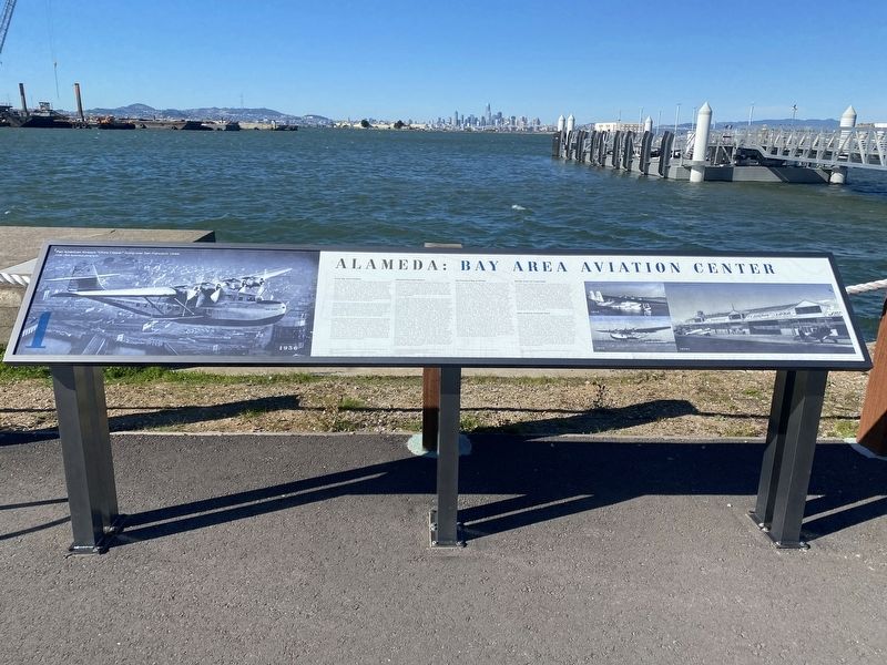
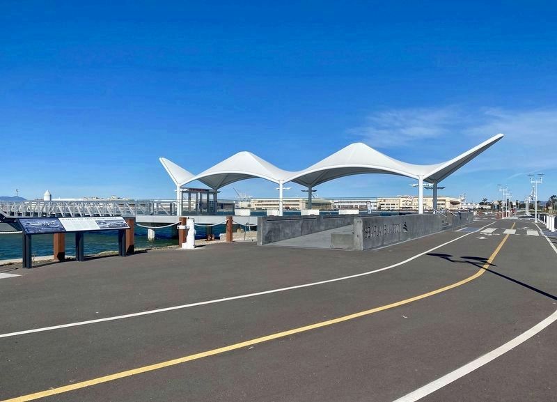
Alameda: Bay Area Aviation Center
Early Bay Area Aviation
During the early 20th century, early Bay Area aviators faced the challenge of frequent fog and limited areas of flat, vacant land for aircraft takeoff and landing. The western portion of Alameda was identified as an ideal site for civil aviation, however, given its central location, abundant level land, and frequent fog-free days. The first recorded flight at Alameda Point took place on Columbus Day, October 9, 1911, when aviator Weldon Cooke took off from Alameda Point to entertain President William Taft and spectators gathered on the north side of the estuary in Oakland. Alameda Point's deepwater access and protected bayside location attracted the attention of military officials in the years leading up to the First World War. Defense-related industry materialized in 1916 when Bethlehem Steel Shipbuilding Company established a shipyard on the estuary immediately northeast of what is now Naval Air Station (NAS) Alameda.
In 1917, during the height of the First World War, Alameda business leader John J. Mulvany convinced the Navy that Alameda Point would be an ideal location for a destroyer ship base. A fact-finding investigation headed by Admiral James Helm followed. Helm argued that Alameda's sheltered location on a major bay, and the presence of local industry and infrastructure, fit well with the Navy's plans to create a chain of facilities along the Pacific Coast. However, it would take two decades before Congress approved funds for the establishment of an air station.
Alameda Municipal Airport
In 1927, Charles Lindbergh's famous transatlantic flight unleashed a second wave of interest in commercial aviation, which saw hundreds of small private and municipal airfields open, including several in the Bay Area. The City of Alameda, private interests, and the Army began to develop land at the west end of the island for aviation uses, which was later redeveloped as NAS Alameda.
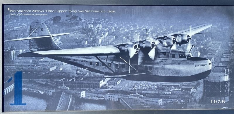
In March 1929, Alameda Municipal Airport opened on filled land close to the Alameda Pier and Ferry Terminal that extended into San Francisco Bay from the western tip of Alameda Point. This land later formed the north-western edge of NAS Alameda. The airport joined Mills Field in South San Francisco and Oakland Municipal Airport, both of which opened in 1927. The facility had a short runway, an administration building, and three aircraft hangars. Curtiss Wright Aviation was the principal tenant until Pan American Airways leased the facility to house their Martin M-130 flying boats, which became popularly known as "China Clippers," and came to symbolize American commercial aviation in the 1930s. On October 15, 1935, veteran naval pilot Lieutenant-Commander
Kneffler J. McGinnis set a new distance record for seaplanes - flying 3,387 miles from Coco Solo, Panama to Alameda Airport in just under 35 hours. McGinnis flew in an experimental Consolidated XP3Y-1 seaplane. On November 22, 1935, Pan American Airways began trans-Pacific airmail and commercial passenger service, with a flight that reached Manila, Philippines via Hawaii, Midway and Wake Islands, and Guam. The site of the aircraft's departure is commemorated by California Historical Landmark #968, located at 950 West Mall Square.
San Francisco Bay Airdrome
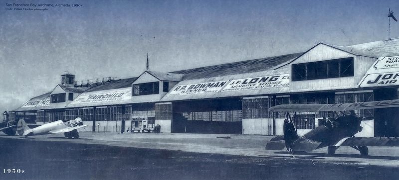
After witnessing the success of Alameda Municipal Airport, the Board of Regents of the University of California began making plans to construct an airdrome for various aircraft flight operations on 458 acres of university-owned marshland in western Alameda. The rectangular tract was bounded by Atlantic Avenue, Main Street, the Bethlehem Steel Shipbuilding Company yard at north, and Webster Street. The airdrome was envisioned as a major regional airport when construction began in 1930. After draining the site, two runways were graded and paved with crushed oyster shells from nearby Bay Farm Island. Airport offices and the terminal were first housed in a single hangar, with a second hangar built soon after. By the mid-1930s, however, the facility began to lose most of its major airline tenants to nearby
Oakland Municipal Airport and Mills Field across the bay. For the rest of the 1930s the San Francisco Bay Airdrome was primarily used by private aircraft. In 1941, during the construction of NAS Alameda, the Navy condemned 70 acres of the airdrome bordering Atlantic Avenue for a housing project and later ordered the abandonment of the rest of "America's first downtown Airport" to eliminate possible flight interference with operations at NAS Alameda. Today, the former Airdrome site is occupied by College of Alameda, a portion of the Alameda Landing shopping center, and at the west by the City of Alameda's Bayport neighborhood.
Benton Army Air Corps Field
The third airfield established at Alameda Point got its start in 1930 when the Army acquired a 128-acre tract of partially submerged land between Alameda Municipal Airport and the San Francisco Bay Airdrome. Construction of Benton Army Air Corps Field (Benton Field) began with well drilling, pile driving, dredging, and levee construction in May 1931. Around 100 acres of land was filled, forming what became the northeast corner of NAS Alameda. The Army received assistance from the Works Progress Administration in 1935 for the planning and construction of roads, railroad spurs, utilities, a small runway, and a well in the area that became the administrative core of NAS Alameda. The airfield was substantially underway when the Navy began to show renewed interest in the site.
Navy Acquires Alameda Point
In 1935, the Navy met with Alameda officials about acquiring 1,000 acres of land in western Alameda for a naval installation. With construction of Benton Field continuing; the lands west of Webster Street appeared capable of becoming a larger military installation. In June 1936, Congress authorized President Franklin D. Roosevelt to accept the Alameda Municipal Airport from the City. In October 1936, the Navy acquired Benton Field, bringing the total area of the proposed naval base to around 2,000 acres. The Navy's Hepburn Report of 1938 recommended NAS Alameda be elevated to the status of a major air station supporting operations and aircraft assembly and repair. As such, the station would accommodate up to four aircraft carrier groups, three to six patrol squadrons, and two utility squadrons.
Erected 2022. (Marker Number 1.)
Topics. This historical marker is listed in this topic list: Air & Space. A significant historical date for this entry is October 9, 1911.
Location. 37° 46.618′ N, 122° 17.904′ W. Marker is in Alameda, California, in Alameda County. Marker is on Ferry Point Road. Touch for map. Marker is in this post office area: Alameda CA 94501, United States of America. Touch for directions.
Other nearby markers. At least 8 other markers are within walking distance of this marker. Seaplane Lagoon (within shouting distance of this marker); Seaplanes and Flying Boats at NAS Alameda (within shouting distance of this marker); Aircraft Carriers and Seaplane Tenders (about 300 feet away, measured in a direct line); Douglas SBD Dauntless (approx. 0.2 miles away); Grumman J2F Duck (approx. ¼ mile away); Vought A-7A Corvair II (approx. ¼ mile away); Grumman F6F Hellcat (approx. ¼ mile away); The Jimmy Doolittle Pier – Alameda Naval Air Station (approx. 0.4 miles away). Touch for a list and map of all markers in Alameda.
Credits. This page was last revised on February 12, 2022. It was originally submitted on February 12, 2022, by Andrew Ruppenstein of Lamorinda, California. This page has been viewed 294 times since then and 27 times this year. Photos: 1, 2, 3, 4. submitted on February 12, 2022, by Andrew Ruppenstein of Lamorinda, California.


