Produce and Waterfront in Oakland in Alameda County, California — The American West (Pacific Coastal)
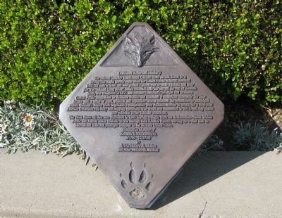
Oakland Railroad History
The Third Street rail line was eliminated in 1998 leaving a single track on Embarcadero Street. Union Pacific and Amtrak trains continue to run through Jack London Square, serving as a vital link to international trade and passenger transport in the Western United States.
Donated in Memory of Kenneth E. McDowell, Jr.
9/1/59-12/27/99
By Sylvia McDowell, Mother and Mike McDowell, Brother
Topics. This historical marker is listed in this topic list: Railroads & Streetcars. A significant historical year for this entry is 1868.
Location. 37° 47.668′ N, 122° 16.592′ W. Marker is in Oakland, California, in Alameda County. It is in Produce and Waterfront. Marker can be reached from Water Street near Broadway. Touch for map. Marker is in this post office area: Oakland CA 94607, United States of America. Touch for directions.
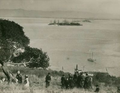
Other nearby markers. At least 8 other markers are within walking distance of this marker. Pony Express Ferry “Oakland” (within shouting distance of this marker); Origins of Oakland (about 300 feet away, measured in a direct line); Oakland's First Wharf (about 300 feet away); Jack London (about 300 feet away); Live Oak Lodge U.D (about 300 feet away); Jack London Square Development (about 300 feet away); Birthplace of Oakland (about 500 feet away); Jack London’s Cabin (about 500 feet away). Touch for a list and map of all markers in Oakland.
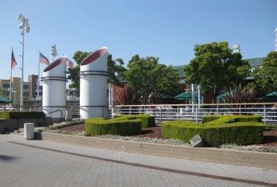
More about this marker. The marker is located in a pedestrian area of Jack London Square, on Water Street, between Broadway and Franklin Street.
The wolf and pawprint visible on the marker are allusions to Jack London, in whose most famous works wolves were prominently featured.
Regarding Oakland Railroad History.
•Oakland's rail service began in 1862 with the San Francisco and Oakland Railroad, which took passengers and freight across the San Francisco Bay by ferry, and then into Oakland by train.
• The Central
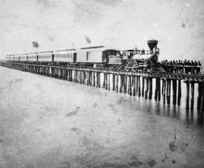
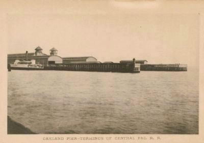
Pacific Railroad decided to make Oakland the western terminus of the transcontinental railroad, and bought out the San Francisco and Oakland Railroad. Central Pacific then greatly lengthened and expanded the existing wharf, renaming it the Oakland Long Wharf. On November 8, 1869, Oakland became the western terminus of the transcontinental railroad. Previously, Alameda, and before then, Sacramento, had been the western terminus of the transcontinental railroad.
• John Scott's 1871 pamphlet, Information Concerning the Terminus of the Rail System of the Pacific Coast, provides an undated quote from the San Francisco Alta Bulletin describing the Oakland Long Wharf, "A wharf, running 11,000 feet long,...having twelve railroad tracks upon its last 1,000 feet, a wide carriage way, a spacious passenger depot and railroad offices, warehouses and outside storage for 40,000 tons of grain or other large merchandise, three docks, one of which affords ample space for five of the largest steamers or clippers afloat, is not often seen, even in this age of railroad and engineering wonders. Such a structure has, however, recently been completed by the Central Pacific Railroad on the Oakland or easterly side of the Bay of San Francisco."
• The Oakland Long Wharf remained in service until 1958, and it was removed in the early 1960's to provide room for the expansion of the
Port of Oakland's container ship facilities.
Also see . . .
1. Central Pacific Reaches San Francisco Bay: Later Developments at Oakland and Alameda. The Central Pacific Railroad Photographic History Webpage reprint of Chapter XXIX of From Trail to Rail - The Story of the Beginning of the Southern Pacific. Includes photos. (Submitted on May 19, 2009.)
2. Oakland Long Wharf. Wikipedia.org's article on the Oakland Long Wharf. (Submitted on May 19, 2009.)
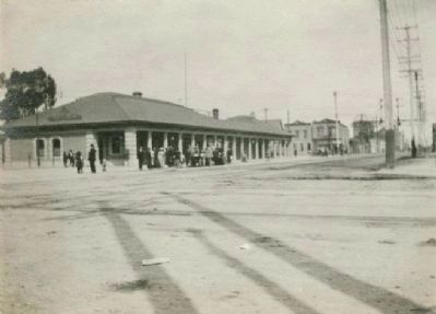
Photographed By Horace E. Smith, 1913
6. Southern Pacific Rail Station in Oakland
This 1913 photo, provided courtesy of the Oakland History Room of the Oakland Public Library, shows the Southern Pacific Rail Station in Oakland, located at Broadway and Embarcadero, less than 1,000 feet from the Oakland Railroad History marker. Oakland's Amtrak rail station is in roughly the same location today.
Credits. This page was last revised on February 7, 2023. It was originally submitted on May 18, 2009, by Andrew Ruppenstein of Lamorinda, California. This page has been viewed 4,598 times since then and 112 times this year. Last updated on May 20, 2009, by Andrew Ruppenstein of Lamorinda, California. Photos: 1, 2, 3, 4. submitted on May 18, 2009, by Andrew Ruppenstein of Lamorinda, California. 5, 6. submitted on May 19, 2009, by Andrew Ruppenstein of Lamorinda, California. • Kevin W. was the editor who published this page.
