Millville in Worcester County, Massachusetts — The American Northeast (New England)
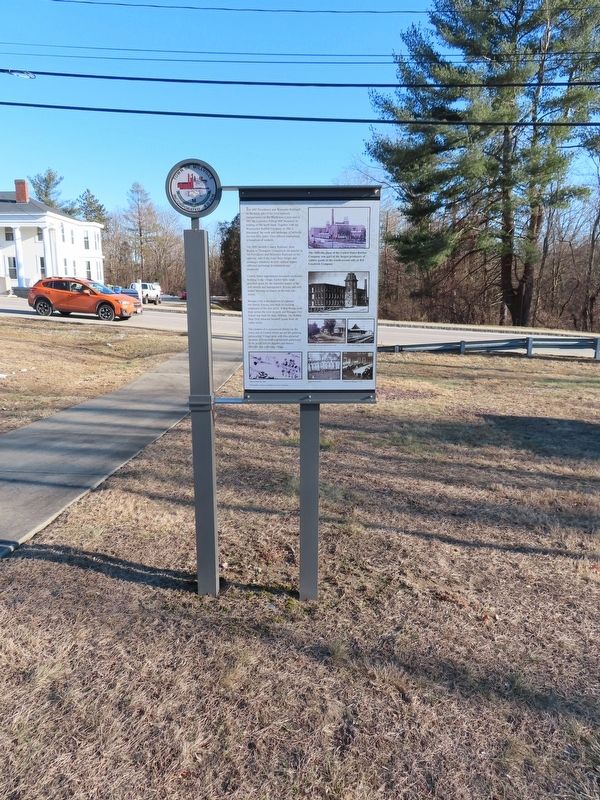
Millville Mills

Photographed by Michael Herrick, January 26, 2022
1. Millville Mills Marker
Standing at this point the visitor will view the sites of mills dating from 1727 through 1977, when the last mill was lost to fire.
The Island in the Blackstone River was the site of the earliest mills in 1727. Here the first bridge crossing the river was built in 1732. The first mills were later replaced by a large saw mill and two larger woolen mills. Two equally larger mills were built on the east island.
The creation of a road across the river divided the larger island into two smaller segments. Mills were built along the both sides of the river and on the two islands.
In 1828 when the Blackstone Canal was constructed, a third island was created between the canal and the river. This provided more land for industrial development that played a significant role in the expansion of the little manufacturing village.
The Dams were in disrepair in 1928. The south dam was breached in 1935 and the north damn was removed soon after. They were not replaced.
The mills of the late 1800's depended also on water power provided by pumping stations on the banks of the river.
( photo captions )
— A.W. 1828 Axe and Scythe Mill
this page online
— Woolen Mill, 1850, on the new Island created by the Blackstone River and canal.
— Island Mills on the east and west side of Central Street.
— Millville Dam c. 1910, one of the succession of Dams first built in mid 1700.
( back )
The 1847 Providence and Worcester Railroad on the north side of the river replaced transportation on the Blackstone Canal and in 1857 the Lawrence Felting Mill increased its holding on the north bank. Together with the Woonsocket Rubber Company in 1882 it dominated the work and landscape of Millville for over fifty years. They offered employment to hundreds of workers.
The 1859 Norfolk County Railroad, from Boston to Thompson Connecticut ran parallel to the Providence and Worcester Railroad on the opposite side of the river. Busy freight and passenger schedules at both railroad depots reflected increasing development and prosperity.
Central Street experienced increased residential building in the village. Earlier farm lands provided space for the beautiful homes of the mill owners and management. Private and mill worker housing increased on the new side streets.

Photographed by Michael Herrick, January 26, 2022
2. Millville Mills Marker
Banigan City, a development of eighteen two-family houses, was built for housing employees of the new mills. A Red Bridge took them across the river to work and Banigan City School was built for their children. The Rubber Shop Oval attracted baseball teams from all valley towns.
The creation of a commercial district on the lower end of Central Street served the growing community. Village-wide activities attracted residents to basketball and baseball games and to the social hall for suppers and dances. Millville was a thriving village.
The Milleville plant of the United States Rubber Company was apart of the largest producers of rubber goods in the world second only to B.F. Goodrich Company
( photo captions )
— Lawrence Felting company
— Central and Lincoln Streets circa 1910
— P&W Main Street Depot, circa 1910
— Map of Millville, 1887
— Millville Townies
— Celebration Banquet, 1916
Photographs courtesy of Margaret Carrol Collection
Topics. This historical marker is listed in these topic lists: Industry & Commerce • Settlements & Settlers. A significant historical year for this entry is 1727.
Location. 42° 1.629′ N, 71° 34.864′ W.

Photographed by Michael Herrick, January 26, 2022
3. Millville Mills Marker

Regionally, this marker is in the Quiet Corner, in Greater Worcester, and in the Blackstone Valley. It is also in the American Northeast and in New England. Globally, it is in North America, the Western Hemisphere, the Western World, and the Anglosphere. Historically, it finds itself in what was once one of the original Thirteen Colonies.
Other nearby markers. At least 8 other markers are within walking distance of this marker: Millville Village (here, next to this marker); Udor Tower (here, next to this marker); Samuel Thompson’s Gristmill Stone 1727 (within shouting distance of this marker); Longfellow School (within shouting distance of this marker); The Raceway (within shouting distance of this marker); “Old Cemetery” (about 400 feet away, measured in a direct line); Millville Main Street (about 500 feet away); Millville Veterans Monument
Photographed by Michael Herrick, January 26, 2022
4. Millville Mills Marker
Credits. This page was last revised on February 22, 2022. It was originally submitted on February 22, 2022, by Michael Herrick of Southbury, Connecticut. This page has been viewed 972 times since then and 73 times this year. Photos: 1, 2, 3, 4. submitted on February 22, 2022, by Michael Herrick of Southbury, Connecticut.
