Lemay in St. Louis County, Missouri — The American Midwest (Upper Plains)
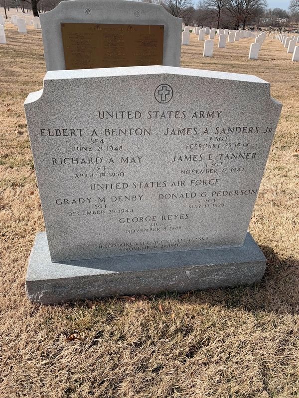
Killed - Aircraft Accident - Alaska
November 26 , 1970
United States Army
Elbert A Benton, SP4, June 21, 1948 • Richard A. May, Pvt., April 19 1950 • James A. Sanders Jr., S.Sgt., November 27, 1942 • James L. Tanner, S. Sgt., November 27 1942
United States Air Force
Grady M. Denby, Sgt., December 29 1944 • Donald G Pederson, T/Sgt., May 13 1929 • George Reyes, AIC, November 6 1948
Killed - Aircraft accident - Alaska - November 27, 1970
Topics. This memorial is listed in these topic lists: Air & Space • War, Cold. A significant historical date for this entry is November 27, 1970.
Location. 38° 30.047′ N, 90° 16.799′ W. Marker is in Lemay, Missouri, in St. Louis County. Memorial is on North Drive just east of Circle Drive, on the left when traveling east. Touch for map. Marker is at or near this postal address: 44 Johnson Rd, Saint Louis MO 63125, United States of America. Touch for directions.
Other nearby markers. At least 8 other markers are within walking distance of this marker. United States Air Force (here, next to this marker); Ambushed Patrol (within shouting distance of this marker); Khe Sanh Veterans Memorial (within shouting distance of this marker); Army Air Forces (about 300 feet away, measured in a direct line); Victims of the Japanese Massacre (about 300 feet away); U.S. Army Air Forces Air Crash Victims May 13, 1945 (about 400 feet away); Killed in Vietnam October 8, 1969 (about 400 feet away); Killed in Crash (about 400 feet away). Touch for a list and map of all markers in Lemay.
Credits. This page was last revised on February 23, 2022. It was originally submitted on February 23, 2022, by Thomas Smith of Waterloo, Ill. This page has been viewed 126 times since then and 16 times this year. Photo 1. submitted on February 23, 2022, by Thomas Smith of Waterloo, Ill. • Devry Becker Jones was the editor who published this page.
