Upper Sandusky in Wyandot County, Ohio — The American Midwest (Great Lakes)
Fort Ferree
Ohio Revolutionary Memorial Trail
Photographed by Dale K. Benington, August 6, 2008
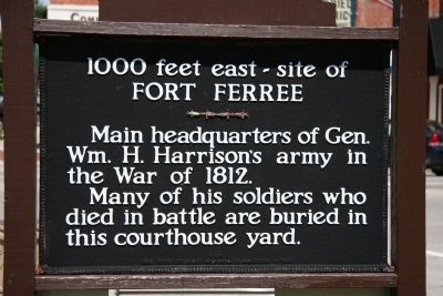
1. Fort Ferree Marker
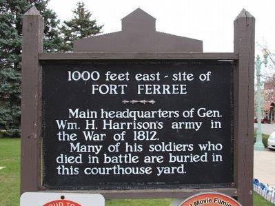
Fort Ferree
Main headquarters of General
William H. Harrison's army in
the War of 1812.
Many of his soldiers who
died in battle are buried in
this courthouse yard.
Erected 1930 by Ohio Revolutionary Memorial Commission. (Marker Number C481.)
Topics and series. This memorial is listed in these topic lists: Forts and Castles • Military • War of 1812. In addition, it is included in the Ohio Revolutionary Memorial Commission series list. A significant historical year for this entry is 1812.
Location. Memorial has been reported permanently removed. It was located near 40° 49.642′ N, 83° 16.87′ W. Memorial was in Upper Sandusky, Ohio, in Wyandot County. It was at the intersection of S. Sandusky Avenue (Ohio Route 53) and E. Wyandot Avenue (U.S. 30), on the right when traveling north on S. Sandusky Avenue. This historical marker is located in downtown Upper Sandusky, Ohio, on the northwest corner of the front lawn of the Wyandot County courthouse. Touch for map. Memorial was at or near this postal address: 109 S Sandusky Ave, Upper Sandusky OH 43351, United States of America.
this page online
We have been informed that this memorial is no longer there and will not be replaced. This page is an archival view of what was.
Regionally, this memorial was in the Till Plains. It was also in the American Midwest and in the Corn Belt. Globally, it was in North America, the Western Hemisphere, the Western World, and the Anglosphere. Historically, it found itself in what was once the Viceroyalty of New France, the Haudenosaunee (Iroquois) Confederacy, the territory of the Mississippian Culture, and the Northwest Territory.

Other nearby markers. At least 8 other markers are within walking distance of this location: 1000 feet east - site of Fort Ferree (here, next to this marker); Wyandot County Courthouse & The Shawshank Redemption (here, next to this marker); William Naus VFW Post 2842 Upper Sandusky, Ohio (about 300 feet away, measured in a direct line); Wyandot Museum (about 700 feet away); The William Walker Jr. House (approx. 0.2 miles away); Old Indian Burial Grounds (approx. 0.2 miles away); Fort Ferree - Overland Inn - Indian Spring (approx. 0.2 miles away); Neil A. Armstrong (approx. 0.2 miles away). Touch for a list and map
Photographed by Dale K. Benington, August 6, 2008
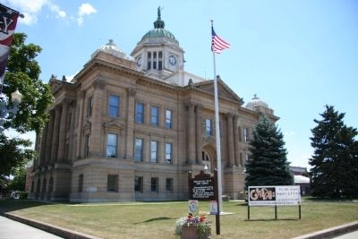
2. Fort Ferree Marker
This historical marker as viewed in the Northwest corner of the Wyandot County courthouse front lawn.
More about this memorial. There is a related historical marker regarding Fort Ferrre, located 1,000 feet to the east, on the old Lincoln Highway (modern day US 30), on the original site of the fort.
That being said, this particular featured historical marker is part of the Ohio Revolutionary Memorial Trail series (type C) which was put in place in 1930 to celebrate the 150th anniversary of the Ohio's Revolutionary War era Battle of Piqua, by the Ohio Revolutionary Memorial Commission.
In order to accomplish this, in 1929 the state of Ohio created the Ohio Revolutionary Memorial Commission, and then in 1930 this commission created 22 military trails, throughout western Ohio, between Cincinnati, Ohio on the state's southern border and Toledo, Ohio on the state's northern border. Each of these military trails represented the routes, or trails, used by military leaders during either the Revolutionary War, the Indian Wars of 1790 to 1795, or the War of 1812. Each of these military routes connected various related historical sites, that were marked with Ohio Revolutionary Memorial Commission (type
Photographed by Dale K. Benington, August 6, 2008
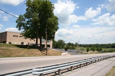
3. Fort Ferree Marker
View of the marker that is located approximately 1,000 feet to the east of this marker, in front of the local Elk Lodge, at the original site of Fort Ferree.
The routes of these military trails were in turn marked by type A and type B Ohio Revolutionary Memorial Commission markers that served as directional (type B) and distance (type A) markers.
Originally, back in 1930, there were erected 70 some of these Ohio Revolutionary Memorial Commission, type C, markers. To date, there are only 20 some of them that have been located and posted on the Historical Marker database. A number of them are presently missing, and presumed to be permanently lost.
Of the 20 some original markers that have been included in the historical marker database only a small number of them have the original art work, sometimes referred to as silhouettes, across the top of the historical marker. This is a feature that makes these markers quite unique from most other historical markers. This "Fort Ferree" marker is one of those very few markers.
Related markers. Click here for a list of markers that are related to this marker. To better understand the relationship, study each marker in the order shown.
Also see . . . Ohio Revolutionary Memorial Trail System.
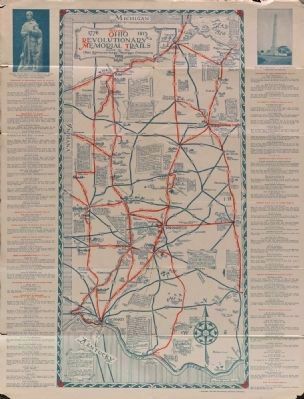
Image courtesy of the MidPointe Library System (www.MidPointeLibrary.org)
4. Ohio Revolutionary Memorial Trail Map
A view of an original Ohio Revolutionary Memorial Trail Map, from 1930. For a better view double click on this picture.
Additional commentary.
1. Ohio Revolutionary Memorial Trail System.
Back in 2008, while I was attempting to post as many War of 1812 related markers as I could find, in preparation for the approaching Bicentennial celebration of the War of 1812, I began to discover (quite by accident) the Ohio Revolutionary Memorial Trail System. As I started to read about this network of markers, that was originally erected back in 1930 as part of Ohio's 150 year celebration of its involvement in the American Revolutionary War, I came to realize that it was also a potentially excellent source of historical markers that featured information regarding Ohio's role in the War of 1812. The Ohio Revolutionary Memorial Commission (ORMC) had published a 1931 planning report that listed all of the historical markers that had been commissioned to be erected, listing each marker by county, with text included, and of the nearly 70 markers erected, close to 25 of them featured
Photographed by Dale K. Benington, April 6, 2016
5. Fort Ferree Marker
Close-up view of the marker, with silhouette art work across the top of the marker included in the picture.
Unfortunately I soon discovered that there were more of these 1930 era markers that were missing than what had survived. So that made it all the more satisfying each time that I was able to discover, and post on the Historical Marker database, a surviving ORMC marker.
Well the Bicentennial Celebration of the War of 1812 has come and gone, and the focus is no longer on rushing to discover and post all of Ohio's War of 1812 related historical markers. So in the spirit of taking the time to relax and to smell the roses, that's just what I have been doing with the ORMC markers. In doing so, I noticed something about these markers that I had completely overlooked before.
To the best of my knowledge, of the 70 some ORMC, Type C, markers, that were originally erected back in 1930, there are 23 that are still standing. Of the 23 ORMC, Type C, markers that are still standing, only 16 of them still have the marker's unique silhouette art work attached to the top of the marker.
It is my impression, that the ORMC markers, were the only marker series ever commissioned
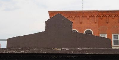
Photographed by Dale K. Benington, April 6, 2016
6. Fort Ferree Marker
Close-up view of the unique silhouette art work that is featured across the top of this marker.
So, having now come to better appreciate the significance of this rare silhouette art work feature, I have decided to try and go back to each of these surviving 16 markers, and to better feature and record for the historical record, the silhouettes on each of these surviving ORMC markers.
— Submitted April 7, 2016, by Dale K. Benington of Toledo, Ohio.
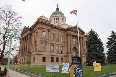
Photographed by Dale K. Benington, April 6, 2016
7. Fort Ferree Marker
A distant view of the marker as seen in the northwest corner of the Wyandot County courthouse front lawn.
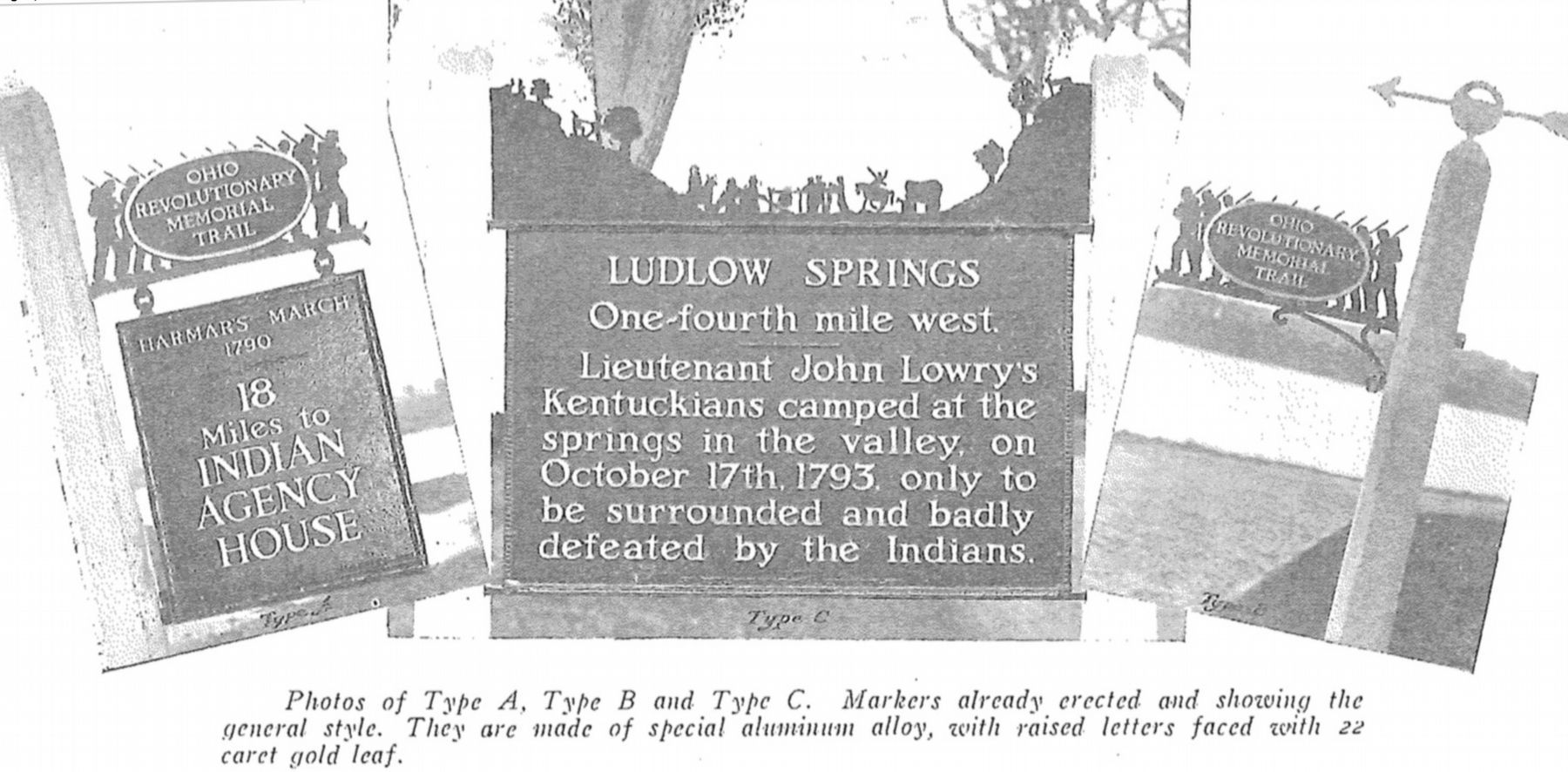
Image provided by Ohio Revolutionary Memorial Commission publication, dated 1931., June 26, 2019
8. Ohio Revolutionary Memorial Commission Marker Types
View of the three types of markers used by the Ohio Revolutionary Memorial Commission. The marker on the left is a type A marker, the marker in the middle is a type C (just like our featured marker), and the marker on the right is a type B. For a better view double click on this picture.
Credits. This page was last revised on July 25, 2022. It was originally submitted on April 19, 2009, by Dale K. Benington of Toledo, Ohio. This page has been viewed 3,030 times since then and 97 times this year. Last updated on March 3, 2022, by Craig Doda of Napoleon, Ohio. Photos: 1, 2, 3. submitted on April 19, 2009, by Dale K. Benington of Toledo, Ohio. 4. submitted on September 2, 2014, by Dale K. Benington of Toledo, Ohio. 5, 6, 7. submitted on April 7, 2016, by Dale K. Benington of Toledo, Ohio. 8. submitted on June 28, 2019, by Dale K. Benington of Toledo, Ohio. • Devry Becker Jones was the editor who published this page.
