Saint Marys in Perth County, Ontario — Central Canada (North America)
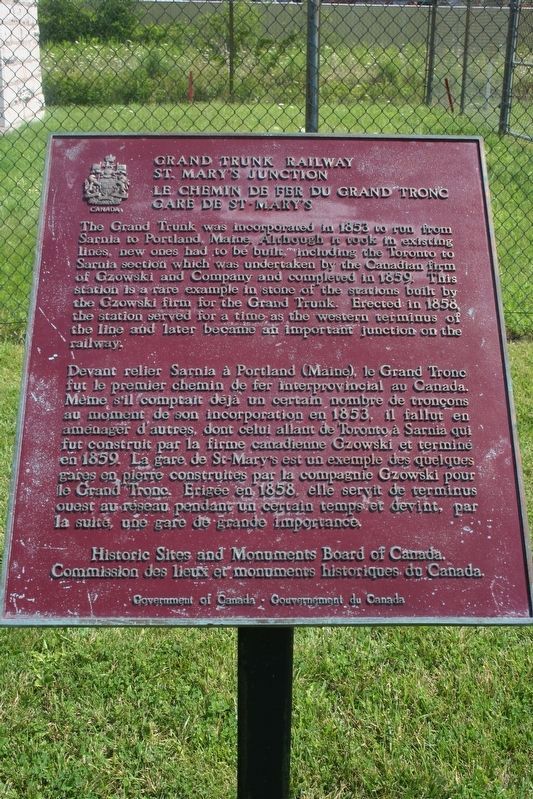
Grand Trunk Railway St. Mary's Junction
Robert Taylor via Flickr (CC BY 2.0), July 29, 2010
1. Grand Trunk Railway St. Mary's Junction Marker
Le Chemin de Fer du Grand Tronc Gare de St. Mary's
Devant relier Sarnia à Portland (Maine), le Grand Tronc fut le premier chemin de fer interprovincial au Canada. Meme s'il comptait déjà un certain nombre de tronçons au moment de son incorporation en 1853, il fallut en aménager d'autres, dont celui allant de Toronto à Sarnia qui fut construit par la firme canadienne Gzowski et terminé en 1859. La gare de St-Mary's est un exemple des quelques gares en pierre construites par la compagnie Gzowski pour le Grand Tronc. Erigée en 1858. elle servit de terminus ouest au reseau pendant un certain temps et devint, par la suite, une gare de grande importance.
Erected by Historic Sites and Monuments Board of Canada/Commission des lieux et monuments historiques du Canada.
Topics and series. This historical marker is listed in these topic lists: Architecture • Railroads & Streetcars. In addition, it is included in the Canada, Historic Sites and Monuments Board series list. A significant historical year for this entry is 1858.
Location. 43° 16.307′ N, 81° 7.89′ W. Marker is in Saint Marys, Ontario, in Perth County. It is on Glass Street just north of Samuel Street, on the right when traveling north. Touch for map. Marker is at or near this postal address: 480 Glass St, Saint Marys ON N4X 1E5,
this page online

Regionally, this marker is in the Huron-Perth-Waterloo-Wellington Area and in Southwestern Ontario. It is also in Central Canada. Globally, it is in North America, the Western Hemisphere, the Western World, and the Anglosphere. Historically, it finds itself in what was once a British colony, the Viceroyalty of New France, the Haudenosaunee (Iroquois) Confederacy, and Rupert’s Land.
Other nearby markers. At least 8 other markers are within walking distance of this marker: St. Marys Grand Trunk Station (approx. 1.3 kilometers away); St. Marys Water Tower (approx. 1.4 kilometers away); The Church Street Bridge (approx. 1.4 kilometers away); St. Marys Public Library (approx. 1.5 kilometers away); Town Hall (approx. 1.5 kilometers away); The Historic Banks of Trout Creek (approx. 1.5 kilometers away); Robert Eaton Building (approx. 1.6 kilometers away); The A. Workman Building (approx. 1.6 kilometers away). Touch for a list and map of all markers in Saint Marys.
Also see . . .
1. St. Marys Junction station. Wikipedia entry on the station, which was used from 1858 until 1941. (Submitted on March 3, 2022, by Duane and Tracy Marsteller of Murfreesboro, Tennessee.)
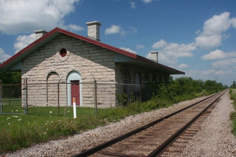
2. Former Grand Trunk Railway Station.
Robert Taylor via Flickr (CC BY 2.0), July 29, 2010
2. Grand Trunk Railway St. Mary's Junction station
Credits. This page was last revised on March 3, 2022. It was originally submitted on March 3, 2022, by Duane and Tracy Marsteller of Murfreesboro, Tennessee. This page has been viewed 206 times since then and 24 times this year. Photos: 1, 2. submitted on March 3, 2022, by Duane and Tracy Marsteller of Murfreesboro, Tennessee.
