Preston in New London County, Connecticut — The American Northeast (New England)
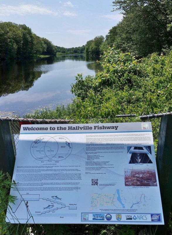
Welcome to the Hallville Fishway
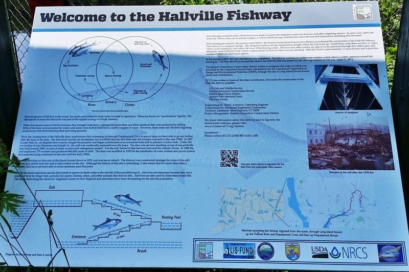
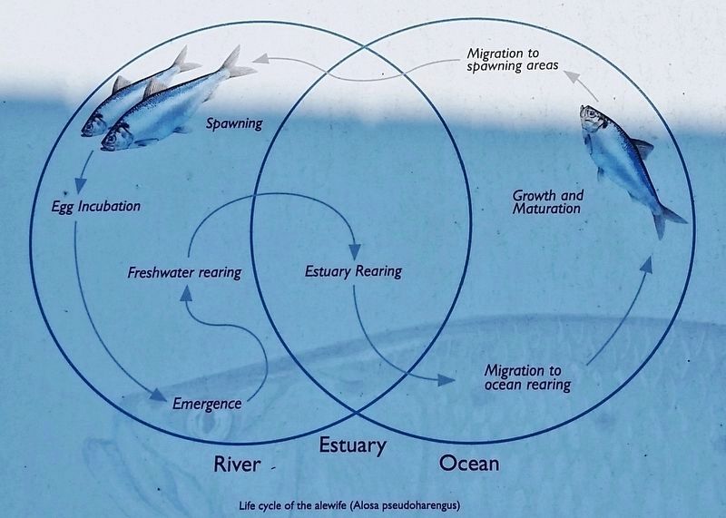
Several species of fish live in the ocean, but must come inland to fresh water in order to reproduce. These are known as "anadromous" species. For thousands of years this life cycle was part of the aquatic ecology in North America.
When Europeans came to North America, they brought with them a demand for grain flour and other products that were produced by milling. Mills of the time were powered by water, and dams were built to hold back a reserve supply of water. However, these dams also blocked migrating anadromous fish from reaching their spawning grounds.
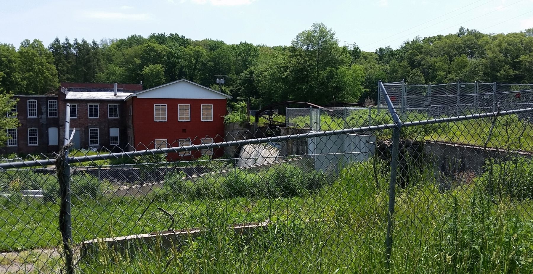
Since the construction of the Hallville dam, anadromous fish swimming up through Poquetanuck Cove to spawn have not been able to go any farther than the base of the dam. The historical records are incomplete, but it is likely that the first dam near this location was built in the mid-1700s. In 1857 Joseph Hall, Sr., an English-born weaver, bought the property and began construction of an industrial-scale mill to produce woolen cloth. Under the ownership of sons Benjamin and Joseph, Jr., the mill was continually expanded over the years. The dam you are now standing on top of was probably first built around 1880, as part of major woolen mill enlargement project. It is the only barrier to fish between here and the Atlantic Ocean. In 1888 the mill employed 175 workers and produced 860,000 yards of cloth. The dam was modified in 1920 for the installation of a new turbine and power system, and manufacturing continued at this site until the early 1960s.
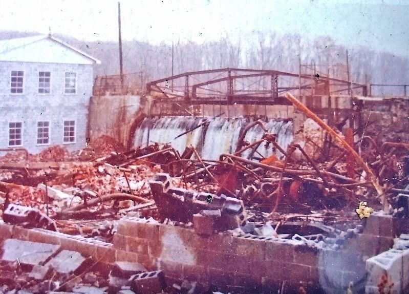
The mill building on this side of the brook burned down in 1978, and was never rebuilt. The fishway was constructed amongst the ruins of the mill. Rubble and debris from the mill is still evident on the site. Although the history of this site is interesting, it also means that for much more than a century, fish have not been able to swim upstream past this point.
One of the most important species that needs to spawn in fresh water is the alewife [Alosa pseudoharengus]. Alewives are important because they are a source of food for larger fish, and also for osprey, herons, otters, and other animals that feed on fish. Alewives are also used by fishermen as bait fish. The dams built along the alewives' migration routes in New England and elsewhere have been devastating for the alewife population.
Over the past several decades, efforts have been made to reopen the migration routes for alewives and other migrating species. In some cases, dams are removed. Where dams are to remain in place, a variety of fish passage methods have been devised and constructed, including fish elevators!
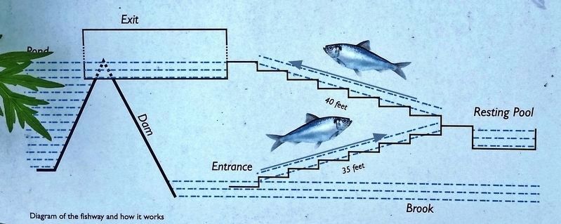
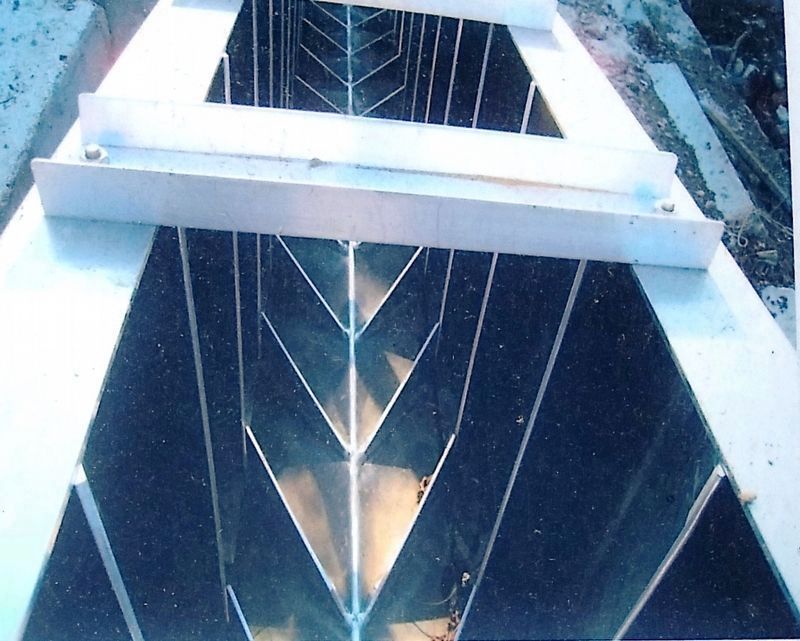
With funding provided by the partners listed below, the Eastern Connecticut Conservation District coordinated the construction of the Hallville fishway. This fishway is a steeppass design. The steeppass sections are the sloped metal troughs which the fish swim up. Inside these units there are fins, which create turbulence and reduce the force of the flowing water. Alewives and other species are able to swim upstream through this whitewater, and ultimately reach Hallville Pond, which is immediately in front of where you are standing. Hallville Pond is approximately 11 acres in size, and it provides excellent habitat for alewives to spawn.
In the spring of 2013, the Hallville fishway was completed. The fishway includes an underwater window which allows a video camera to record fish passing by. The first alewife to successfully ascend the Hallville fishway passed by the viewing window at 1:21 a.m., April 11, 2013.
The Eastern Connecticut Conservation District wishes to recognize that major funding was provided by the Long Island Sound Fund, administered by the Connecticut Department of Energy and Environmental Protection (DEEP), through the sale of Long Island Sound license plates and contributions.
ECCD also wishes to thank all the other contributors, who made the construction of the Hallville fishway possible:
U.S. Fish and Wildlife Service
Natural Resources Conservation Service
Fishers Island Ferry District
Andrew Tate Memorial Fund
The Piela Family
Engineering by: Karl F. Acimovic, Consulting Engineer
Construction by: Schumack Engineered Construction
Technical Assistance: Steve Gephard, CT DEEP
Project Management: Eastern Connecticut Conservation District
For more information about this fishway and to log onto the underwater webcam, please visit:
www.ConserveCT.org/Eastern
Questions?
Please contact ECCD at 860-887-4163 x 400
Erected by Eastern Connecticut Conservation District.
Topics. This historical marker is listed in these topic lists: Animals • Industry & Commerce • Settlements & Settlers • Waterways & Vessels. A significant historical date for this entry is April 11, 2013.
Location. 41° 29.651′ N, 72° 2.007′ W. Marker is in Preston, Connecticut, in New London County. Marker is on Hallville-Poquetanuck Road (Connecticut Route 2A) half a mile north of Lincoln Park Road, on the right when traveling north. Marker is located in a pull-out on the east side of the highway, overlooking Hallville Pond. Touch for map. Marker is in this post office area: Preston CT 06365, United States of America. Touch for directions.
Other nearby markers. At least 8 other markers are within 4 miles of this marker, measured as the crow flies. Gurdon Bill’s Station (approx. 2.7 miles away); Samuel Seabury (approx. 2.7 miles away); William A. Buckingham House (approx. 2.9 miles away); Norwich and Worcester Railroad (approx. 2.9 miles away); Hopkins & Allen Gun Factory (approx. 3.1 miles away); Once upon a time in Norwich… (approx. 3.1 miles away); David Ruggles Freedom Courtyard (approx. 3.1 miles away); Central Baptist Church (approx. 3.1 miles away).
Regarding Welcome to the Hallville Fishway. Hallville Pond Dam is a contributing property in the Hallville Mill Historic District, National Register of Historic Places #96000913.
Also see . . .
1. Hallville Mill Historic District. Wikipedia entry:
The district includes the dam that forms Hallville Pond, historic manufacturing buildings and worker housing, and the Hallville Mill Bridge, a lenticular pony truss bridge built circa 1890 by the Berlin Iron Bridge Company. In 1857 Joseph Hall, Sr., a weaver born in England, built an industrial-scale woolen mill on the site. The mill remained under his family's ownership under the name Hall Brothers' Woolen Mill and was continually expanded over the years.(Submitted on March 6, 2022, by Cosmos Mariner of Cape Canaveral, Florida.)
2. Eastern Connecticut Conservation District. Connecticut Conservation District website entry:
The fishway passed 16 alewife and two gizzard shad in 2020, as well as numerous trout. Live webcam viewing available here (in season).(Submitted on March 6, 2022, by Cosmos Mariner of Cape Canaveral, Florida.)
Credits. This page was last revised on January 10, 2023. It was originally submitted on March 5, 2022, by Cosmos Mariner of Cape Canaveral, Florida. This page has been viewed 243 times since then and 68 times this year. Photos: 1, 2, 3, 4, 5, 6. submitted on March 5, 2022, by Cosmos Mariner of Cape Canaveral, Florida. 7. submitted on March 6, 2022, by Cosmos Mariner of Cape Canaveral, Florida.
