Lewes Historic District in Sussex County, Delaware — The American Northeast (Mid-Atlantic)
Lightship Overfalls
Photographed by Richard E. Miller, May 14, 2009
1. Lightship Overfalls Marker
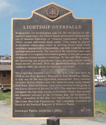
Responsible for establishing aids for the navigation of our nation’s waterways, the United States government initiated the use of manned lightships or “floating lighthouses" in 1820. These vessels addressed many needs. They could be placed in locations where deep water or shifting shoals made fixed structures impractical or impossible, and they could be moved and repositioned easily. The beacon on the lightship’s mast and the sound of its foghorn contributed greatly to the safe passage of ships in various weather conditions. By the mid-20th century the increasing use of automated lights and radio signals made these vessels obsolete. With the decommissioning of the last vessel in 1985, the era of the lightship was ended.
The Lightship Overfalls (LV-118 or WAL-539) was built in 1938 at the Rice Brothers Shipyard in East Boothbay, Maine. It was one of the last lightships constructed. Duty stations included Boston Harbor and two locations near Long Island, New York. After retirement from active service it was given to the Lewes Historical Society in 1973. The ship was renamed to recognize the lightship station on Overfalls
this page online
Erected 2003 by Delaware Public Archives. (Marker Number SC-175.)
Topics and series. This historical marker is listed in this topic list: Waterways & Vessels. In addition, it is included in the Delaware Public Archives, and the Lighthouses series lists. A significant historical month for this entry is December 1813.
Location. 38° 46.669′ N, 75° 8.492′ W. Marker is in Lewes, Delaware, in Sussex County. It is in the Lewes Historic District. It is on Shipcarpenter Street, on the left when traveling north. Marker is on a median island in the service road south of the lifesaving station and north of the Shipscarpenter Street, Pilottown Road, Front Street (DE-267) intersection. Touch for map. Marker is at or near this postal address: 110 Shipcarpenter Street, Lewes DE 19958, United States of America. Touch for directions.

Regionally, this marker is on Delaware’s Beaches. It is also in the American Mid-Atlantic,
Photographed by Richard E. Miller, May 14, 2009
2. Lightship Overfalls Marker
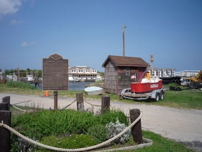
the lightship's moorings (center background) are presently empty - a large model of Overfalls is in view on the trailer, center right.
Other nearby markers. At least 8 other markers are within walking distance of this marker: Monomoy History & Restoration (a few steps from this marker); Lightship LV-118 Overfalls (within shouting distance of this marker); Overfalls Lightship (within shouting distance of this marker); The Lightship Overfalls LV-118/WAL-539 (within shouting distance of this marker); Life Saving Station (within shouting distance of this marker); The Blizzard of 1888 (within shouting distance of this marker); Shipbuilding (about 500 feet away, measured in a direct line); Hiram Rodney Burton House (about 500 feet away). Touch for a list and map of all markers in Lewes.
Regarding Lightship Overfalls. The Lightship Overfalls is owned by the Overfalls Maritime Museum Foundation. Presently, it is undergoing repairs in Virginia, but it is
Photographed by Mike Stroud, October 15, 2010
3. Lightship Overfalls Marker
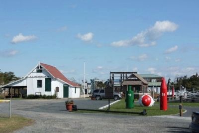
Shares location with "The Blizzard of 1888" Marker, seen in background
Also see . . .
1. United States Lightship Overfalls (LV-118). Wikipedia entry (Submitted on July 13, 2023, by Larry Gertner of New York, New York.)
2. Lightship Overfall (LV-118). Overfalls Foundation website homepage (Submitted on May 24, 2009, by Richard E. Miller of Oxon Hill, Maryland.)
3. Lewes Historical Society. Society website homepage (Submitted on May 24, 2009, by Richard E. Miller of Oxon Hill, Maryland.)
4. Lightship Overfalls. Lighthouse Friends website entry (Submitted on May 25, 2009, by Craig Swain of Leesburg, Virginia.)
Additional keywords. U.S. Coast Guard
Photographed by Mike Stroud, October 15, 2010
4. Lightship Overfalls Marker
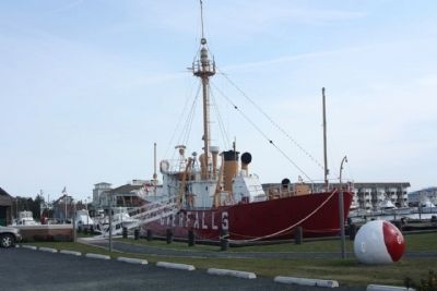
Photographed by Mike Stroud, October 18, 2011
5. Lightship Overfalls
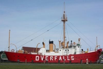
Photographed by Mike Stroud, October 18, 2011
6. Lightship Overfalls
National Register of Historic Places:Lightship WLV 539 *** (added 1989 - Structure - #89000006)
• Also known as S-7857 The Lightship "Overfalls"
• Period of Significance: 1925-1949
• Also known as S-7857 The Lightship "Overfalls"
• Period of Significance: 1925-1949
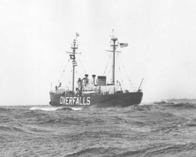
7. Lightship Overfalls
The Overfalls either returning from or to her station. An undated photograph from the files of the US Coast Guard Historian's office.
Click for more information.
Click for more information.
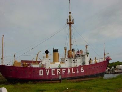
Photographed by Mike Wintermantel, May 14, 2005
8. Lightship Overfalls
At its first docking place in May of 2005, before it was refurbished
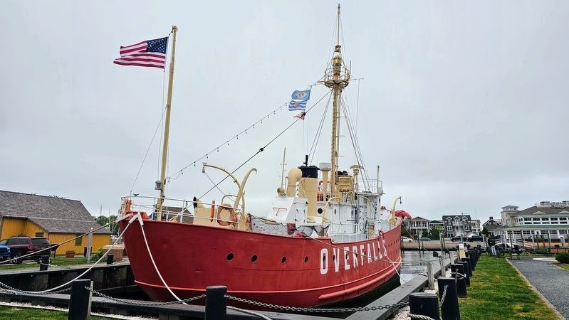
Photographed by Ian Lefkowitz, May 4, 2024
9. Lightship Overfalls
Credits. This page was last revised on April 2, 2025. It was originally submitted on May 24, 2009, by Richard E. Miller of Oxon Hill, Maryland. This page has been viewed 1,702 times since then and 36 times this year. Photos: 1, 2. submitted on May 24, 2009, by Richard E. Miller of Oxon Hill, Maryland. 3. submitted on October 18, 2010, by Mike Stroud of Bluffton, South Carolina. 4, 5, 6. submitted on October 17, 2010, by Mike Stroud of Bluffton, South Carolina. 7. submitted on May 25, 2009, by Craig Swain of Leesburg, Virginia. 8. submitted on November 8, 2012, by Mike Wintermantel of Pittsburgh, Pennsylvania. 9. submitted on March 19, 2025, by Ian Lefkowitz of New York, New York. • Craig Swain was the editor who published this page.
