North Bennington in Bennington County, Vermont — The American Northeast (New England)
Paper Mill History / Covered Bridges Span Rivers And Time
Inscription.
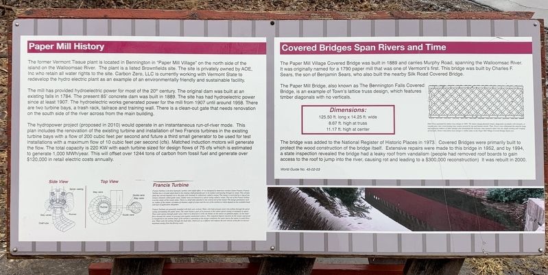
Paper Mill History
The former Vermont Tissue plant is located in Bennington in "Paper Mill Village” on the north side of the island on the Walloomsac River. The plant is a listed Brownfields site. The site is privately owned by AOE, Inc. who retain all water rights to the site. Carbon Zero, LLC is currently working with Vermont State to redevelop the hydro electric plant as an example of an environmentally friendly and sustainable facility.
The mill has provided hydroelectric power for most of the 20th century. The original dam was built at an existing falls in 1784. The present 85' concrete dam was built in 1889. The site has had hydroelectric power since at least 1907. The hydroelectric works generated power for the mill from 1907 until around 1958. There are two turbine bays, a trash rack, tailrace and training wall. There is a clean-out gate that needs renovation on the south side of the river across from the main building.
The hydropower project (proposed in 2010) would operate in an instantaneous run-of-river mode. This plan includes the renovation of the existing turbine and installation of two Francis turbines in the existing turbine bays with a flow of 200 cubic feet per second and future a third small generator to be used for test installations with a maximum flow of 10 cubic feet per second (cfs). Matched induction motors will generate the flow. The total capacity is 220 KW with each turbine sized for design flows of 75 cfs which is estimated to generate 1,000 MWh/year. This will offset over 1244 tons of carbon from fossil fuel and generate over $120,000 in retail electric costs annually.
Francis Turbine
Francis Turbine is the first hydraulic turbine with radial inflow. It was designed by American scientist James Francis. Francis Turbine has a circular plate fixed to the rotating shaft perpendicular to its surface and passing through its center. This circular plate has curved channels on it; the plate with channels is collectively called a runner. The runner is encircled by a ring of stationary channels called guide vanes. Guide vanes are housed in a spiral casing called a volute. The exit of the Francis turbine is at the center of the runner plate. There is a draft tube attached to the central exit of the runner. The design parameters such as, radius of the runner, curvature of channel, angle of vanes and the size of the turbine as whole depend on the available head and type of application altogether.
Francis Turbines are generally installed with their axis vertical. Water with high pressure enters the turbine through the spiral casing surrounding the guide vanes. The water looses a part of is pressure in the volute (spiral casing) to maintain
its speed. Then water passes through guide vanes where it is directed to strike the blades on the runner at optimum angles. As the water flows through the runner its pressure and angular momentum reduces. This reduction imparts reaction on the runner and power is transferred to the turbine shaft. If the turbine is operating at the design conditions the water leaves the runner in axial direction. Water exits the turbine through the draft tube, which acts as a diffuser and reduces the exit velocity of the flow to recover maximum energy from the flowing water.
Covered Bridges Span Rivers and Time
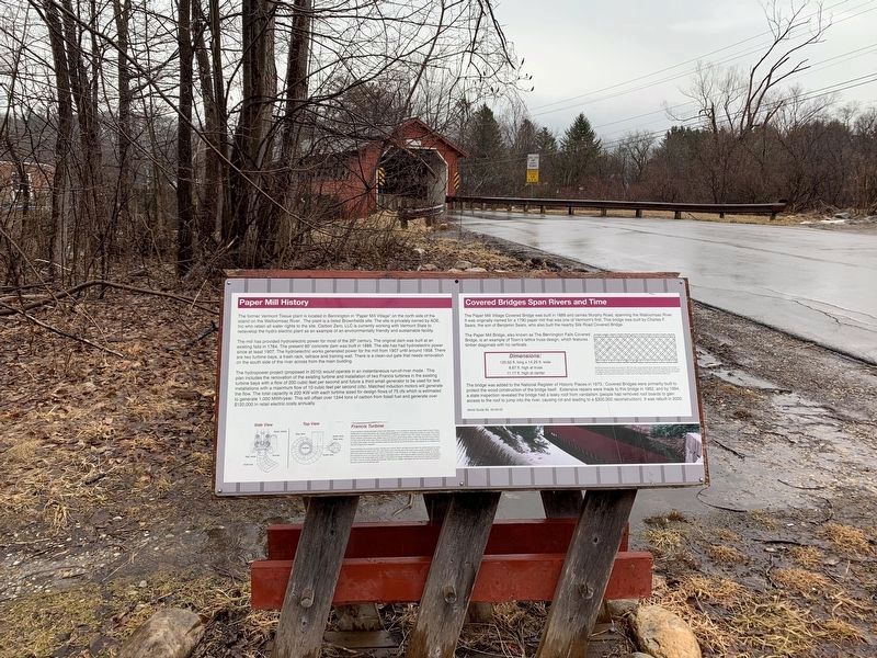
The Paper Mill Village Covered Bridge was built in 1889 and carries Murphy Road, spanning the Walloomsac River. It was originally named for a 1790 paper mill that was one of Vermont's first. This bridge was built by Charles F. Sears, the son of Benjamin Sears, who also built the nearby Silk Road Covered Bridge.
The Paper Mill Bridge, also known as The Bennington Falls Covered Bridge, is an example of Town's lattice truss design, which features timber diagonals with no verticals.
Dimensions:
125.50 ft. long x 14.25 ft. wide
8.67 ft. high at truss
11.17 ft. high at center
The bridge was added to the National Register of Historic Places in 1973. Covered Bridges were primarily built to protect the wood construction of the bridge
itself. Extensive repairs were made to this bridge in 1952, and by 1994, a state inspection revealed the bridge had a leaky roof from vandalism (people had removed roof boards to gain access to the roof to jump into the river, causing rot and leading to a $300,000 reconstruction) It was rebuilt in 2000.
(illustration caption)
Ithiel Town patented his lattice truss design in 1820. The lattice design fastened simple, diagonally set planks with treenails, or wooden pins, into crisscrossing truss system secured by top and bottom chords. Thus, Town's truss eliminated the need for large and expensive timbers of other designs and streamlined the intricate, time-intensive labor into the simple slotting and wedging of treenails. Town's innovative truss design is visible today in the Paper Mill Village Covered Bride before you.
World Guide No. 45-02-03
Topics and series. This historical marker is listed in these topic lists: Bridges & Viaducts • Industry & Commerce. In addition, it is included in the Covered Bridges series list. A significant historical year for this entry is 1889.
Location. 42° 54.751′ N, 73° 14.052′ W. Marker is in North Bennington, Vermont, in Bennington County. Marker is on Murphy Road, 0.1 miles south of N Bennington Road (Vermont Route 67A), on the left when traveling north. Touch for map. Marker is in this post office area: North Bennington VT 05257, United States of America. Touch for directions.
Other nearby markers. At least 8 other markers are within 2 miles of this marker, measured as the crow flies. The Paper Mill Village Bridge (within shouting distance of this marker); Birthplace of Vermont (approx. 0.8 miles away); Seth Warner House (approx. one mile away); McWaters Park (approx. one mile away); Hub of History (approx. one mile away); Henry Covered Bridge (approx. one mile away); Park-McCullough House (approx. 1.3 miles away); Railroad Station (approx. 1.4 miles away). Touch for a list and map of all markers in North Bennington.
Also see . . . Ithiel Town (Wikipedia). (Submitted on March 8, 2022, by Steve Stoessel of Niskayuna, New York.)
Credits. This page was last revised on February 16, 2023. It was originally submitted on March 8, 2022, by Steve Stoessel of Niskayuna, New York. This page has been viewed 140 times since then and 30 times this year. Photos: 1, 2, 3. submitted on March 8, 2022, by Steve Stoessel of Niskayuna, New York. • Michael Herrick was the editor who published this page.


