
Latrobe in El Dorado County, California — The American West (Pacific Coastal)
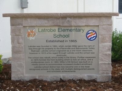
Latrobe Elementary School
Established in 1865
Photographed by Syd Whittle, May 24, 2009
1. Latrobe Elementary School Marker
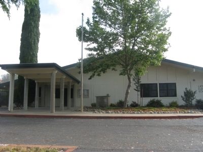
The school was rebuilt, which today is the library. Further expansion in 1975 formed the front building which is now an office, and a multipurpose room. In 1983, Mill’s Hill School was built on a nearby parcel to accommodate increased student enrollment.
Latrobe school district has now become one of the most recognized schools in the state with multiple distinguished awards and scholarship achievements.
Topics. This historical marker is listed in these topic lists: Education • Notable Buildings. A significant historical year for this entry is 1864.
Location. 38° 33.563′ N, 120° 58.946′ W. Marker is in Latrobe, California, in El Dorado County. It can be reached from Alvira Street near South Shingle Road. Marker is at the entrance to the school office. Touch for map. Marker is at or near this postal address: 7900 South Shingle Road, Shingle Springs CA 95682,
this page online

Regionally, this marker is in California’s Sacramento Metro, in the Sierra Nevada, and in the Lake Tahoe Basin. It is also in the American Mountain West. Globally, it is in North America, on the Ring of Fire, in the Pacific Rim, in the Western Hemisphere, in the Western World, and in the Anglosphere. Historically, it finds itself in what was once New Spain and also Mexico’s Alta California.
Other nearby markers. At least 8 other markers are within 9 miles of this marker, measured as the crow flies: Latrobe (about 400 feet away, measured in a direct line); Gold Mining and Michigan Bar (approx. 6.3 miles away); Forest Home (approx. 6.6 miles away); Du Roc House (approx. 6.6 miles away); Mormon Tavern (approx. 7.9 miles away); Camp Site of Boston-Newton Party (approx. 7.9 miles away); Chinese Store (approx. 8.9 miles away); Memorial Entrance (approx. 9 miles away).
Photographed by Syd Whittle, May 24, 2009
2. Latrobe Elementary School and Marker
Photographed by Syd Whittle, May 24, 2009
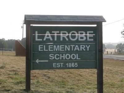
3. Latrobe Elementary School Directional Sign
LATROBE
Elementary
School
EST. 1865
Photographed by Syd Whittle, May 24, 2009
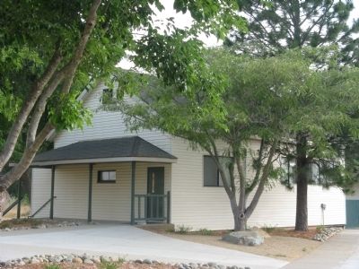
4. The 1915 Re-Built One Room School
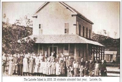
circa 1888
5. The Original Latrobe Elementary School
Credits. This page was last revised on June 16, 2016. It was originally submitted on May 24, 2009, by Syd Whittle of Mesa, Arizona. This page has been viewed 1,594 times since then and 46 times this year. Photos: 1, 2, 3, 4. submitted on May 24, 2009, by Syd Whittle of Mesa, Arizona. 5. submitted on February 1, 2013, by Syd Whittle of Mesa, Arizona.
