East Bronx in Bronx County, New York — The American Northeast (Mid-Atlantic)
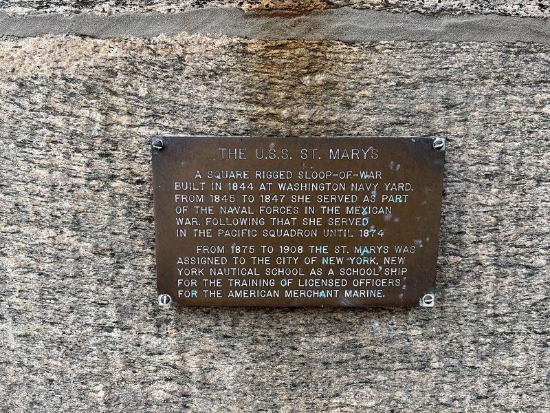
The U.S.S. St. Marys
A square rigged Sloop-of-War built in 1844 at Washington Navy Yard from 1845 to 1847 she served as part of the Naval forces in the Mexican War. Following that she served in the Pacific Squadron until 1874.
From 1875 to 1908 the St. Marys was assigned to the City of New York, New York Nautical School as a school ship for the training of licensed officers for the American Merchant Marine.
Erected by State University of New York, Maritime College.
Topics. This historical marker is listed in these topic lists: Education • War, Mexican-American • Waterways & Vessels. A significant historical year for this entry is 1844.
Location. 40° 48.325′ N, 73° 47.514′ W. Marker is in Bronx, New York, in Bronx County. It is in East Bronx. Marker can be reached from Wadhams Street, 0.1 miles south of Hanus Street, on the left when traveling south. Touch for map. Marker is in this post office area: Bronx NY 10465, United States of America. Touch for directions.
Other nearby markers. At least 8 other markers are within 2 miles of this marker, measured as the crow flies. The U.S.S. Newport (here, next to this marker); Fort Schuyler (a few steps from this marker); a different marker also named Fort Schuyler (within shouting distance of this marker); S.S. United States (about 500 feet away, measured in a direct line); Commodore Leroy J. Alexanderson (about 500 feet away); Main Magazine of Fort Totten (approx. 0.9 miles away); Fort Totten Park (approx. 1.1 miles away); a different marker also named Fort Totten Park (approx. 1.1 miles away). Touch for a list and map of all markers in Bronx.
Credits. This page was last revised on January 31, 2023. It was originally submitted on March 10, 2022, by Devry Becker Jones of Washington, District of Columbia. This page has been viewed 130 times since then and 21 times this year. Photos: 1, 2. submitted on March 10, 2022, by Devry Becker Jones of Washington, District of Columbia.

