Near Livingston in Park County, Montana — The American West (Mountains)
Fort Parker
Cultural Crossroads, Vanquished Dreams

Photographed By Barry Swackhamer, July 23, 2021
1. Fort Parker Marker
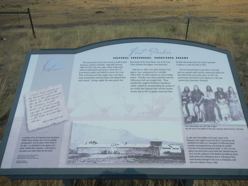
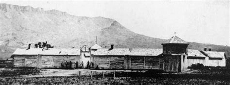
Captions: (bottom left) A member of the 1871 Hayden Survey Expedition, William Henry Jackson. one of the era's leading photographers, took the photo of Fort Parker to the right. It is identified as Crow Agency, Fort Parker, Shields River, Montana. Corner post in the pasture now show where the fort stood.; (lower right) Crow Tribe Leaders, circa 1871 (left to right): Poor Elk, Sits In The Middle Of The Land, Long Ears, Shows His Face, Old Onion.; In 1868, Sits In The Middle Of The Land, a leader of the Mountain Crows, signed a treaty with the U.S. government that established Fort Parker as a "counterpoint" for delivering annual annuities, encouraging farming, and teaching the nomadic Crow how to become permanently settled. In 1875, the Crow Agency was moved east to more fertile land, sheltered from the wind, near the confluence of the Rosebud and Stillwater Rivers. Lands south of the Yellowstone River to Yellowstone Park's north boundary belonged to the Crow, or Absaalooke, until they were headed by Treaty in 1882.
The area in front of you once served as south-central Montana's cultural crossroads. Especially between 1868 and 1875, this was a place where settlers and Indians traded goods and services, where the U.S. government sought (and failed) to convert the Crow Tribe to farming and other Anglo ways - and where many frontiersmen married Indians and adopted their ways instead. During roughly the same period, the bison hears of the Great Plains, core of the Crow Tribe's lifestyle and religion were destroyed.
Built here in 1869, Fort Parker, the first Crow Agency, was a resting point for a veritable "Who's Who" of white explores as well as Indian leaders. Virtually every major expedition into the Yellowstone Park area stopped here. These included the Langford-Washburn Expedition - widely credited for recommending the creation of the world's first National Park; and the Hayden Survey, sent in 1871 to gather visual and other detailed information that was used to persuade Congress to create the Park in 1872.
The Fort burned down a year after it was built, and was replaced with a poorly constructed adobe fort that lasted only a few more years. In 1875, the government moved the Crow Agency to a site near present-day Absarokee, Montana.
"...it seems almost impossible for the Government to protect the Indians in the rights guaranteed then by their treaties against the mountaineer and gold-hunter...and I most earnestly urge upon the Department the necessity of immediate action in this matter to protect these Indians..." - Agent F.D. Pease August 31, 1871
Erected by Undaunted Stewardship.
Topics. This historical marker is listed in these topic lists: Exploration • Forts and Castles • Native Americans. A significant historical date for this entry is August 31, 1871.
Location. 45° 42.621′ N, 110° 24.194′ W. Marker is near Livingston, Montana, in Park County. Marker is on Mission Creek Road, ¼ mile south of Interstate 90, on the right when traveling north. Touch for map. Marker is in this post office area: Livingston MT 59047, United States of America. Touch for directions.
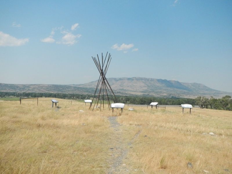
Other nearby markers. At least 8 other markers are within 8 miles of this marker, measured as the crow flies. Indians, Explorers & Cowboys (here, next to this marker); Welcome to the Mission Ranch (here, next to this marker); Heading down the Yellowstone (approx. 6.7 miles away); KPRK Radio (approx. 7.1 miles away); 810 East Callender Street (approx. 7.8 miles away); 802 East Callender Street (approx. 7.8 miles away); Livingston Eastside Residential Historic District (approx. 8 miles away); A Civil War Cannon: (approx. 8.1 miles away). Touch for a list and map of all markers in Livingston.
Also see . . .
1. Fort Parker. Legends of America website entry:
Located a few miles below the great bend of the Yellowstone River, it was named for E.S. Parker, Commissioner of Indian Affairs. The area was intended to be a refuge for the Crow Indians from their enemies — the Sioux, Cheyenne, and Blackfoot. The government encouraged the Crow to adopt an agricultural lifestyle with little success. (Submitted on March 10, 2022, by Barry Swackhamer of Brentwood, California.)
2. William Henry Jackson. National Park Service website entry:
William Henry Jackson (1843–1942) was one of the best-known photographers of the American West. He is renowned for his photographs of...mountain scenery, many of which show now-famous landmarks such as Mount of the Holy Cross, Garden of the Gods, Mesa Verde, and Royal Gorge. His photographs captured the vastness of Colorado’s beauty and helped lure many people to the state from the late nineteenth century onward. (Submitted on March 10, 2022, by Barry Swackhamer of Brentwood, California.)
Credits. This page was last revised on March 11, 2022. It was originally submitted on March 10, 2022, by Barry Swackhamer of Brentwood, California. This page has been viewed 365 times since then and 113 times this year. Photos: 1, 2, 3, 4, 5. submitted on March 10, 2022, by Barry Swackhamer of Brentwood, California.


