Saltville in Smyth County, Virginia — The American South (Mid-Atlantic)
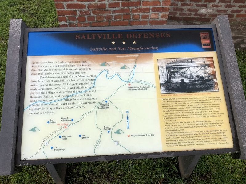
Saltville Defenses
Saltville and Salt Manufacturing
The defenses consisted of a half dozen earthen forts, hundreds of yards of trenches, several arsenals and camps for the troops. Picket posts guarded the roads radiating out of Saltville, and additional posts guarded the bridges and culverts of the Virginia and Tennessee Railroad and the Saltville branch line. Well-preserved remains of hilltop forts and hundreds of yards of trenches still exist on the hills surrounding Saltville Valley. (Town code prohibits the removal of artifacts.)
(sidebar)
The Saltville Valley was once part of an ancient riverbed. Bones and teeth of Ice Age animals that became extinct 10,000 years ago have been collected here since the late 1700s. Salt, one of the world's most essential substances became the town's namesake. The salt water has drawn giant mammals Native Americans, colonial settlers, Confederate and Union armies, and the industrial development that ushered the town into the 20th century.
The commercial development of salt occurred in the 1780s. The early "salt works" consisted of open wells from which brine was drawn, furnaces in which the material was boiled in iron kettles, and salt buildings that stored the salt.
Before the Civil War, the salt works operated with only a few furnaces. During the war, three dozen furnaces operated, firing 2,600 kettles. Salt production grew from 150,000 bushels per year before the war to four million bushels in 1864.
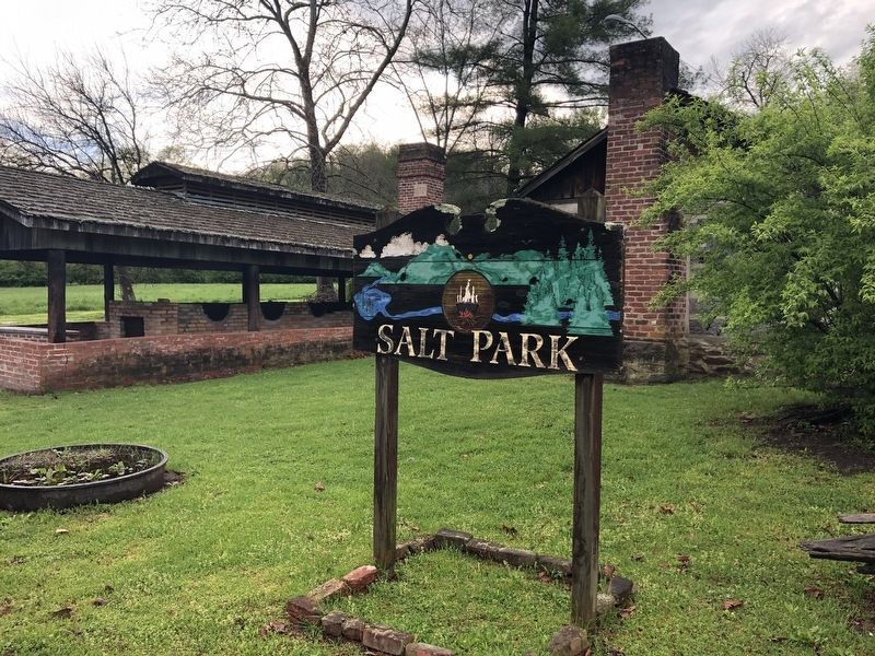
The kettles in this replica salt furnace, and at sites throughout the town of Saltville, were used during and after the Civil War. You are standing a few feet from the Smyth/Washington County Line that was drawn in 1832 between the original Preston/King Saltworks so both counties could share the revenues. This is also the site of the first attempt to mine salt in the United States. That attempt failed, as operators continued to rely on wells.
(caption)
View of a Saltville furnace from Harpers Weekly magazine 1857.
Erected by Virginia Civil War Trails.
Topics and series. This historical marker is listed in these topic lists: Forts and Castles • Industry & Commerce • War, US Civil. In addition, it is included in the Virginia Civil War Trails series list. A significant historical month for this entry is June 1863.
Location. 36° 52.181′ N, 81° 46.718′ W. Marker is in Saltville, Virginia, in Smyth County. Marker is at the intersection of West Main Street (Virginia Route 91) and King Avenue, on the right when traveling west on West Main Street. Located within Salt Park. Touch for map. Marker is in this post office area: Saltville VA 24370, United States of America. Touch for directions.
Other nearby markers. At least 8 other markers are within 7 miles of this marker, measured as the crow flies. U.S. General Stoneman's Raid (here, next to this marker); Saltville (approx. 0.8 miles away); History of Saltville Valley (approx. 1.2 miles away); Battle at Cedar Branch (approx. 2.1 miles away); Fort Kilmachronan (approx. 6.4 miles away); Sulphur Springs Church and Campground (approx. 6˝ miles away); Brig. Gen. William E. "Grumble" Jones, C.S.A. (approx. 7.1 miles away); Mrs. Eliza M. Jones (approx. 7.1 miles away). Touch for a list and map of all markers in Saltville.
Credits. This page was last revised on March 14, 2022. It was originally submitted on March 10, 2022, by Pete Skillman of Townsend, Delaware. This page has been viewed 287 times since then and 38 times this year. Photos: 1, 2. submitted on March 10, 2022, by Pete Skillman of Townsend, Delaware. • Bernard Fisher was the editor who published this page.

