Locust Grove in Orange County, Virginia — The American South (Mid-Atlantic)
Fort Germanna
A Fort for German Settlers on the Colonial Frontier
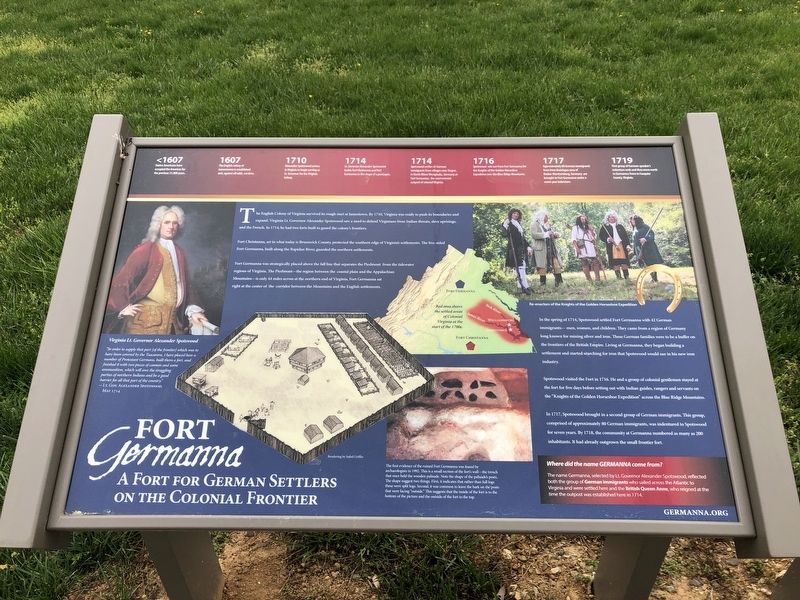
"In order to supply that part [of the frontier] which was to have been covered by the Tuscarora, I have placed here a number of Protestant Germans, built them a fort, and finished it with two pieces of cannon and some ammunition, which will awe the straggling parties of northern Indians and be a good barrier for all that part of the country."
— Lt. Gov. Alexander Spotswood, May 1714
The English Colony of Virginia survived its rough start at Jamestown. by 1710, Virginia was ready to push its boundaries and expand. Virginia Lt. Governor Alexander Spotswood saw a need to defend Virginians from Indian threats, slave uprisings and the French. In 1714, he had two forts built to guard the colony's frontiers.
Fort Christanna, set in what today is Brunswick County, protected the southern edge of Virginia's settlements. The five-sided Fort Germanna, built along the Rapidan River, guarded the northern settlements.
Fort Germanna was strategically placed above the fall line that separates the Piedmont from the tidewater regions of Virginia. The Piedmont—the region between the coastal plain and the Appalachian Mountains—is only 44 miles across at the northern end of Virginia. Fort Germanna sat right at the center of the corridor between the Mountains and the English settlements.
In the spring of 1714, Spotswood settled Fort Germanna with 42 German immigrants—men, women, and children. They came from a region of Germany long known for mining silver and iron. These German families were to be a buffer on the frontiers of the British Empire. Living at Germanna, they began building a settlement and started searching for iron that Spotswood would use in his new iron industry.
Spotswood visited the Fort in 1716. He and a group of colonial gentlemen stayed at the fort for five days before setting out with Indian guides, rangers and servants on the "Knights of the Golden Horseshoe Expedition" across the Blue Ridge Mountains.
In 1717, Spotswood brought in a second group of German immigrants. This group, comprised of approximately 80 German immigrants, was indentured to Spotswood for seven years. By 1718, the community at Germanna numbered as many as 200 inhabitants. It had already outgrown the small frontier fort.
Where did the name Germanna come from?
The name Germanna, selected by Lt. Governor Alexander Spotswood, reflected both the group of German immigrants who sailed across the Atlantic to Virginia and were settled here and the British Queen Anne, who reigned at the time the outpost was established here in 1714.
[Timeline:]
<1607: Native Americans have occupied the Americas
1607: The English colony of Jamestowne is established, and, against all odds, survives.
1710: Alexander Spotswood arrives in Virginia to begin serving as Lt. Governor for the Virginia Colony.
1714: Lt. Governor Alexander Spotswood builds Fort Christanna and Fort Germanna in the shape of a pentagon.
1714: Spotswood settles 42 German immigrants from villages near Siegen, in North Rhine Westphalia, Germany at Fort Germanna, the westernmost outpost of colonial Virginia.
1716: Spotswood sets out from Fort Germanna for the Knights of the Golden Horseshoe Expedition over the Blue Ridge Mountains.
1717: Approximately 80 German immigrants from from Kraichgau area of Baden-Wurttemberg, Germany are brought to Fort Germanna under a seven year indenture.
1719: First group of German-speaker's indenture ends and they move north to Germanna Town in Fauquier County, Virginia.
[Caption:]
The first evidence of the ruined Fort Germanna was found by archaeologists in 1992. This is a small section of the fort's wall—the trench that once held the wooden palisade. Note the shape of the palisade's post. The shape suggest two things. First, it indicates that rather than full logs these were split logs. Second, it was common to leave the bark on the posts that were facing "outside." This suggests that the inside of the fort is to the bottom of the picture and the outside of the fort is to the top.
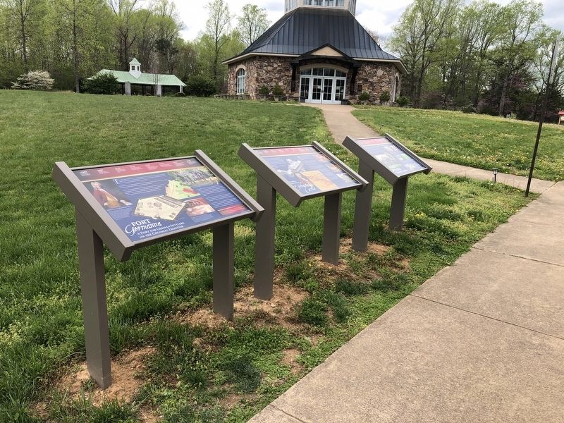
Erected by the Germanna Foundation.
Topics. This historical marker is listed in these topic lists: Colonial Era • Forts and Castles • Settlements & Settlers. A significant historical year for this entry is 1710.
Location. 38° 22.666′ N, 77° 46.983′ W. Marker is in Locust Grove, Virginia, in Orange County. Marker is on College Drive (Virginia Route 375) 0.2 miles west of Germanna Highway (Virginia Route 3), on the right when traveling west. Touch for map. Marker is at or near this postal address: 2062 Germanna Hwy, Locust Grove VA 22508, United States of America. Touch for directions.
Other nearby markers. At least 8 other markers are within walking distance of this marker. Alexander Spotswood's Enchanted Castle (here, next to this marker); Fort Germanna Visitor Center (here, next to this marker); Grant Takes Command (within shouting distance of this marker); Germanna Ford (within shouting distance of this marker); Hans Conrad Amberger (within shouting distance of this marker); Giuseppe Oddenino (within shouting distance of this marker); Spotswood (within shouting distance of this marker); Site of the First German Reformed Church (about 300 feet away, measured in a direct line). Touch for a list and map of all markers in Locust Grove.
Credits. This page was last revised on March 12, 2022. It was originally submitted on April 19, 2021, by Devry Becker Jones of Washington, District of Columbia. This page has been viewed 386 times since then and 56 times this year. Last updated on March 10, 2022, by Carl Gordon Moore Jr. of North East, Maryland. Photos: 1, 2. submitted on April 19, 2021, by Devry Becker Jones of Washington, District of Columbia.

