Ticonderoga in Essex County, New York — The American Northeast (Mid-Atlantic)
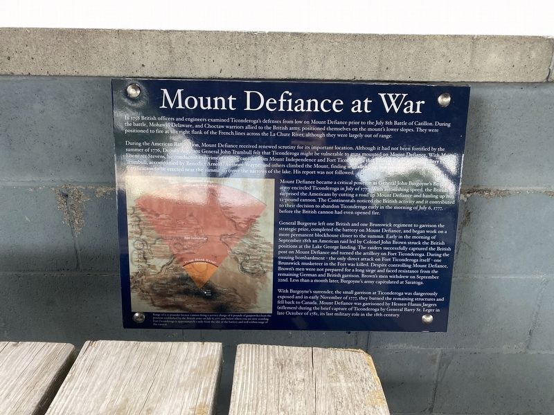
Mount Defiance at War
In 1758 British officers and engineers examined Ticonderoga's defenses from low on Mount Defiance prior to the July 8th Battle of Carillon. During the battle, Mohawk, Delaware, and Choctaw warriors allied to the British army, positioned themselves on the mount's lower slopes. They were positioned to fire at the right flank of the French lines across the La Chute River, although they were largely out of range.
During the American Revolution, Mount Defiance received renewed scrutiny for its important location. Although it had not been fortified by the summer of 1776, Deputy Adjutant General John Trumbull felt that Ticonderoga might be vulnerable to guns mounted on Mount Defiance. With Major Ebenezer Stevens, he conducted experiments firing cannon from Mount Independence and Fort Ticonderoga that proved it was within artillery range. Trumbull, accompanied by Benedict Arnold, Anthony Wayne, and others climbed the Mount, finding it challenging, but possible and urged a fortification to be erected near the summit to cover the narrows of the lake. His report was not followed.
Mount Defiance became a critical position as General John Burgoyne's British army encircled Ticonderoga in July of 1777. With astonishing speed, the British surprised the Americans by cutting a road up Mount Defiance and hauling up two 12-pound cannon. The Continentals noticed the British activity and it contributed to their decision to abandon Ticonderoga early in the morning of July 6, 1777, before the British cannon had even opened fire.
General Burgoyne left one British and one Brunswick regiment to garrison the strategic prize, completed the battery on Mount Defiance, and began work on a more permanent blockhouse closer to the summit. Early in the morning of September 18th an American raid led by Colonel John Brown struck the British positions at the Lake George landing. The raiders successfully captured the British post on Mount Defiance and turned the artillery on Fort Ticonderoga. During the ensuing bombardment - the only direct attack on Fort Ticonderoga itself - one Brunswick musketeer in the Fort was killed. Despite controlling Mount Defiance, Brown's men were not prepared for a long siege and faced resistance from the remaining German and British garrison. Brown's men withdrew on September 22nd. Less than a month later, Burgoyne's army capitulated at Saratoga.
With Burgoyne's surrender, the small garrison at Ticonderoga was dangerously exposed and in early November of 1777, they burned the remaining structures and fell back to Canada. Mount Defiance was garrisoned by Hessen-Hanau Jaegers (riflemen) during the brief capture of Ticonderoga by General Barry St. Leger in late October of 1781,
its last military role in the 18th century.
(caption) Range of a 12-pounder bronze cannon firing a service charge of 6 pounds of gunpowder from the position established by the British army on July 6, 1777. just below where you are now standing. Fort Ticonderoga is approximately i mile from the site of the battery and well within range of the cannon.
Topics. This historical marker is listed in these topic lists: Forts and Castles • War, French and Indian • War, US Revolutionary.
Location. 43° 49.883′ N, 73° 24.381′ W. Marker is in Ticonderoga, New York, in Essex County. Marker can be reached from Defiance Street, 1.3 miles east of The Portage when traveling east. Located in the Pavilion on Mount Defiance. Touch for map. Marker is in this post office area: Ticonderoga NY 12883, United States of America. Touch for directions.
Other nearby markers. At least 8 other markers are within 2 miles of this marker, measured as the crow flies. Summit of Mount Defiance (here, next to this marker); A Dominating Presence with Many Names (here, next to this marker); Old Military Road (approx. 0.9 miles away); Fort Ticonderoga and Mount Defiance (approx. one mile away in Vermont); From this point south… (approx. 1.1 miles away); Eighteen Colonial Soldiers (approx. 1.1 miles away); A Soldier of France (approx. 1.1 miles away); Mount Defiance (approx. 1.1 miles away). Touch for a list and map of all markers in Ticonderoga.
Also see . . . Fort Ticonderoga National Historic Landmark. (Submitted on March 22, 2022, by Michael Herrick of Southbury, Connecticut.)
Credits. This page was last revised on March 22, 2022. It was originally submitted on March 17, 2022, by Pete Skillman of Townsend, Delaware. This page has been viewed 278 times since then and 55 times this year. Photos: 1, 2. submitted on March 17, 2022, by Pete Skillman of Townsend, Delaware. • Michael Herrick was the editor who published this page.

