Near Louisa in Louisa County, Virginia — The American South (Mid-Atlantic)
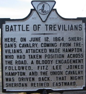
Battle of Trevilians
Erected 1928 by Conservation & Development Commission. (Marker Number W-209.)
Topics and series. This historical marker is listed in this topic list: War, US Civil. In addition, it is included in the Virginia Department of Historic Resources (DHR) series list. A significant historical month for this entry is June 2006.
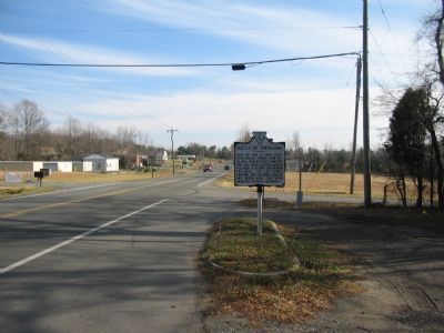
Location. 38° 3.079′ N, 78° 4.589′ W. Marker is near Louisa, Virginia, in Louisa County. Marker is at the intersection of Louisa Road (U.S. 33) and Trevilians Square, on the right when traveling east on Louisa Road. Located at a pull off at the intersection, on the south side of the highway. Touch for map. Marker is in this post office area: Louisa VA 23093, United States of America. Touch for directions.
Other nearby markers. At least 8 other markers are within 3 miles of this marker, measured as the crow flies. Battle of Trevillians (here, next to this marker); Trevilian Station Battle (about 500 feet away, measured in a direct line); Custer's First Last Stand (about 700 feet away); Custer Rescued (about 700 feet away); Netherland Tavern (approx. one mile away); Ogg Farm (approx. 1˝ miles away); Bibb's Crossroads (approx. 2.9 miles away); Green Springs (approx. 3 miles away). Touch for a list and map of all markers in Louisa.
Regarding Battle of Trevilians. This is one of several markers interpreting the Battle of Trevilian Station, June 11-12, 1864. See the Battle of Trevilian Station Virtual Tour by Markers linked below for additional related markers.
Also see . . . Trevilian Station Battlefield Foundation. The foundation has worked to preserve the remaining sections of the battlefield. A detailed driving tour of the battlefield is offered. (Submitted on January 20, 2008, by Craig Swain of Leesburg, Virginia.)

Photographed By Craig Swain, January 12, 2008
4. Fitzhugh Lee's Flanking Attack
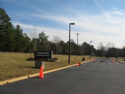
Late in the afternoon, as Confederate General Matthew Butler's Brigade held off attacks at the Bloody Angle, General Fitzhugh Lee dispatched Lomax's Brigade from his division on a march around to the west to flank the Federals. Lomax passed through the grounds of what is today the Trevilians Elementary School and attacked the exposed Federal right (western) flank. This action broke the Federal lines and effectively ended the battle.
Credits. This page was last revised on March 20, 2022. It was originally submitted on January 20, 2008, by Craig Swain of Leesburg, Virginia. This page has been viewed 2,710 times since then and 42 times this year. Last updated on March 17, 2022, by Bradley Owen of Morgantown, West Virginia. Photos: 1, 2. submitted on January 20, 2008, by Craig Swain of Leesburg, Virginia. 3, 4. submitted on January 21, 2008, by Craig Swain of Leesburg, Virginia. • J. Makali Bruton was the editor who published this page.


