Near Mount Crawford in Rockingham County, Virginia — The American South (Mid-Atlantic)
Battle of Cross Keys
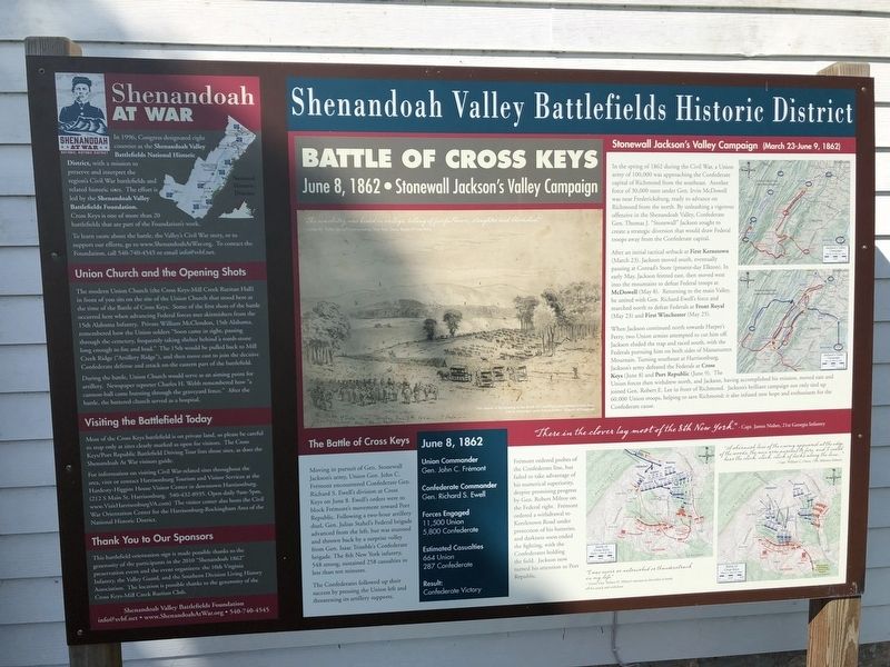
June 8, 1862 • Stonewall Jackson's Valley Campaign
— Shenandoah Valley Battlefields Historic District —
Stonewall Jackson's Valley Campaign (March 23-June 9, 1862)
"The musketry was heard in volleys, telling of fearful havoc, slaughter and bloodshed." - Charles H. Webb, Special Correspondent, New York Times, Battle of Cross Keys
(caption) This sketch of the opening of the Battle of Cross Keys, from behind Union lines, was by newspaper artist Edwin Forbes. (Library of Congress)
In the spring of 1862 during the Civil War, a Union army of 100,000 was approaching the Confederate capital of Richmond from the southeast. Another force of 30,000 men under Gen. Irvin McDowell was near Fredericksburg, ready to advance on Richmond from the north. By unleashing a vigorous offensive in the Shenandoah Valley, Confederate Gen. Thomas J. "Stonewall" Jackson sought to create a strategic diversion that would draw Federal troops away from the Confederate capital.
After an initial tactical setback at First Kernstown (March 23), Jackson moved south, eventually pausing at Conrad's Store (present-day Elkton). In early May, Jackson feinted east, then moved west into the mountains to defeat Federal troops at McDowell (May 8). Returning to the main Valley, he united with Gen. Richard Ewell's force and marched north to defeat Federals at Front Royal (May 23) and First Winchester (May 25).
When Jackson continued north towards Harper's Ferry; two Union armies attempted to cut him off. Jackson eluded the trap and raced south, with the Federals pursuing him on both sides of Massanutten Mountain. Turning southeast at Harrisonburg, Jackson's army defeated the Federals at Cross Keys (June 8) and Port Republic (June 9). The Union forces then withdrew north, and Jackson, having accomplished his mission, moved east and joined Gen. Robert E. Lee in front of Richmond. Jackson's brilliant campaign not only tied up 60,000 Union troops, helping to save Richmond; it also infused new hope and enthusiasm for the Confederate cause.
The Battle of Cross Keys
“There in the clover lay most of the 8th New York.” - Capt. James Nisbet, 21st Georgia Infantry
June 8, 1862
Union Commander
Gen. John C. Frémont
Confederate Commander
Gen. Richard S. Ewell
Forces Engaged
11,500 Union
5,800 Confederate
Estimated Casualties
664 Union
287 Confederate
Result:
Confederate Victory
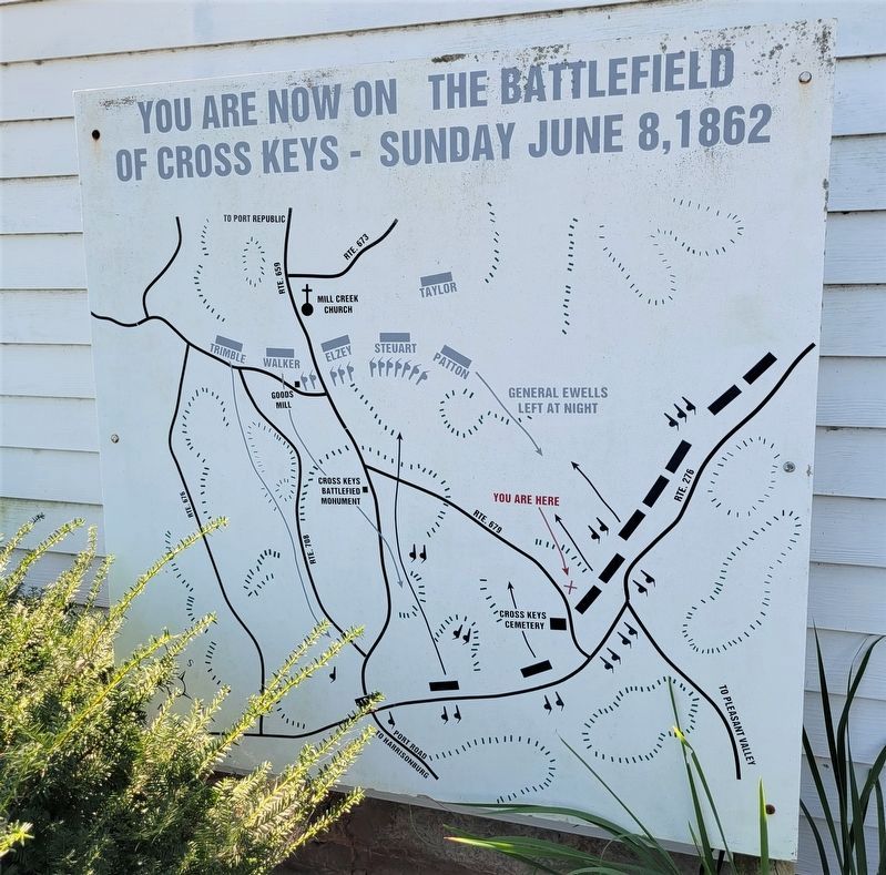
Moving in pursuit of Gen. Stonewall Jackson's army, Union Gen. John C. Frémont encountered Confederate Gen. Richard S. Ewell's division at Cross Keys on June 8. Ewell's orders were to block Frémont's movement toward Port Republic. Following a two-hour artillery duel, Gen. Julius Stahel's Federal brigade advanced from the left, but was stunned and thrown back by a surprise volley from Gen. Isaac Trimble's Confederate brigade. The 8th New York infantry, 548 strong, sustained 258 casualties in less than ten minutes.
The Confederates followed up their success by pressing the Union left and threatening its artillery supports.
Frémont ordered probes of the Confederate line, but failed to take advantage of his numerical superiority, despite promising progress by Gen. Robert Milroy on the Federal right. Frémont ordered a withdrawal to Keezletown Road under protection of his batteries, and darkness soon ended the fighting, with the Confederates holding the field. Jackson now turned his attention to Port Republic.
"I was never so astonished or thunderstruck in my life." - Union Gen. Robert H. Milroy's reaction to the order to break off his attack and withdraw
"A skirmish line of the enemy appeared at the edge of the woods; the men were anxious to fire, and I could hear the click, click, click of locks along the line..." - Capt. William C. Oates, 15th Alabama Infantry
Shenandoah At War
In 1996, Congress designated eight counties as the Shenandoah Valley Battlefields National Historic District, with a mission to preserve and interpret the region's Civil War battlefields and related historic sites. The effort is led by the Shenandoah Valley Battlefields Foundation. Cross Keys is one of more than 20 battlefields that are part of the Foundation's work.
To learn more about the battle, the Valley's Civil War story, or to support our efforts, go to www.ShenandoahAtWar.org. To contact the Foundation, call 540-740-4545 or email [email protected].
Union Church and the Opening Shots
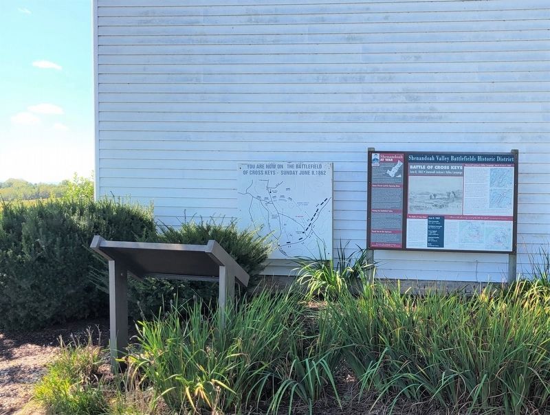
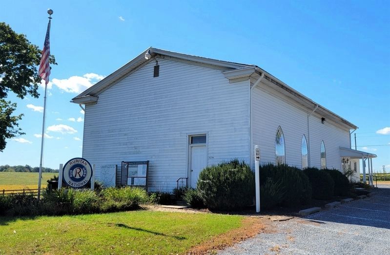
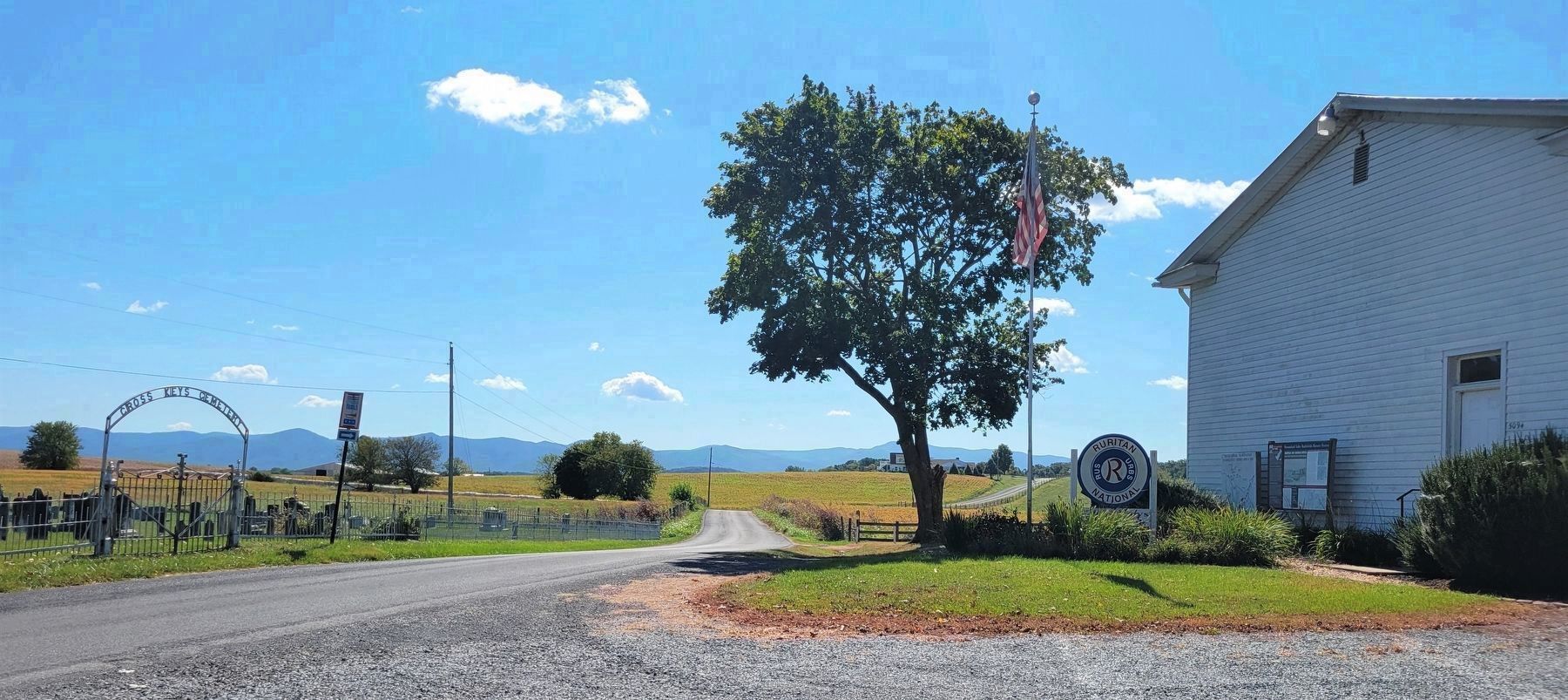
The modern Union Church (the Cross Keys-Mill Creek Ruritan Hall) in front of you sits on the site of the Union Church that stood here at the time of the Battle of Cross Keys. Some of the first shots of the battle occurred here when advancing Federal forces met skirmishers from the 15th Alabama Infantry. Private William McClendon, 15th Alabama, remembered how the Union solders "Soon came in sight, passing through the cemetery, frequently taking shelter behind a tomb-stone long enough to fire and load." The 15th would be pulled back to Mill Creek Ridge ("Artillery Ridge"), and then move cast to join the decisive Confederate defense and attack on-the eastern part of the battlefield.
During the battle, Union Church would serve as an aiming point for artillery. Newspaper reporter Charles H. Webb remembered how "a cannon-ball came bursting through the graveyard fence." After the battle, the battered church served as a hospital.
Visiting the Battlefield Today
Most of the Cross Keys battlefield is on private land, so please be careful to stop only at sites clearly marked as open for visitors. The Cross Keys/Port Republic Battlefield
Driving Tour lists those sites, as does the Shenandoah At War visitors guide.
For information on visiting Civil War-related sites throughout the area, visit or contact Harrisonburg Tourism and Visitor Services at the Hardesty-Higgins House Visitor Center in downtown Harrisonburg, (212 S Main St, Harrisonburg. 540-432-8935. Open daily 9am-5pm. www.VisitHarrisonburgVA.com) The visitor center also hosts the Civil War Orientation Center for the Harrisonburg-Rockingham Area of the National Historic District.
Thank You to Our Sponsors
This battlefield orientation sign is made possible thanks to the generosity of the participants in the 2010 "Shenandoah 1862" preservation event and the event organizers: the 10th Virginia Infantry, the Valley Guard, and the Southern Division Living History Association. The location is possible thanks to the generosity of the Cross Keys-Mill Creek Ruritan Club.
Erected by Shenandoah Valley Battlefields Foundation.
Topics. This historical marker is listed in this topic list: War, US Civil. A significant historical date for this entry is June 8, 1862.
Location. 38° 21.488′ N, 78° 50.493′ W. Marker is near Mount Crawford, Virginia, in Rockingham County. Marker is on Battlefield Road (Virginia Route 679) south of Cross Keys Road (Virginia Route 276), on the right when traveling south. Touch for map. Marker is at or near this postal address: 5094 Battlefield Road, Harrisonburg VA 22801, United States of America. Touch for directions.
Other nearby markers. At least
Photographed By J. J. Prats, September 26, 2022
5. This is the Cross Keys Battlefield
This view is east northeast. The Union line would be arrayed on either side and just behind the photographer, and in the distance facing the photographer would have been the Confederate lines just before the battle began.
Also see . . .
1. Shenandoah Valley Battlefields Historic District. National Park Service (Submitted on March 18, 2022.)
2. Shenandoah At War. Shenandoah Valley Battlefields Foundation (Submitted on March 18, 2022.)
3. Visit Harrisonburg. Harrisonburg Tourism (Submitted on March 18, 2022.)
Credits. This page was last revised on February 2, 2023. It was originally submitted on March 18, 2022, by Pete Skillman of Townsend, Delaware. This page has been viewed 452 times since then and 77 times this year. Last updated on March 18, 2022, by Bradley Owen of Morgantown, West Virginia. Photos: 1. submitted on March 18, 2022, by Pete Skillman of Townsend, Delaware. 2, 3, 4, 5. submitted on September 26, 2022, by J. J. Prats of Powell, Ohio. • J. Makali Bruton was the editor who published this page.
