Clyde in Haywood County, North Carolina — The American South (South Atlantic)
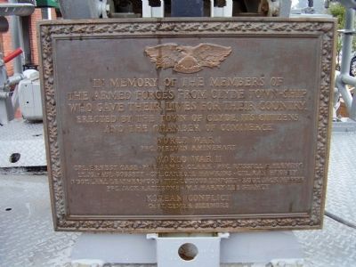
The Armed Forces from Clyde Town-ship
Photographed by Stanley and Terrie Howard, March 13, 2009
1. The Armed Forces from Clyde Town-ship Marker
Erected by the Town of Clyde, its citizens, and the Chamber of Commerce.
World War I
World War II
Korean Conflict
Erected by The Town of Clyde its Citizens,and the Chamber of Commerce.
Topics. This memorial is listed in these topic lists: War, Korean • War, World I • War, World II.
Location. 35° 32.01′ N, 82° 54.659′ W. Memorial is in Clyde, North Carolina, in Haywood County. It is on N Main St. (County Route 1642). Touch for map. Memorial is in this post office area: Clyde NC 28721, United States of America. Touch for directions.

Regionally, this memorial is in the Mountains, specifically in Greater Asheville, and in the Great Smoky Mountains. It is also in the American
this page online
Other nearby markers. At least 8 other markers are within 4 miles of this marker, measured as the crow flies: Clyde High School (about 600 feet away, measured in a direct line); The Shook House (approx. 0.4 miles away); Lambuth Inn (approx. 3.2 miles away); Honorable Chief Junaluska (approx. 3.4 miles away); Bishop Francis Asbury (approx. 3.4 miles away); Osborne Boundary Oak Tree (approx. 3½ miles away); Garden Creek (approx. 3.8 miles away); Colonial Theatre (approx. 4 miles away). Touch for a list and map of all markers in Clyde.
Photographed by Stanley and Terrie Howard, March 13, 2009
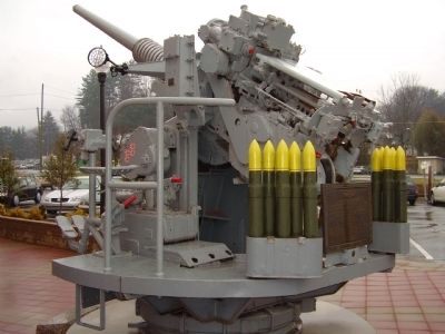
2. The Armed Forces from Clyde Town-ship Marker
Photographed by Stanley and Terrie Howard, March 13, 2009
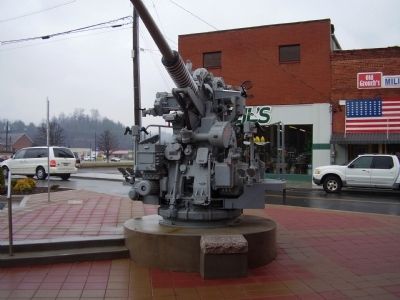
3. The Armed Forces from Clyde Town-ship Marker
Photographed by Stanley and Terrie Howard, March 13, 2009
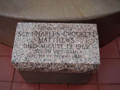
4. Sgt. Charles Crockett Matthews
Sgt. Charles Crockett Matthews Died August 13, 1969
South Viet Nam Erected by his wife Mary
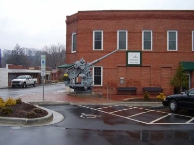
Photographed by Stanley and Terrie Howard, March 13, 2009
5. The Armed Forces from Clyde Town-ship Marker
Credits. This page was last revised on June 16, 2016. It was originally submitted on May 26, 2009, by Stanley and Terrie Howard of Greer, South Carolina. This page has been viewed 1,189 times since then and 26 times this year. Photos: 1, 2, 3, 4, 5. submitted on May 26, 2009, by Stanley and Terrie Howard of Greer, South Carolina. • Bill Pfingsten was the editor who published this page.
