Frankfort in Franklin County, Kentucky — The American South (East South Central)
The R. T. Brooks Pavilion
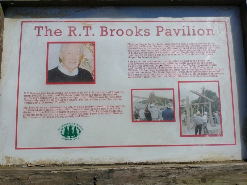
Mr. Brooks was an outstanding athlete and participated in many sports. He played golf skillfully into his nineties. One of his sons, Steve was director of the City of Frankfort Department of Parks, Recreation, and Historic Sites for many years. He and his wife Betty Jean Smith Brooks had three other sons; Bruce, David, and Glenn.
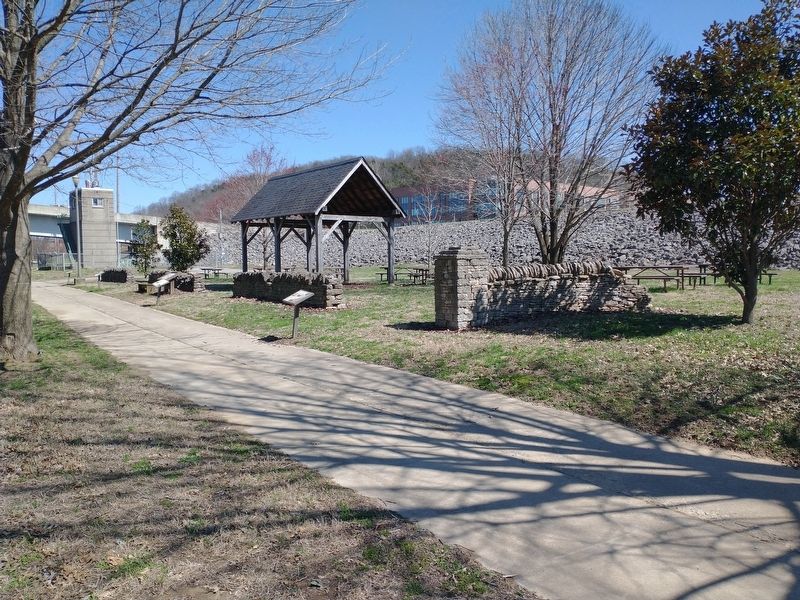
This pavilion is both a functional shelter and a demonstration of the building skills used by early settlers across the eastern United States. The timbers in its frame were all hewn by hand at an outdoor workshop site about two miles away, then brought here and erected according to plans developed by a master builder. The Shelters frame is held together by wooden pegs rather than nails. The slate roofing was shaped by hand as well.
This structure was erected in July, 2009 as part of the Frankfort Preservation Rendezvous, a traditional skills workshop sponsored by the Preservation Trades Network, Inc. the Timber Framers Guild, and the Slate Roofing Contractors Association. Rudy Christian of Christian & Son, Inc. designed the structure. Buckingham Slate Company donated the slate. The Slate Roofing Contractors Association donated the copper flashing and nails. Members of the Slate Roofing Contractors Association installed the roof. Meyer Midwest provided scaffolding.
Erected by Frankfort Parks, Recreation & Historical Sites.
Topics. This historical marker is listed in this topic list: Parks & Recreational Areas. A significant historical month for this entry is July 2009.
Location. 38° 12.196′ N, 84° 52.783′ W. Marker is in Frankfort, Kentucky, in Franklin County. Marker is on Wilkinson Boulevard, on the right when traveling south. Located in River View Park. Touch for map. Marker is in this post office area: Frankfort KY 40601, United States of America. Touch for directions.
Other nearby markers. At least 8 other markers are within walking distance of this marker. Turnpike Era Fence (a few steps from this marker); Kentucky Edge Fence (a few steps from this marker); Plantation Era Fence (a few steps from this marker); Farm Entryway and Pillar (a few steps from this marker); Franks Ford, Fishtrap Island, and Craw (within shouting distance of this marker); List of CSO Points in Frankfort (about 300 feet away, measured in a direct line); History of Kentucky's Formation (about 300 feet away); Kentucky River Water Trail (about 300 feet away). Touch for a list and map of all markers in Frankfort.
Credits. This page was last revised on March 26, 2022. It was originally submitted on March 25, 2022, by Craig Doda of Napoleon, Ohio. This page has been viewed 61 times since then and 13 times this year. Photos: 1, 2, 3. submitted on March 25, 2022, by Craig Doda of Napoleon, Ohio. • Mark Hilton was the editor who published this page.


