Orwell in Addison County, Vermont — The American Northeast (New England)
Southern Battery – 1777
Mount Independence State Historic Site
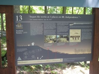
“began the works at 3 places on Mount Independence.” -
Col. Jeduthan Baldwin, June 20, 1777
On June, 1777, American Chief Engineer Jeduthan Baldwin wrote in his journal, “in the afternoon went with Col. Kosiusko to advise what works had best be done on the mount.” “Kosiusko” was classically trained Polish engineer Thaddeus Kosciuszko, Gen. Horatio Gates assigned him to survey the fortifications at Mount Independence and Fort Ticonderoga and make plans for improvements. The Northern Department of the American Army was on high alert, preparing for the arrival of British Lt. Gen. John Burgoyne, who was sailing south on Lake Champlain to fulfill his plan to split New England off from the rest of the American states. The American defenses along the southern land approach to Mount Independence clearly would not stand up to an enemy trying to encircle the Mount.
A few days later American Maj. Isaac Dunn observed about one hundred men under the direction of Kosciuszko, building three redoubts “in the rear of the Mount, and forming an abbatis.” The work progressed rapidly. By about June 23 there were five to six hundred men “employed on the batteries at Mount Independence,” and on June 27 Baldwin recorded, “leying platforms on the batteries on the S.E. side of the Mount.”
Kosciuszko and Baldwin capitalized on the rugged topography and existing 1776 log and stone breastwork to create a three-level defensive system here. Some of the stonework from the old breastwork can be seen along the edge of the loop at the end of the spur trail. In these classic defenses the front line had cannon, and the second and third lines supported what was in front of them. Well to the rear was the camp, and at the Mount two-story blockhouses armed with more cannon to protect the rear lines.
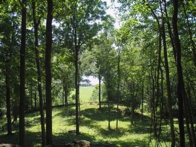
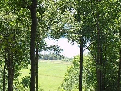
On the plateau below you is the second, or middle, of the three batteries. The battery wall is built of stone and sod, with remains of the cannon platform foundations near the wall. Built into the stone outcropping immediately below you are traces of building foundations, likely soldier’s huts erected by the British and Germans garrisoned here after the Americans withdrew in July 1777.
The three batteries were laid out so the lines of fire intersected with each other. Attacking forces would be subject to a number of cannon as they advanced over the cleared ground in front of the batteries. If the attackers were able to draw closer, soldiers with muskets would open fire.
The American forces never had a real chance to test the batteries they constructed. After they withdrew under the cover of darkness
the night of July 5 and 6, 1777, British and German forces encamped in this area. They made good use of these defenses from September 19 to the 21, when the Americans tried to regain Mount Independence and Fort Independence and Fort Ticonderoga. Finally, the British also had to withdraw, on November 8, after the defeat of British Lt. Gen. John Burgoyne at the battles of Saratoga.
Erected by Mount Independence State Historic Site.
Topics. This historical marker is listed in this topic list: War, US Revolutionary. A significant historical date for this entry is June 20, 1777.
Location. 43° 49.352′ N, 73° 22.756′ W. Marker is in Orwell, Vermont, in Addison County. Marker can be reached from Mount Independence Road, on the right when traveling south. Marker is along the walking trail in Mount Independence State Historic Site. Touch for map. Marker is in this post office area: Orwell VT 05760, United States of America. Touch for directions.
Other nearby markers. At least 8 other markers are within walking distance of this marker. The American Southern Defenses – 1776-1777 (within shouting distance of this marker); British Blockhouse - 1777 (within shouting distance of this marker); Foundation -1776 or 1777 (within shouting distance of this marker); German Hut – 1777 (about 400 feet away, measured in a direct line); Storehouse - 1776 (about 500 feet away);
Lake Champlain and the American Revolution (about 600 feet away); Third Brigade Encampment – 1776 (about 700 feet away); Heritage Travelers over the Years (about 700 feet away). Touch for a list and map of all markers in Orwell.
More about this marker. The bottom left of the marker contains an illustration of Mount Independence’s Southern Battery. Included is a picture of “A cannon on its garrison carriage, with cannon balls or round shot, case shot, and bar shot ready to fire. Case shot used cast iron balls packed either in canisters or canvas bags bound with cord. Bar shot rotated in the air and did great damage to ship rigging or ranks of soldiers. A picture of a British “Brown Bess” musket is seen on the top right of the marker. Some photographs from the Collection of the Mount Independence State Historic Site appear at the bottom of the marker. They have captions of “Archaeological investigation in 1992 discovered foundations of huts built into the rock outcroppings. Inside the foundations were bottles, the bottom of a canteen, and other personal items.” and “Kosciuszko designed and built this gun battery out of stone and sod, erecting a strong defense by situating it on the crest of the rugged slope.”
Related markers. Click here for a list of markers that are related to this marker. This series of markers are found on the walking trails in Mount Independence State Historic Site.
Credits. This page was last revised on June 16, 2016. It was originally submitted on May 28, 2009, by Bill Coughlin of Woodland Park, New Jersey. This page has been viewed 1,406 times since then and 14 times this year. Photos: 1, 2, 3. submitted on May 28, 2009, by Bill Coughlin of Woodland Park, New Jersey.


