Toledo in Lucas County, Ohio — The American Midwest (Great Lakes)
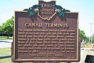
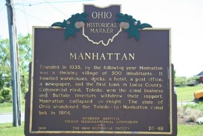
Canal Terminus / Manhattan
Erected 1988 by Riverside Hospital, Toledo Sesquicentennial Commission, and The Ohio Historical Society. (Marker Number 26–48.)
Topics and series. This historical marker is listed in these topic lists: Industry & Commerce • Settlements & Settlers • Waterways & Vessels. In addition, it is included in the Ohio Historical Society / The Ohio History Connection, the The Miami & Erie Canal, and the Wabash & Erie Canal series lists. A significant historical year for this entry is 1864.
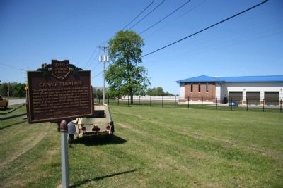
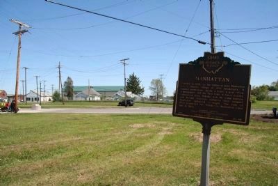
Location. 41° 41.31′ N, 83° 29.112′ W. Marker is in Toledo, Ohio, in Lucas County. Marker is at the intersection of Summit Street and Marina Road, on the right when traveling north on Summit Street. This historical marker is located in Toledo's north end neighborhood, near the water front, in front of the City of Toledo’s water sanitation facility. Touch for map. Marker is at or near this postal address: 3749 Erie St, Toledo OH 43611, United States of America. Touch for directions.
Other nearby markers. At least 8 other markers are within walking distance of this marker. Dempsey-Willard Fight (approx. 0.4 miles away); Bayview Retirees Golf Course (approx. 0.4 miles away); The Man Behind the Name (approx. half a mile away); Frogtown: Past and Present (approx. half a mile away); The Lost City (approx. 0.7 miles away); Lucas County Medal of Honor Recipients (approx. 0.7 miles away); Lucas County Vietnam Veterans Memorial (approx. ¾ mile away); Lucas County WWII Veterans Memorial (approx. ¾ mile away). Touch for a list and map of all markers in Toledo.
Regarding Canal Terminus / Manhattan. This marker marks the northern terminus the longest artificial water way in the United States, the Wabash & Erie Canal.
Also see . . . Marker found - waiting to be re-erected!. After nearly 5 years the marker has been found at a city workshop. At first they thought they had only found the "Manhattan" side. No one had looked at the reverse side of that marker to note it was the "Canal Terminus" side. (Submitted on February 15, 2024, by Mark Hilton of Montgomery, Alabama.)
Additional commentary.
1. Marker is missing
My wife and I visited this site today and it appears this marker is missing. Note To Editor only visible by Contributor and editor
— Submitted May 25, 2019, by Myron Charles Collins of Toledo, Ohio.
Credits. This page was last revised on April 29, 2024. It was originally submitted on May 28, 2009, by Dale K. Benington of Toledo, Ohio. This page has been viewed 2,280 times since then and 160 times this year. Last updated on April 28, 2024, by Grant & Mary Ann Fish of Galloway, Ohio. Photos: 1, 2, 3, 4. submitted on May 28, 2009, by Dale K. Benington of Toledo, Ohio. 5. submitted on April 29, 2024. • Devry Becker Jones was the editor who published this page.
Editor’s want-list for this marker. Clear wide photo of now replaced marker. • Can you help?


