
Idabel in McCurtain County, Oklahoma — The American South (West South Central)
Operation Desert Shield/Storm Memorial
Photographed by Jason Armstrong, September 11, 2021
1. Operation Desert Shield/Storm Memorial
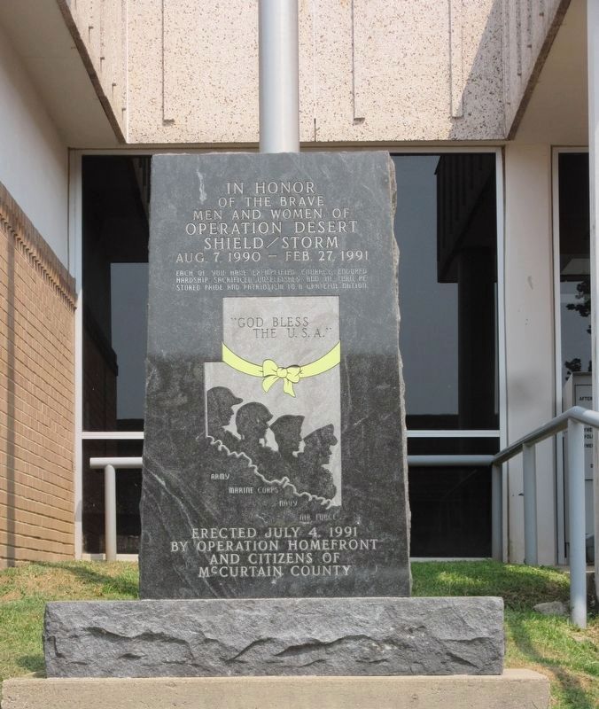
In honor of the brave men and women of Operation Desert Shield/Storm
Aug. 7, 1990 - Feb. 27, 1991
Each of you have exemplified courage, endured hardship, sacrificed unselfishly, and in turn restored pride and patriotism to a grateful nation.
"God Bless the U.S.A."
Army · Marine Corps · Navy · Air Force
Erected 1991 by Operation Homefront and Citizens of McCurtain County.
Topics. This memorial is listed in this topic list: War, 1st Iraq & Desert Storm.
Location. 33° 53.801′ N, 94° 49.723′ W. Memorial is in Idabel, Oklahoma, in McCurtain County. It is on North Central Avenue north of NE Martin Luther King Avenue, on the right when traveling north. Touch for map. Memorial is at or near this postal address: 108 N Central Ave, Idabel OK 74745, United States of America. Touch for directions.

Regionally, this memorial is in Oklahoma’s Choctaw Nation. It is also in the American South, specifically in the Piney Woods, on the prairies, and on the Southern Plains. Globally, it is in North America, the Western Hemisphere, the Western World, and the Anglosphere.
this page online
Other nearby markers. At least 8 other markers are within 13 miles of this marker, measured as the crow flies: We Served Proudly (a few steps from this marker); Miller Courthouse (approx. 1.1 miles away); Shawneetown (approx. 1.1 miles away); Isaac Levi Garvin (approx. 6.9 miles away); Waterhole Cemetery (approx. 6.9 miles away); Military Road (approx. 10.4 miles away); Wheelock Mission (approx. 10.9 miles away); The Choctaw Nation of Oklahoma (approx. 12.4 miles away). Touch for a list and map of all markers in Idabel.
Another marker is no longer nearby. Shawneetown (was approx. 1.1 miles away but has been confirmed missing).
Photographed by Jason Armstrong, September 11, 2021
2. Operation Desert Shield/Storm Memorial
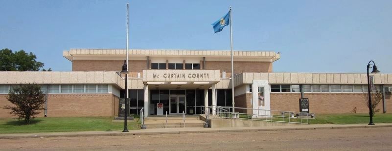
The memorial is to the left of the entrance.
Credits. This page was last revised on June 13, 2024. It was originally submitted on March 27, 2022, by Jason Armstrong of Talihina, Oklahoma. This page has been viewed 266 times since then and 14 times this year. Photos: 1, 2. submitted on March 27, 2022, by Jason Armstrong of Talihina, Oklahoma. • J. Makali Bruton was the editor who published this page.
