
Tolchester Beach in Kent County, Maryland — The American Northeast (Mid-Atlantic)
Tolchester Beach Amusement Park
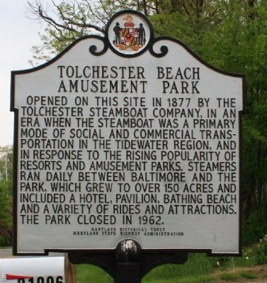
Photographed by Bob Marshall, April 29, 2009
1. Tolchester Beach Amusement Park Marker
Erected 2002 by Maryland Historical Trust and the Maryland State Highway Administration.
Topics and series. This historical marker is listed in these topic lists: Entertainment • Notable Places. In addition, it is included in the Maryland Historical Trust series list. A significant historical year for this entry is 1877.
Location. 39° 12.875′ N, 76° 14.429′ W. Marker is in Tolchester Beach, Maryland, in Kent County. It is on Tolchester Beach Road (Maryland Route 21) 1.4 miles west of Tolchester Road ( Route 445), on the right when traveling west. Marker can be found just before the Tolchester Marina, on the right when traveling west on Tolchester Beach Road. Marker is located in
this page online

Regionally, this marker is on the Eastern Shore. It is also in the American Mid-Atlantic, on the Delmarva Peninsula, in the Tidewater, in the Chesapeake Bay Region, and on the Eastern Seaboard. Globally, it is in the North Atlantic Region, North America, the Western Hemisphere, the Western World, and the Anglosphere. Historically, it finds itself in what was once one of the original Thirteen Colonies and also the Antebellum South.
Other nearby markers. At least 8 other markers are within 4 miles of this marker, measured as the crow flies: Rude Awakening (approx. 0.6 miles away); Battle of Caulk's Field Bicentennial Memorial (approx. 2.3 miles away); Royal Navy and Royal Marines Memorial (approx. 2.4 miles away); Caulk’s Field Monument (approx. 2.4 miles away); Battle of Caulk’s Field (approx. 3 miles away); Kent Meeting House (approx. 3½ miles away); St. Paul's Oak Tree (approx. 3.8 miles away); Bass Propagation Lake (approx. 4 miles away).
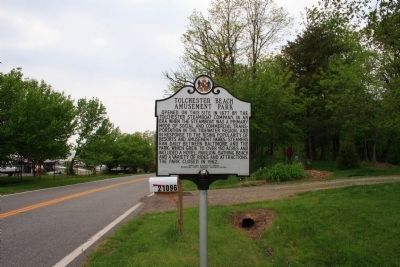
Photographed by Bob Marshall, April 29, 2009
2. Tolchester Beach Amusement Park Marker
Credits. This page was last revised on December 29, 2024. It was originally submitted on May 29, 2009, by Bob Marshall of Baltimore, Maryland. This page has been viewed 4,438 times since then and 82 times this year. Photos: 1, 2. submitted on May 29, 2009, by Bob Marshall of Baltimore, Maryland. • Kevin W. was the editor who published this page.
