Roberts in Escambia County, Alabama — The American South (East South Central)
Elim Baptist Church
(Silas Creek Baptist Church)
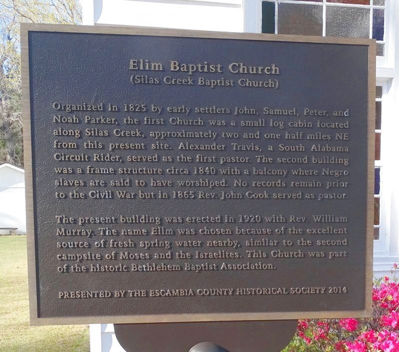
Photographed by David J Gaines, March 12, 2022
1. Elim Baptist Church Marker
Erected 2014 by Escambia County Historical Society.
Topics. This historical marker is listed in this topic list: Religion & Religious Structures.
Location. 31° 5.551′ N, 86° 52.202′ W. Marker is in Roberts, Alabama, in Escambia County. It is at the intersection of Bradley Road (County Road 4) and Hickory
this page online

Regionally, this marker is in the American South and specifically in the Deep South. Globally, it is in North America, a Gulf of Mexico state, the Western Hemisphere, the Western World, and the Anglosphere. Historically, it finds itself in what was once New Spain, the territory of the Mississippian Culture, one of the Confederate States of America, and the Antebellum South.
Other nearby markers. At least 8 other markers are within 12 miles of this marker, measured as the crow flies: Damascus Travelers Well (approx. 5.6 miles away); Site of Fort Crawford (approx. 11 miles away); Downing-Shofner School (approx. 11 miles away); Dixon Home Place / History of the Dixon Home (approx. 11.1 miles away); Second Saint Siloam Missionary Baptist Church (approx. 11.6 miles away); Hart Station (approx. 11.9 miles away); Escambia County Veterans Memorial (approx. 12 miles away); Bank of Brewton (approx. 12 miles away).

Photographed by David J Gaines, March 12, 2022
2. Elim Baptist Church
Credits. This page was last revised on April 10, 2022. It was originally submitted on March 28, 2022, by David J Gaines of Pinson, Alabama. This page has been viewed 1,068 times since then and 84 times this year. Photos: 1, 2. submitted on March 28, 2022, by David J Gaines of Pinson, Alabama. • Mark Hilton was the editor who published this page.
