Havre de Grace in Harford County, Maryland — The American Northeast (Mid-Atlantic)
Tollhouse and Covered Bridge at Rock Run
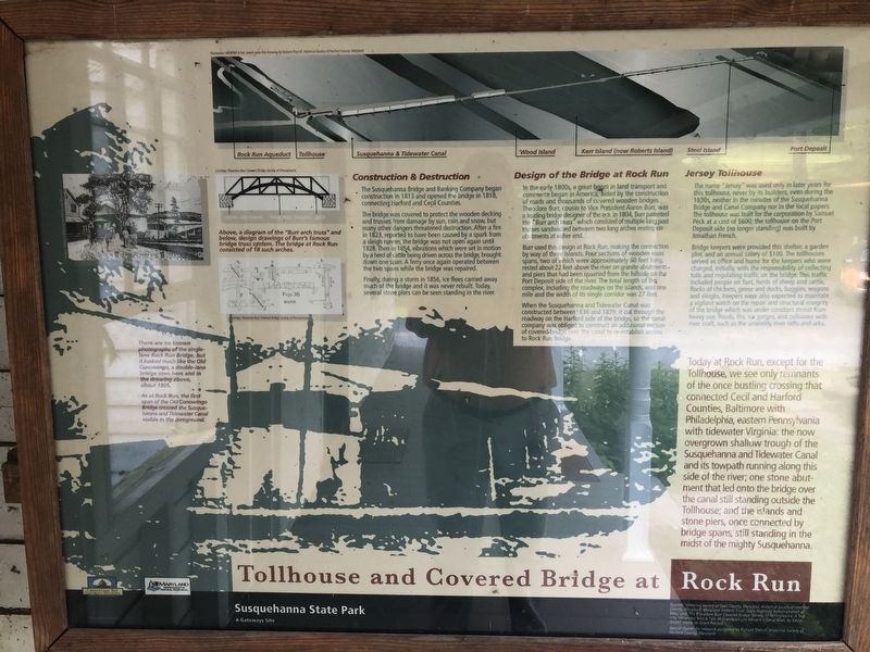
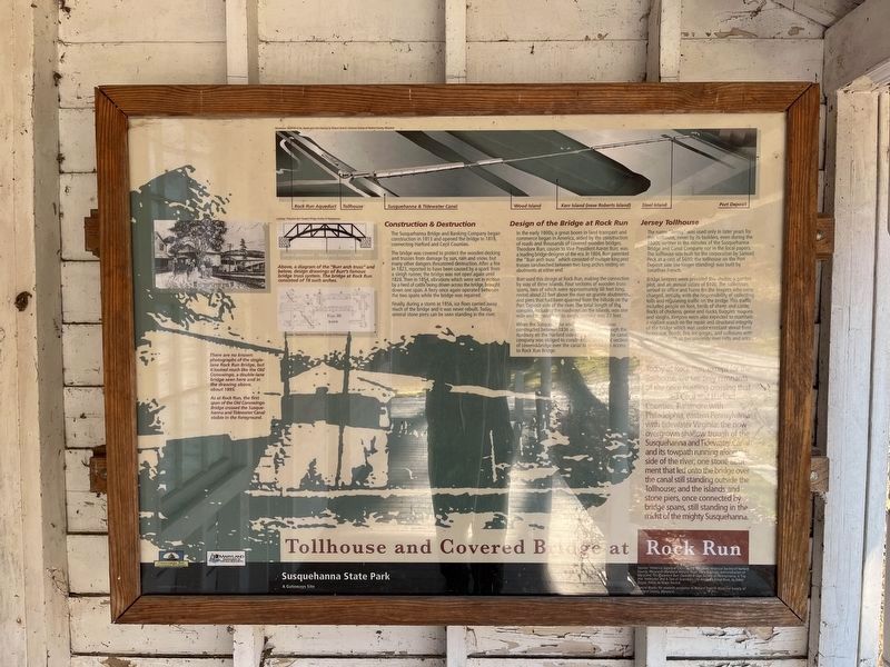
The Susquehanna Bridge and Banking Company began construction in 1813 and opened the bridge in 1818, connecting Harford and Cecil Counties.
The bridge was covered to protect the wooden decking and trusses from damage by sun, rain and snow, but many other dangers threatened destruction. After a fire in 1823, reported to have been caused by a spark from a sleigh runner, the bridge was not open again until 1828. Then in 1854, vibrations which were set in motion by a herd of cattle being driven across the bridge, brought down one span. A ferry once again operated between the two spans while the bridge was repaired.
Finally, during a storm in 1856, ice floes carried away much of the bridge and it was never rebuilt. Today, several stone piers can be seen standing in the river.
Design of the Bridge at Rock Run
In the early 1800s, a great boom in land transport and commerce began in America, aided by the construction of roads and thousands of covered wooden bridges. Theodore Burr, cousin to Vice President Aaron Burr, was a leading bridge designer of the era. In 1804, Burr patented the "Burr arch truss” which consisted of multiple king post trusses sandwiched between two long arches resting on abutments at either end.
Burr used this design at Rock Run, making the connection by way of three islands. Four sections of wooden truss spans, two of which were approximately 60 feet long, rested about 22 feet above the river on granite abutments, and piers that had been quarried from the hillside on the Port Deposit side of the river. The total length of the complex, including the roadways on the islands, was one mile and the width of its single corridor was 27 feet.
When the Susquehanna and Tidewater Canal was constructed between 1836 and 1839, it cut through the roadway on the Harford side of the bridge, so the canal company was obliged to construct an additional section of covered-bridge over the canal to re-establish access to Rock Run Bridge.
Jersey Tollhouse
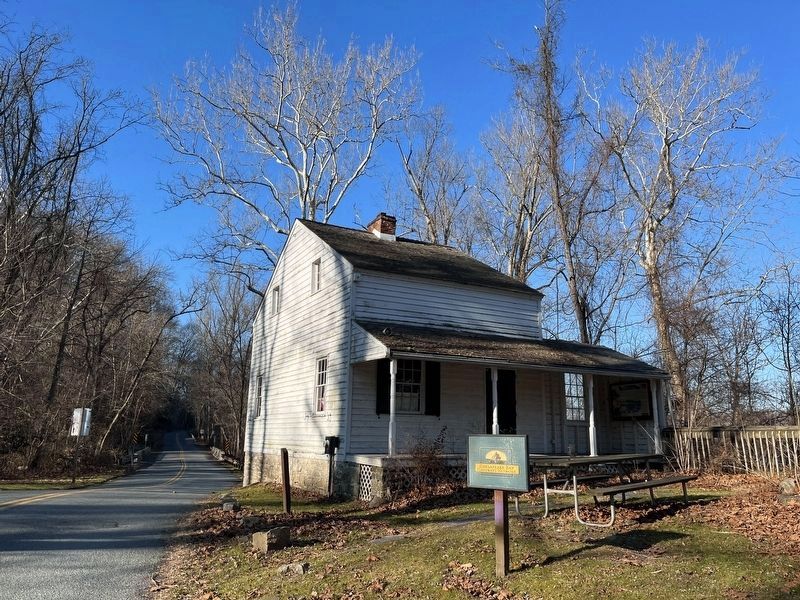
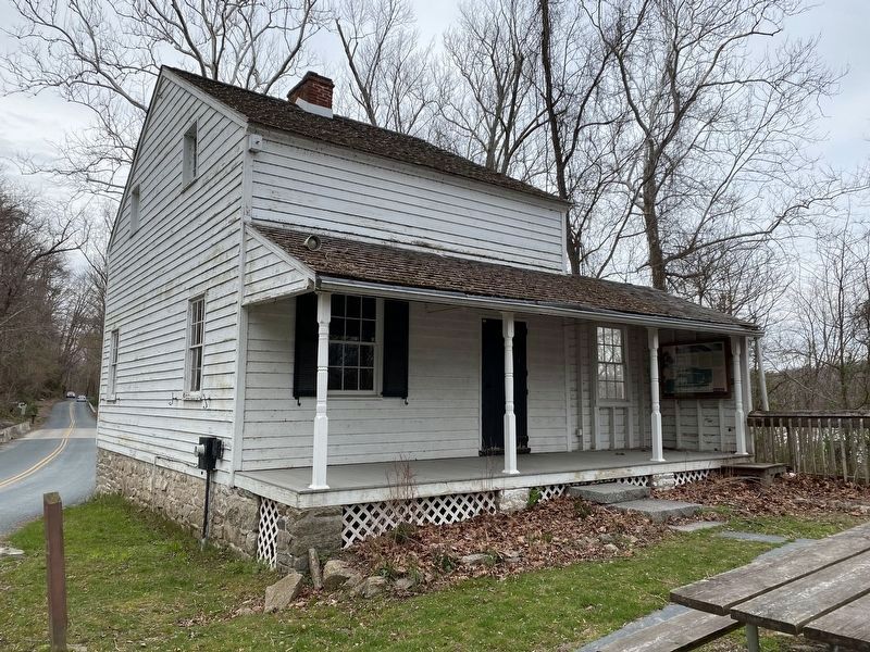
The name "Jersey” was used only in later years for this tollhouse, never by its builders, even during the 1830s, neither in the minutes of the Susquehanna Bridge and Canal Company nor in the local papers. The tollhouse was built for the corporation by Samuel Peck at a cost of $600; the tollhouse on the Port Deposit side (no longer standing) was built by Jonathan French.
Bridge keepers were provided this shelter, a garden plot, and an annual salary of $100. The tollhouses served as office and home for the keepers who were charged, initially, with the responsibility of collecting tolls and regulating traffic on the bridge This traffic included people, flocks of chickens, geese and ducks, buggies, wagons and sleighs. Keepers were also expected to maintain a vigilant watch on the repair and structural integrity of the bridge which was under constant threat from heavy use, floods, fire, ice gorges, and collisions with river craft, such as the unwieldy river rafts and arks.
Today at Rock Run, except for the Tollhouse, we see only remnants of the once bustling crossing that connected Cecil and Harford Counties, Baltimore with Philadelphia, eastern Pennsylvania with tidewater Virginia: the now overgrown shallow trough of the Susquehanna and Tidewater Canal and its towpath running along this side of the river; one stone abutment that led onto the bridge over the canal still standing outside the Tollhouse; and the islands and stone piers, once connected by bridge spans, still standing in the midst of the mighty Susquehanna.
Captions:
Above, a diagram of the "Burr arch truss" and below, design drawings of Burr's famous bridge truss system. The bridge at Rock Run consisted of 18 such arches.
There are no known photographs of the single-lane Rock Run Bridge, but it looked much like the Old Conowingo, a double-lane bridge seen here and in the drawing above, about 1895.
As at Rock Run, the first span of the Old Conowingo Bridge crossed the Susquehanna and Tidewater Canal visible in the foreground.
Erected by Susquehanna State Park.
Topics and series. This historical marker is listed in these topic lists: Bridges & Viaducts • Industry & Commerce • Waterways & Vessels. In addition, it is included in the Covered Bridges, and the Susquehanna and Tidewater Canal series lists.
Location. 39° 36.519′ N, 76° 8.584′ W. Marker is in Havre de Grace, Maryland, in Harford County. Marker can be reached from the intersection of Stafford Road and Rock Run Road, on the right when traveling west. The marker is located on the porch of the tollhouse. Touch for map. Marker is in this post office area: Havre de Grace MD 21078, United States of America. Touch for directions.
Other nearby markers. At least 8 other markers are within walking distance of this marker. Explore Your Chesapeake (a few steps from this marker); Toll House & Tidewater Canal (within shouting distance of this marker); Rock Run Landing (within shouting distance of this marker); Miller's House (about 300 feet away, measured in a direct line); Rock Run (about 300 feet away); Rock Run Mill (about 400 feet away); Carter-Archer House (about 400 feet away); Spring House (about 400 feet away). Touch for a list and map of all markers in Havre de Grace.
Credits. This page was last revised on January 24, 2023. It was originally submitted on April 4, 2022, by Pete Skillman of Townsend, Delaware. This page has been viewed 340 times since then and 71 times this year. Photos: 1. submitted on April 4, 2022, by Pete Skillman of Townsend, Delaware. 2, 3. submitted on January 13, 2023, by Adam Margolis of Mission Viejo, California. 4. submitted on April 4, 2022, by Pete Skillman of Townsend, Delaware. • J. Makali Bruton was the editor who published this page.


