Groveton in Prince William County, Virginia — The American South (Mid-Atlantic)
Broken by Artillery
Second Battle of Manassas: Day Three, August 30, 1862 3:30 p.m.
| — | Manassas National Battlefield Park, National Park Service, U.S. Department of the Interior | — |
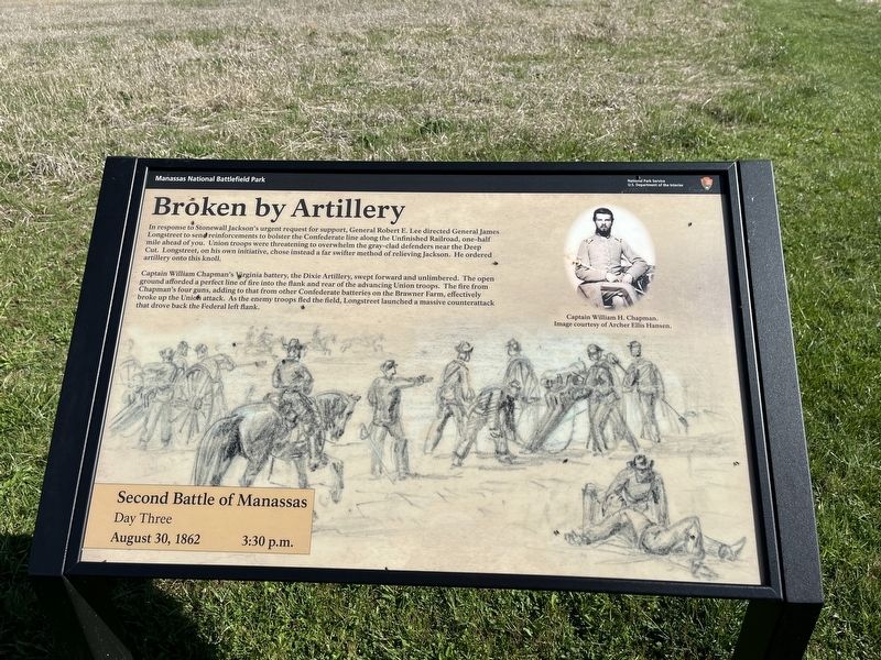
In response to Stonewall Jackson's urgent request for support, General Robert E. Lee directed General James Longstreet to send reinforcements to bolster the Confederate line along the Unfinished Railroad, one-half mile ahead of you. Union troops were threatening to overwhelm the gray-clad defenders near the Deep Cut. Longstreet, on his own initiative, chose instead a far swifter method of relieving Jackson. He ordered artillery on this knoll.
Captain William Chapman's Virginia battery, the Dixie Artillery, swept forward and unlimbered. The open ground afforded a perfect line of fire into the flank and rear of the advancing Union troops. The fire from Chapman's four guns, adding to that from other Confederate batteries on the Brawner Farm, effectively broke up the Union attack. As the enemy troops fled the field, Longstreet launched a massive counterattack that drove back the Federal left flank.
Erected by National Park Service, U.S. Department of the Interior.
Topics. This historical marker is listed in this topic list: War, US Civil.
Location. 38° 48.72′ N, 77° 33.422′ W.
this page online

Regionally, this marker is in the Washington Metropolitan Area, in Northern Virginia, and in the Piedmont. It is also in the American South, specifically in the Upper South, in the Mid-Atlantic, and on the Eastern Seaboard. Globally, it is in the North Atlantic Region, North America, the Western Hemisphere, the Western World, and the Anglosphere. Historically, it finds itself in what was once the territory of the Mississippian Culture, one of the original Thirteen Colonies, one of the Confederate States of America, and the Antebellum South.
Other nearby markers. At least 8 other markers are within walking distance of this marker: Battery Heights (within shouting distance of this marker); Manassas National Battelfield Park (within shouting distance of this marker); Company B, 4th U.S. Artillery (about 400 feet away, measured
Another marker is no longer nearby. Second Battle of Manassas (was within shouting distance of this marker but has been replaced with another marker now near it).
Credits. This page was last revised on May 10, 2023. It was originally submitted on April 9, 2022, by Devry Becker Jones of Washington, District of Columbia. This page has been viewed 355 times since then and 34 times this year. Photos: 1, 2. submitted on April 9, 2022, by Devry Becker Jones of Washington, District of Columbia.
