Appomattox in Appomattox County, Virginia — The American South (Mid-Atlantic)
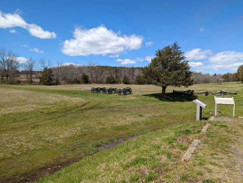
Surrender of the Artillery
April 11, 1865
Confederate General E. P. Alexander stated: "I had arranged to form all our guns on the road early, Tuesday morning, & did so, making over half a mile of column. There we left them to the Federals, . . [the next morning] many of the horses were dead ... It was a pitiable site."
A Federal soldier noted it was: "the remnants of 15 or 16 batteries ... . Sometimes they had a caisson for, every two guns, sometimes only one for a whole battery, and sometimes none at all, but carried their ammunition in gun-limbers. But not a third of the artillery they had when they left their trenches was surrendered at Appomattox. The rest had been captured or destroyed in the fights from Gravelly Run to Appomattox or abandoned."
Chief of Artillery for the Army of Northern Virginia, Brigadier General Pendleton, reported starting the Appomattox Campaign with 250 cannons. Of the 180 Lee had at his disposal on the morning of April 8, 1865: 15 were abandoned to the pursuing Army of the Potomac; 25 were captured at Appomattox Station by Custer; 54 were recovered from Red Oak Church (most having been buried); 21 escaped to Lynchburg; and 65 were surrendered or dismantled in camp.
"Tonight the men are celebrating the surrender with improvised fireworks. It was some time before I could make out how they managed to obtain what appeared to be hundreds of roman candles but at last discovered that they were shooting rebel [artillery] fuses from their muskets with small charges of powder. These exactly resemble the balls thrown out by roman candles. The effect, together with the camp fires, was really beautiful,” recorded Federal Colonel Charles Wainwright.
General Lee selected one-armed Major Haskell (age 23) of Columbia, South Carolina, to supervise the surrender of the Confederate artillery. His brother Alexander oversaw the cavalry surrender. Haskell had six brothers in service, two of whom died in the war. John Haskell had served on the staffs of Generals Johnston, Smith, Longstreet and Beauregard, and eventually commanded artillery in Longstreet's corps. Haskell's Federal counterpart, 30-year-old" Brevet Major General Bartlett, originally led the 27th New York Infantry and rose to division command in the Sixth Corps before being transferred to the Fifth Corps.
The two first met during the commissioners meeting at the McLean House on April 10. Haskell recounted: “For two days I was kept constantly busy with Bartlett, making out lists and turning over guns and supplies.... Bartlett and I got to be very friendly, and he was very kind in trying to do anything he could for me."
Erected by National Park Service.
Topics. This historical marker is listed in this topic list: War, US Civil. A significant historical date for this entry is April 8, 1865.
Location. 37° 22.978′ N, 78° 47.364′ W. Marker is in Appomattox, Virginia, in Appomattox County. Marker is on Old Courthouse Road (Virginia Route 24) 0.2 miles south of Joel Sweeney Lane (Virginia Route 710), on the right when traveling south. Touch for map. Marker is in this post office area: Appomattox VA 24522, United States of America. Touch for directions.
Other nearby markers. At least 8 other markers are within walking distance of this marker. After the Surrender (here, next to this marker); Artillery Park (within shouting distance of this marker); African American Banjoists (within shouting distance of this marker); Popularizer of the Banjo (within shouting distance of this marker); Appomattox River (about 300 feet away, measured in a direct line); a different marker also named Appomattox River (about 300 feet away); Lee's Apple Tree (about 400 feet away); Grant and Lee Meeting (approx. 0.3 miles away). Touch for a list and map of all markers in Appomattox.
Credits. This page was last revised on April 12, 2022. It was originally submitted on April 12, 2022, by Mike Wintermantel of Pittsburgh, Pennsylvania. This page has been viewed 242 times since then and 56 times this year. Photos: 1, 2. submitted on April 12, 2022, by Mike Wintermantel of Pittsburgh, Pennsylvania.

