Near Keeler in Inyo County, California — The American West (Pacific Coastal)
Highway History
Inyo County
— Point of Interest —
On Names and Routes
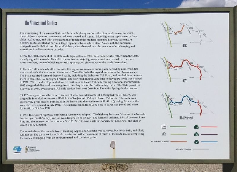
The numbering of the current State and Federal highways reflects the piecemeal manner in which these highway systems were conceived, constructed and signed. Most highways replicate or replace older local routes, and with the exception of much of the modern Interstate highway system, are not new routes created as part of a large regional infrastructure plan. As a result, the numerical designation of both State and Federal highways has changed over the years to reflect changing and sometimes idealistic notions of order.
Before the establishment of the state route sign system in 1934, automobile clubs, rather than the State, usually signed the roads. To add to the confusion, state highways sometimes carried two or more route numbers, none of which necessarily appeared on either maps or the roads themselves.
In the late 19th and early 20th centuries this region was a major mining area served by numerous dirt roads and trails that connected the mines at Cerro Gordo in the Inyo Mountains to the Owens Valley. The State acquired some of these old roads, including the Eichbaum Toll Road, and graded links between them to create SR-127 (unsigned route). The new road linking Lone Pine to Stovepipe Wells was opened in 1931. With the development of tourist facilities and Death Valley becoming a national monument in 1933 the graded dirt road was not going to be adequate for the forthcoming traffic. The State paved the highway in 1934, bypassing a 17.5-mile section from near Darwin to Panamint Springs in the process.
SR 127 (unsigned) was the eastern section of what would become SR 190 (signed route). SR 190 was originally intended to run from SR-99 in the San Joaquin Valley to Baker, California. The route was extensively promoted on both sides of the Sierra, and the section from SR-99 to Quaking Aspen on the west side was opened in July 1931. The eastern section from Lone Pine to Baker was paved and open for traffic in October 1937.
In 1964 the current highway numbering system was adopted. The highway between Baker and the Nevada border near Death Valley Junction was designated as SR-127. The formerly unsigned SR-127 between Lone Pine and the intersection here became SR-136. SR-190 now starts in Olancha, not Lone Pine, and ends at Death Valley Junction.
The remainder of the route between Quaking Aspen and Olancha was surveyed but never built, and likely will not be. The distance, formidable terrain, and wilderness status of much of the route makes completing the route challenging from an environmental and cost standpoint.
Serving the Mines
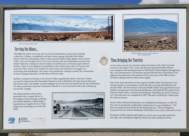
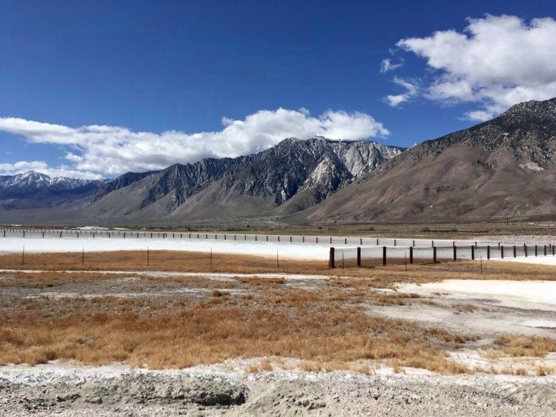
The highways here were once part of a local transportation system that included a tramway, a flume, a steamboat, and later narrow-gauge railroads, that linked mines in the Inyo Mountains, Saline Valley and the Death Valley Region to the Owens Valley. Ore was brought down from Cerro Gordo in the Inyo Mountains and salt from Saline Valley by a tramway whose remains can still be seen, to Swansea (just north of Keeler), where it was shipped by steamboat to the northwestern shore of Owens Lake near Lone Pine. There it was loaded on mule teams and hauled to Los Angeles for processing and distribution. The mines were productive enough to justify the construction of narrow-gauge railroads on both sides of Owens Lake.
Ranches, orchards and farms in the Owens Valley supplied the mines with food. Timber was sent by flume from the Horseshoe Meadows area in the Sierra Nevada down to the once full Owens Lake. The timber was then shipped across the lake and hauled up the Inyo Mountains for mine construction and fuel. Horseshoe Meadows is now accessed by the road winding up toward Mt. Langley.
The mines and the activity they generated were a major factor in developing a local farming, ranching and timber industry, which helped transform Los Angeles from a sleepy village into a bustling city in the late 1800s.
Then Bringing the Tourists
As the mines played out, tourism replaced mining as the chief economic activity in the region. New roads and the growing automobile industry were integral in developing tourism in the Eastern Sierra Region. Recognizing this, local entrepreneurs and business groups like the Inyo Good Road Club aggressively promoted road projects in the early part of the 20th Century in order to bring tourists to this scenic region.
One of the chief attractions in this region is Death Valley, but because of its remote location in mountainous desert the trip was long and difficult well into the 1920s. The first tourist roads into Death Valley were graded dirt roads built by entrepreneurs like Herman Eichbaum, who built the Stovepipe Wells Hotel in Death Valley, and then the Eichbaum Toll Road so tourists could get to it. The toll road was completed in 1927. The toll was $2.00 per vehicle plus 50 cents per person.
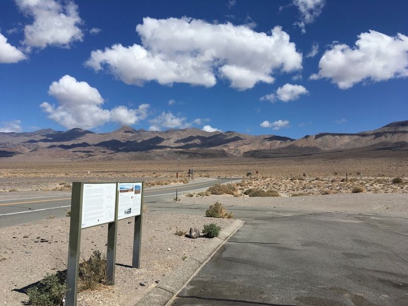
Death Valley National Monument was established on February 11, 1933. By this time its popularity justified the construction of a paved highway. The State rerouted and paved SR-127 the following year. The new highway bypassed Darwin, and the Eichbaum Toll Road is now a four wheel drive route. Remnants of this original state highway can be seen across the road from this sign, and crossing the highway about one mile southeast of here.
Erected by CalTrans.
Topics. This historical marker is listed in this topic list: Roads & Vehicles.
Location. 36° 25.741′ N, 117° 49.515′ W. Marker is near Keeler, California, in Inyo County. Marker is at the intersection of California Route 190 and California Route 136, on the right when traveling east on State Route 190. Touch for map. Marker is in this post office area: Keeler CA 93530, United States of America. Touch for directions.
Other nearby markers. At least 8 other markers are within 9 miles of this marker, measured as the crow flies. Cerro Gordo (approx. 4.6 miles away); Keeler (approx. 4.9 miles away); Keeler Then to Now (approx. 5 miles away); Owens Lake Dust Mitigation Program (approx. 6.4 miles away); Owens Lake Silver-Lead Furnace (approx. 8 miles away); Joshua Tree (approx. 8.1 miles away); New Water, New Life (approx. 8.1 miles away); Gifts of Rock and Water (approx. 8.6 miles away). Touch for a list and map of all markers in Keeler.
Credits. This page was last revised on June 17, 2023. It was originally submitted on April 16, 2022, by Craig Baker of Sylmar, California. This page has been viewed 927 times since then and 40 times this year. Photos: 1, 2, 3. submitted on April 16, 2022, by Craig Baker of Sylmar, California. 4, 5, 6. submitted on May 1, 2023, by Craig Baker of Sylmar, California. 7. submitted on April 16, 2022, by Craig Baker of Sylmar, California.


