Near Woodruff in Navajo County, Arizona — The American Mountains (Southwest)
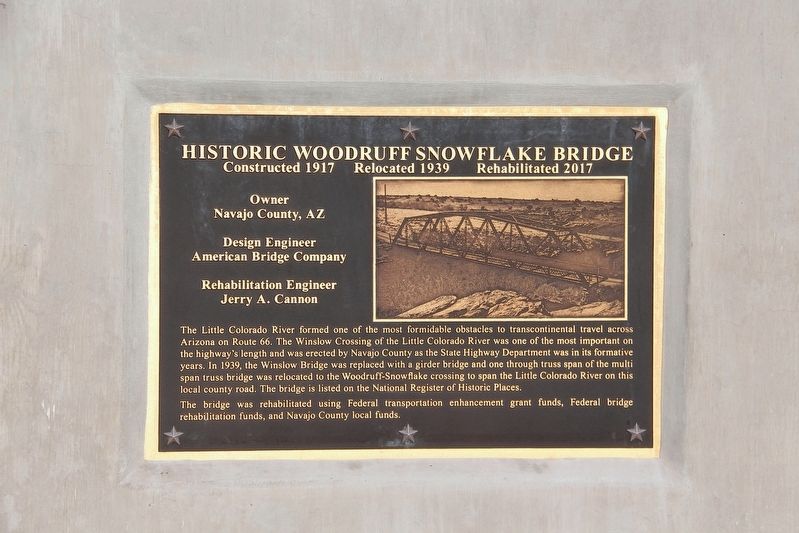
Historic Woodruff Snowflake Bridge
Constructed 1917 • Relocated 1939 • Rehabilitated 2017
Navajo County, AZ
Design Engineer
American Bridge Company
Rehabilitation Engineer
Jerry A. Cannon
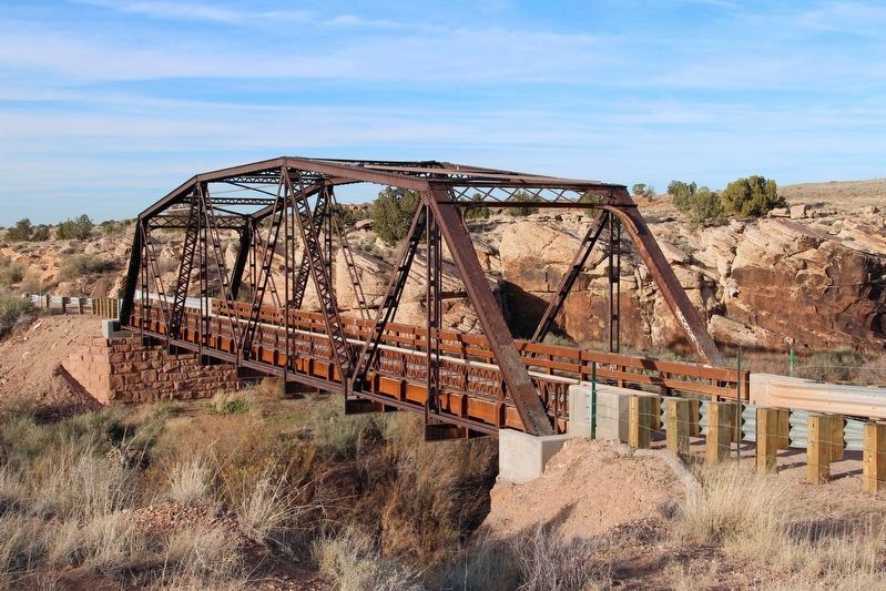
The Little Colorado River formed one of the most formidable obstacles to transcontinental travel across Arizona on Route 66. The Winslow Crossing of the Little Colorado River was one of the most important on the highway's length and was erected by Navajo County as the State Highway Department was in its formative years. In 1939, the Winslow Bridge was replaced with a girder bridge and one through truss span of the multi-span truss bridge was relocated to the Woodruff-Snowflake crossing to span the Little Colorado River on this local county road. The bridge is listed on the National Register of Historic Places.
The bridge was rehabilitated using Federal transportation enhancement grant funds, Fedearl bridge rehabilitation funds, and Navajo County local funds.
Topics. This historical marker is listed in this topic list: Bridges & Viaducts. A significant historical year for this entry is 1939.
Location. 34° 44.354′ N, 110° 2.227′ W. Marker is near Woodruff, Arizona, in Navajo County. Marker is on Country Road, 1.1 miles north of Woodruff Hay Hollow Road, on the right when traveling north. Touch for map. Marker is in this post office area: Woodruff AZ 85942, United States of America. Touch for directions.
Other nearby markers. At least 8 other markers are within 14 miles of this marker, measured as the crow flies. Agate House (approx. 11 miles away); Giant Logs (approx. 11.1 miles away); Stephen Tyng Mather (approx. 11.1 miles away); Little Colorado River Bridge (approx. 12.8 miles away); Historic Wagon Road (approx. 13.1 miles away); Navajo County Courthouse (approx. 13.2 miles away); Sidney Sapp House (approx. 13.3 miles away); Henry R. Holbrook (approx. 13˝ miles away).
Regarding Historic Woodruff Snowflake Bridge. Excerpt from the National Register nomination:
The Lyman Dam at St. Johns collapsed on April 14, wiping out most of the bridges over the Little Colorado River between St. Johns and Winslow. To finance the enormous reconstruction effort, Navajo County in January 1916 voted a $63,000 bond issue. The board of supervisors in June advertised for proposals for 7 bridges, including one over the Little Colorado east of Winslow, and the next month eight companies responded with designs and bids, For the Winslow Bridge, the board contracted with Los Angeles-based Mesmer and Rice, lowest bidder at $23,800. The U.S. Indian Service paid half of this cost. Using steel rolled by Lackawanna and fabricated by the American Bridge Company of Chicago, the contractors worked on the 4-span through truss until their dismissal by thecounty after numerous disputes. The Omaha Structural Steel Works completed the bridge in December 1917 and added a pony truss the following year. The Winslow Bridge carried U.S. 66 traffic until its replacement in 1939. Navajo County then re-erected one of the trusses on this secondary road crossing of the Little Colorado River, where it functions today.
Also see . . . Woodruff Bridge (PDF). National Register of Historic Places nomination and photographs submitted for the bridge. (National Archives and Records Administration) (Submitted on April 18, 2022, by Duane and Tracy Marsteller of Murfreesboro, Tennessee.)
Credits. This page was last revised on April 18, 2022. It was originally submitted on April 18, 2022, by Duane and Tracy Marsteller of Murfreesboro, Tennessee. This page has been viewed 325 times since then and 60 times this year. Photos: 1, 2. submitted on April 18, 2022, by Duane and Tracy Marsteller of Murfreesboro, Tennessee.
Editor’s want-list for this marker. Wide shot of marker and surrounding area in context. • Can you help?

